- Moruya, New South Wales
-
Moruya
New South Wales
Dolphin Beach, Moruya South Head
 Moruya
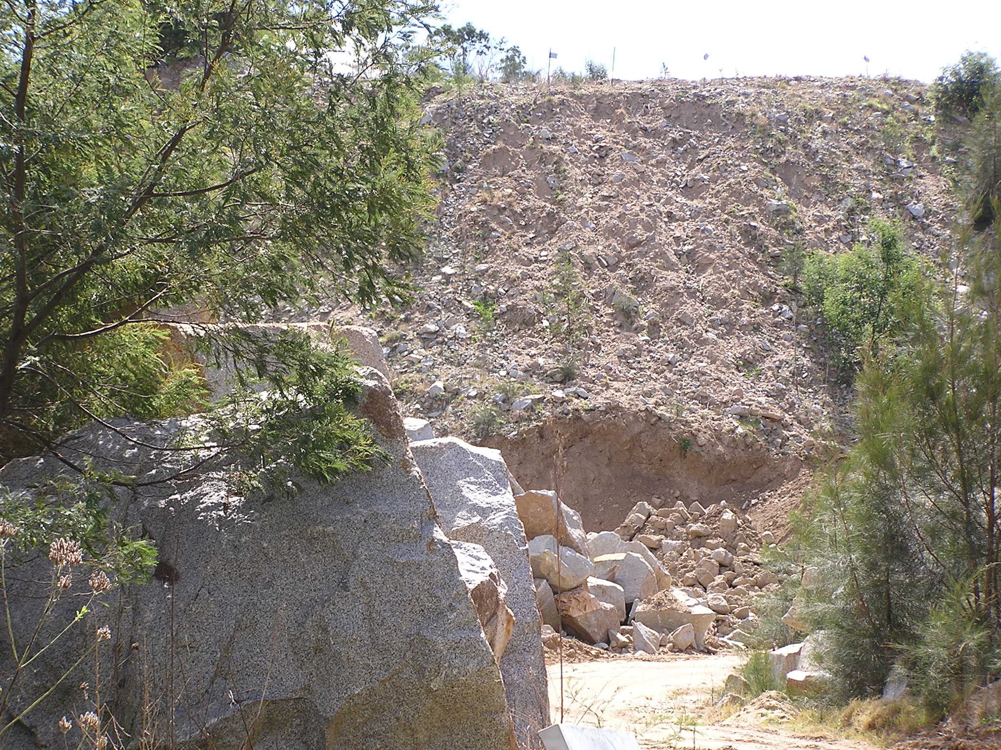
Population: 2,432 (2006 Census)[1] Established: 1851 Postcode: 2537 LGA: Eurobodalla Shire State District: Bega Federal Division: Eden-Monaro 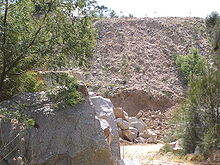 Moruya Quarry
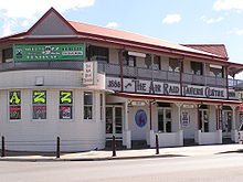 Air Raid Tavern, Moruya
Moruya is a small regional centre in New South Wales, Australia, situated on the Moruya River, approximately 300 kilometers south of Sydney. At the 2006 census, Moruya had a population of 2,432 people.[1] The town relies predominantly on agriculture, aquaculture, and tourism. Moruya is administered by the Eurobodalla Shire council and the shire chambers are located in the town.
Contents
History
The name Moruya is derived from an Indigenous Australian word, mherroyah, meaning "home of the black swan".[2] Black swans can still be seen in the lakes and rivers around Moruya, and the black swan is used locally as an emblem (nationally, the black swan is known as an emblem of Perth ).
The area was the traditional home of two Indigenous Australian tribes: the Walbanga and the Brinja-Yuin. European settlement commenced in the 1820s following the extension of the limits of location in 1829. The coast from Batemans Bay to Mherroyah was surveyed in 1828 by Surveyor Thomas Florance. The first European settler was Francis Flanagan from Ireland who settled at Shannon View in 1829. John Hawdon from England established a property named Kiora in 1831 and a village named after the property grew.
The town centre was surveyed in 1850 and the town gazetted in 1851. Moruya was proclaimed a municipality in 1891. Local industries were timber getting, gold mining, dairying and quarrying for granite. The granite for the Sydney Harbour Bridge pylons was quarried in the area.
Quarrying for granite commenced in the district in the late 1850s by the brothers Joseph and John Flett Loutitt who were from the Orkney Islands. Their quarry on the south side of the river produced stone for many Sydney landmarks including the pillars of the General Post office in Martin Place, and the base of the Captain Cook statue in Hyde Park.
The Moruya Quarry, also known as the Government Quarry, opened in 1876 on the northern bank of the Moruya River. From 1925 to 1932, the Harbour Bridge works saw 250 stonemasons employed and relocated to Moruya by the contractor to produce 18,000 cubic metres of dimension stone for the bridge pylons, 173,000 blocks, and 200,000 yards of crushed stone that was used as aggregate for concrete. During the seven years of this work, a small town of about 70 houses grew up near the quarry called Granitetown; little remains of the town today. The Moruya Quarry is still operated by the New South Wales Department of Infrastructure, Planning and Natural Resources. There was a third quarry west of the Moruya Quarry operated by the Ziegler family.
The first bridge across the Moruya River was erected in 1876 though frequent flooding saw new bridges erected in 1900 and 1945 and, most recently, in 1966.
During World War II Moruya aerodrome was used as an advanced operational base. A trawler was attacked offshore between Moruya and Batemans Bay by the Japanese in 1942. In 1944 a US freighter was torpedoed off Moruya by the German submarine U-862.
Shops
It has 2 Supermarkets a 8 Aisle FoodWorks which opened on May 24th 2005 and a 10 aisle Woolworths which opened in 2000. Moruya has many shops along the main street while the supermarkets are on the side streets. Also Moruya is home to the regional telco Southern Phone.
Landmarks
Moruya has a small airport (Moruya Airport, code MYA) located on the north side of Moruya Heads. The strip adjoins the beachfront, and flights to Moruya offer a slow and picturesque descent along the coastline. Regional Express (REX) flies mostly Saab 340B aircraft from Moruya to Sydney and Moruya to Merimbula, with connecting flights to Melbourne.
Notable residents
- Phillip Norman Ryan
- Josh Cunningham
- Bill Woods
- Michael Weyman
- Chris Houston
Notes and references
- ^ a b Australian Bureau of Statistics (25 October 2007). "Moruya (Urban Centre/Locality)". 2006 Census QuickStats. http://www.censusdata.abs.gov.au/ABSNavigation/prenav/LocationSearch?collection=Census&period=2006&areacode=UCL155000&producttype=QuickStats&breadcrumb=PL&action=401. Retrieved 2 November 2009.
- ^ "Moruya". Geographical Names Board of New South Wales. http://www.gnb.nsw.gov.au/name_search/extract?id=anwGBKUlJP. Retrieved 2 November 2009.
Richie Williams
See also
External links
- Sydney Morning Herald travel article about Moruya
- South Coast Online: Moruya
- Moruya Community, Business and Tourism Website
South Coast, New South Wales Cities: Townships: Basin View · Batehaven · Batemans Bay · Bawley Point · Bega · Bemboka · Bermagui · Berry · Bodalla · Boydtown · Broulee · Callala Bay · Candelo · Cobargo · Congo · Culburra Beach · Dalmeny · Eden · Greenwell Point · Huskisson · Hyams Beach · Kianga · Kioloa · Lake Conjola · Malua Bay · Manyana · Merimbula · Milton · Mogo · Mollymook · Moruya · Mystery Bay · Narooma · Nelligen · Nerrigundah · Pambula · Pambula Beach · Potato Point · Pyree · Rosedale · Sanctuary Point · South Durras · St Georges Basin · Tathra · Tilba · Towamba · Tura Beach · Tuross Head · Ulladulla · Vincentia · Wandandian · Wolumla · WonboynLocal Government Areas: National Parks: Ben Boyd · Bournda · Biamanga · Budawang · Clyde River · Conjola · Deua · Eurobodalla · Gulaga · Jerrawangala · Kooraban · Mimosa Rocks · Monga · Morton · Mount Imlay · Murramarang · South East Forest · WadbilligaCategories:- Towns in New South Wales
- Australian Aboriginal placenames
- Towns in the South Coast, New South Wales


Wikimedia Foundation. 2010.