- Don Tum District
-
Don Tum
ดอนตูม— Amphoe — Amphoe location in Nakhon Pathom Province
Coordinates: 13°57′38″N 100°4′53″E / 13.96056°N 100.08139°ECoordinates: 13°57′38″N 100°4′53″E / 13.96056°N 100.08139°E Country  Thailand
Province Nakhon Pathom Seat Sam Ngam Tambon Muban Amphoe established Area – Total 171.354 km2 (66.2 sq mi) Population (2005) – Total 45,386 – Density 265/km2 (686.3/sq mi) Time zone THA (UTC+7) Postal code 73150 Geocode 7304 Don Tum (Thai: ดอนตูม; IPA: [dɔ̄ːn tūːm]) is a district (Amphoe) in the northern part of Nakhon Pathom Province, central Thailand.
Contents
Etymology
The words Don and Tum in Thai mean land at a slightly high elevation. Due to this the district never had problems with flooding.
History
Mueang Tum was an ancient city of the Srivijaya kingdom. The first official district name of this area was Sam Kaeo. Later it was renamed to Kamphaeng Saen district.
The minor district (King Amphoe) Don Tum was created on January 1, 1966, when seven tambon were split from Kamphaeng Saen district.[1] It was officially upgraded to be full district on March 12, 1969.[2]
Geography
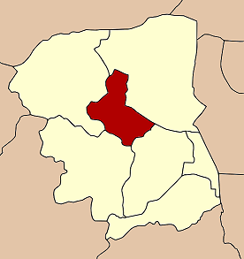
Neighboring districts are (from the north clockwise) Bang Len, Nakhon Chai Si, Mueang Nakhon Pathom and Kamphaeng Saen.
Administration
The district is subdivided into 8 subdistricts (tambon), which are further subdivided into 68 villages (muban). The township (thesaban tambon) Sam Ngam covers the complete tambon Sam Ngam. Each of the other 7 tambon has a Tambon administrative organization (TAO).
Nr. Name Thai name Villages 1. Sam Ngam สามง่าม 12 2. Huai Phra ห้วยพระ 8 3. Lam Hoei ลำเหย 15 4. Don Phutsa ดอนพุทรา 10 5. Ban Luang บ้านหลวง 5 6. Don Ruak ดอนรวก 5 7. Huai Duan ห้วยด้วน 7 8. Lam Luk Bua ลำลูกบัว 6 References
- ^ "ประกาศกระทรวงมหาดไทย เรื่อง แบ่งท้องที่ตั้งเป็นกิ่งอำเภอ" (in Thai). Royal Gazette 83 (1 ง): 9. January 1, 1966. http://www.ratchakitcha.soc.go.th/DATA/PDF/2509/D/001/9.PDF.
- ^ "พระราชกฤษฎีกาจัดตั้งอำเภอสมเด็จ อำเภอสีชมพู อำเภอหนองบัวแดง อำเภอบ้านแท่น อำเภอดอนตูม อำเภอนากลาง อำเภอศรีบุญเรือง และอำเภอป่าติ้ว พ.ศ. ๒๕๑๒" (in Thai). Royal Gazette 86 (16 ก): 225–229. February 25, 1969. http://www.ratchakitcha.soc.go.th/DATA/PDF/2512/A/016/225.PDF.
External links
Categories:- Amphoe of Nakhon Pathom
- Central Thailand geography stubs
Wikimedia Foundation. 2010.