- Dolneni Municipality
-
Dolneni Municipality
Општина Долнени— Municipality — 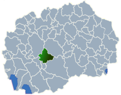
region Pelagonia Statistical Region Municipal seat Dolneni Population - Total 13,568 Time zone CET (UTC+1) Dolneni (Macedonian: Долнени) is a municipality in central Republic of Macedonia. Dolneni is also the name of the village where the municipal seat is found. The municipality is part of the Pelagonia Statistical Region.
Contents
Geography
The municipality borders Čaška Municipality to the northeast, Prilep Municipality to the southeast, Krivogaštani Municipality to the south, Kruševo Municipality to the southwest, and Makedonski Brod Municipality to the northwest.
Demographics
According to the last national census from 2002 this municipality has 13,568 inhabitants.[1]
Ethnic groups in the municipality include:
- Macedonians = 4,871 (35.9%)
- Albanians = 3,616 (26.7%)
- Turks = 2,597 (19.1%)
- Bosniaks = 2,380 (17.5%)
- others.
References
- ^ 2002 census results in English and Macedonian (PDF)
External links
Municipalities Aračinovo • Berovo • Bitola • Bogdanci • Bogovinje • Bosilovo • Brvenica • Čaška • Češinovo-Obleševo • Centar Župa • Čučer-Sandevo • Debar • Debarca • Delčevo • Demir Hisar • Demir Kapija • Dojran • Dolneni • Drugovo • Gevgelija • Gostivar • Gradsko • Ilinden • Jegunovce • Karbinci • Kavadarci • Kičevo • Kočani • Konče • Kratovo • Kriva Palanka • Krivogaštani • Kruševo • Kumanovo • Lipkovo • Lozovo • Makedonska Kamenica • Makedonski Brod • Mavrovo and Rostuša • Mogila • Negotino • Novaci • Novo Selo • Ohrid • Oslomej • Pehčevo • Petrovec • Plasnica • Prilep • Probištip • Radoviš • Rankovce • Resen • Rosoman • Sopište • Staro Nagoričane • Štip • Struga • Strumica • Studeničani • Sveti Nikole • Tearce • Tetovo • Valandovo • Vasilevo • Veles • Vevčani • Vinica • Vraneštica • Vrapčište • Zajas • Zelenikovo • Želino • Zrnovci

Greater Skopje Aerodrom • Butel • Čair • Centar • Gazi Baba • Gjorče Petrov • Kisela Voda • Karpoš • Saraj • Šuto OrizariCategories:

Wikimedia Foundation. 2010.