- Kyū-Yodo River
-
Kyū-Yodo River 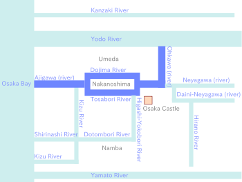
Origin Yodo River, at Kema Lock Mouth Osaka Bay, at Tempozan Basin countries Osaka City, Japan Length 13.83km Mouth elevation 0m The Kyū-Yodo River (旧淀川 Kyū-Yodo-gawa) was the main stream of the Yodo River before 1907, when the current (new) Yodo River was constructed by a normalisation project. Now called the Kyū-Yodo River, it is a major waterway in central Osaka and the main drainage of Neyagawa river.
The name Kyū-Yodo river means former Yodo river in Japanese.
Contents
Subdivisions
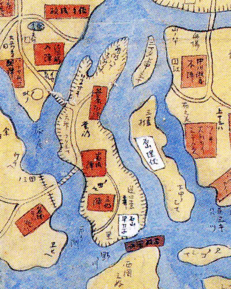
 Map of the Dojima River section of the then-Yodo River around 1570
The name Kyū-Yodo River is a geological name, locally it is called by subdivision names. From the source to the mouth, it is named as follows:
Ōkawa (river)
This is the name for the section from the Kema Lock to the Tenjimbashi (bridge); the Japanese name is Ōkawa (大川).
Dōjima River
 Dojima River
This is the name for the section from the Tenjimbashi (bridge) to the Funatsubashi (bridge) along the north shore of Nakanoshima Island; the Japanese name is Dōjima-gawa (堂島川).
Tosabori River
This is the name for the section from the Tenjimbashi (bridge) to the Funatsubashi (bridge) along the south shore of Nakanoshima Island; the Japanese name is Tosabori-gawa (土佐堀川).
Ajigawa (river)
This is the name for the section from the Funatsubashi (bridge) to Tempōzan, Osaka Bay; the Japanese name is Aji-gawa (安治川).
Points of interest
Points of interest from the source to the mouth.
- Yodo River
- Kema Lock
- Kema Sakuranomiya Park
- OAP Tower
- Imperial Hotel Osaka
- National Mint Factory
- Keihan City Mall (department store)
- Minami-Temma Park
- Nakanoshima
- Nakanoshima Park
- Osaka Stock Exchange
- Museum of Oriental Ceramics
- City Hall
- High District Court Osaka branch
- Bank of Japan Osaka branch
- Hotarumachi
- National Museum of Art, Osaka
- Osaka Science Museum
- Rihga Royal Hotel
- Osaka International Convention Center
- Osaka Central Wholesale Market
- Universal Studios Japan
- Osaka Aquarium Kaiyukan
- Tempōzan
Access
For Nakanoshima area, each station of Keihan Nakanoshima Line is nearest. For Osaka Aquarium Kaiyukan and Tempōzan, Metro Ōsakakō Station is nearest.
Categories:- Rivers of Osaka Prefecture
- Osaka

Wikimedia Foundation. 2010.