- Dodson, Oregon
-
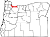
Dodson is an unincorporated community in Multnomah County, Oregon, United States.[1] It is located about 4½ miles east of Multnomah Falls and one mile west of Warrendale, in the Columbia River Gorge on Interstate 84/U.S. Route 30.[2] It it across the Columbia River from Skamania, Washington.[2] Dodson is within the Cascade Locks ZIP code.
Dodson was a railroad station on the Oregon-Washington Railroad & Navigation Company line (today owned by Union Pacific) named for Ira Dodson, who was an early settler in the area.[3][4] Dodson station was moved several times and was once located near present-day Warrendale.[4] Circa 1885 the station was also known as "Dodsons".[5] Author Ralph Friedman says Dodson is a "hamlet that time and tracks have passed by".[6] At one time Dodson had a gas station and a motel.[7] Bonneville Grade School in Dodson closed in 1996 because of declining enrollment.[8][9] The school also served the students of Warrendale and Bonneville.[8]
Dodson was the site of the McGowan salmon cannery and a fish wheel circa 1900.[7][10] In February 1996, a series of massive debris flows, resulting from the same severe weather that caused flooding in the Willamette Valley, occurred between Dodson and Warrendale, destroying homes and blocking the railroad and I-84 for several days.[11][12] A portion of the land slide area has been given to the Friends of the Columbia River Gorge Land Trust, which has plans to open the area to the public.[13]
References
- ^ "Dodson". Geographic Names Information System, U.S. Geological Survey. November 28, 1980. http://geonames.usgs.gov/pls/gnispublic/f?p=gnispq:3:::NO::P3_FID:1167702. Retrieved August 14, 2011.
- ^ a b Oregon Atlas & Gazetteer (7th ed.). Yarmouth, Maine: DeLorme. 2008. p. 24. ISBN 0-89933-347-8.
- ^ Avers, Henry G. (1926). "First-Level Ordering in Oregon". United States Department of Commerce: U.S. Coast & Geodetic Survey. p. 64. http://docs.lib.noaa.gov/rescue/cgs_specpubs/QB275U35no1221926.pdf. Retrieved August 14, 2011.
- ^ a b McArthur, Lewis A.; McArthur, Lewis L. (2003) [First published 1928]. Oregon Geographic Names (7th ed.). Portland, Oregon: Oregon Historical Society Press. p. 294. ISBN 9780875952772. OCLC 53075956.
- ^ Union Pacific Railroad Timetables. 1885. On file at Oregon Historical Society. One of four segments also included in The Railroad Stations of Oregon by Lewis L. McArthur and Cynthia B. Gardiner, 1996.
- ^ Friedman, Ralph (1990). In Search of Western Oregon (2nd ed.). Caldwell, Idaho: The Caxton Printers, Ltd. p. 316. ISBN 0-87004-332-3.
- ^ a b "Dodson, Oregon". The Columbia River - A Photographic Journey. http://columbiariverimages.com/Regions/Places/dodson.html. Retrieved August 14, 2011.
- ^ a b Hays, Jim (January 16, 2010). "Bygone Bonneville". The Oregonian. http://www.oregonlive.com/travel/index.ssf/2010/01/bygone_bonneville.html. Retrieved August 14, 2011.
- ^ "Post-1996 Debris Flow Erosion and Sedimentation, Tumalt Creek Drainage, Multnomah County, Oregon". Geological Society of America. http://gsa.confex.com/gsa/2002CD/finalprogram/abstract_34991.htm. Retrieved August 14, 2011.
- ^ "Fish wheel, Dodson, Oregon circa 1900, from a postcard. Piling from these structures can still be seen along the shore at low water". Panoramio. http://www.panoramio.com/photo/4375771. Retrieved August 14, 2011.
- ^ Pipkin, Bernard W.; D. D. Trent, Richard Hazlett, Paul Bierman (2008). "Dynamic Real Estate in Oregon". Geology and the Environment (5th ed.). Belmont, California: Thomson Brooks/Cole. p. 201. ISBN 0-495-11305-0. http://books.google.com/books?id=JZsmVwwpHh4C&pg=PA201.
- ^ Highland, Lynn M.; Stephenson D. Ellen, Sarah B. Christian, William M. Brown, III. "U.S. Geological Survey Fact Sheet 176-97: Debris-Flow Hazards in the United States". United States Geological Survey. http://pubs.usgs.gov/fs/fs-176-97/fs-176-97.html. Retrieved August 14, 2011.
- ^ "Current Land Trust Properties: Dodson". Friends of Columbia River Gorge. http://www.gorgefriends.org/article.php?id=83. Retrieved August 14, 2011.
External links
- Images of Dodson from Flickr
- Images of the Dodson landslide from Waymarking.com
- The Dodson Debris Flows of 1996 from Portland State University
Coordinates: 45°36′19″N 122°02′08″W / 45.6053953°N 122.0356395°W
Municipalities and communities of Multnomah County, Oregon Cities Fairview | Gresham | Lake Oswego‡ | Maywood Park | Milwaukie‡ | Portland‡ | Troutdale | Wood Village
Unincorporated
communitiesBonneville | Bridal Veil | Corbett | Dodson | Dunthorpe | Interlachen | Kings Heights | Latourell | Riverview | Riverwood | Springdale | Warrendale
Footnotes ‡This populated place also has portions in an adjacent county or counties
Categories:- Unincorporated communities in Multnomah County, Oregon
- Ghost towns in Oregon
- Columbia River Gorge
- Multnomah County, Oregon geography stubs

Wikimedia Foundation. 2010.