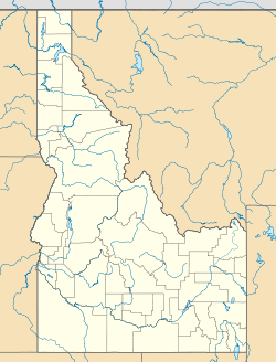
- De Smet, Idaho
-
De Smet, Idaho — Census-designated place — Coordinates: 47°08′46″N 116°54′57″W / 47.14611°N 116.91583°WCoordinates: 47°08′46″N 116°54′57″W / 47.14611°N 116.91583°W Country United States State Idaho County Benewah Area - Total 0.957 sq mi (2.5 km2) - Land 0.957 sq mi (2.5 km2) - Water 0 sq mi (0 km2) Elevation 2,598 ft (792 m) Population (2010) - Total 175 - Density 182.9/sq mi (70.6/km2) Time zone Pacific (PST) (UTC-8) - Summer (DST) PDT (UTC-7) ZIP code 83824 Area code(s) 208 GNIS feature ID 397609[1] De Smet (also spelled Desmet) is an unincorporated census-designated place in Benewah County, Idaho, United States. De Smet is located near U.S. Route 95 1 mile (1.6 km) south of Tensed. De Smet has a post office with ZIP code 83824.[2] As of the 2010 census, its population was 175.[3]
References
- ^ U.S. Geological Survey Geographic Names Information System: De Smet, Idaho
- ^ ZIP Code Lookup
- ^ "American FactFinder". U.S. Census Bureau. http://factfinder2.census.gov/main.html. Retrieved 22 March 2011.
Municipalities and communities of Benewah County, Idaho County seat: St. Maries Cities Plummer | St. Maries | Tensed
CDPs De Smet | Parkline
Unincorporated
communitiesIndian reservation Footnotes ‡This populated place also has portions in an adjacent county or counties
Categories:- Populated places in Benewah County, Idaho
- Census-designated places in Idaho
- Idaho geography stubs
Wikimedia Foundation. 2010.

