- Townline Tunnel
-
Townline Tunnel 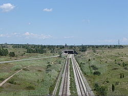
The tunnel seen from the westOfficial name Townline Tunnel Other name(s) Highway 58A, Highway 140 Carries  2 lanes of traffic
2 tracks (only 1 used)Crosses Welland Canal Locale Welland, Ontario Maintained by Ministry of Transportation Total length 330 m Width 35 m Opened July 13, 1972 for cars
January 31, 1973 for trainsCoordinates 42°57′38″N 79°13′45″W / 42.960537°N 79.229107°WCoordinates: 42°57′38″N 79°13′45″W / 42.960537°N 79.229107°W 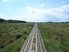 Length of tunnel approaches
The Townline Tunnel, located in Welland, Ontario, Canada, is an underwater tunnel, carrying Highway 58A as well as the Canadian Pacific Railway under the Welland Canal. The "A" suffix is a misnomer since it is more of a connector than an alternative route. Highway 58A is a two-lane freeway in its entirety. This segment of 2-lane freeway continues as Regional Road 525 to the east.
Contents
The highway
 Highway 58A is a provincially maintained highway in the Niagara Region. It is a short link between Highways 140 and 58 underneath the canal.
The 4.4 km (2.7 mi) long highway is important from the province's point of view as a possible spot where the planned Mid-Peninsula Highway might cross the Welland Canal.[citation needed] Should that happen, the designation of Highway 58A will be removed.
The tunnel
The Townline Tunnel is a two-cell reinforced concrete tunnel with a rectangular cross-section. The roof is a post-tensioned concrete slab.
The tunnel was built as a part of the Welland By-Pass project. Its construction was relatively easy since, like the Main Street Tunnel, it was being built at the same time as the channel above it and a simple cut and cover method could be used.
The tunnel provides a sidewalk for pedestrians, two lanes for vehicular traffic, as well as room for three sets of tracks for rail vehicles. It was opened for automobiles on July 13, 1972, and the first train crossed the tunnel on January 31, 1973.
The tunnel is 330 metres (1083 ft) long and 35 metres (115 ft) wide. Due to low grade required for trains, the approaches to the tunnel stretch 4 km (2.5 miles) in each direction. This necessited the removal of about 13,750,000 cubic meters (18,000,000 cubic yards) of material and construction of three viaducts on each side of the canal. As well, a solid earth plug had to be put into the Welland Recreational Waterway (the old alignment of the canal), cutting it in two (satellite photo). The construction cost $40 million. The middle rail line was removed in the 1990s and the two remaining tracks now serve as the CPR Hamilton Subdivision and the CPR Brookfield Siding.Townline Tunnel is known locally as the "Stinky Tunnel" due to the strong smell of rotten eggs as one passes through it.[citation needed]
Issues with Flooding Control
Rain and snow falling on the approaches to the tunnel, as well as ground water flow, necessitate the operation of a pumping system to prevent flooding. Water is pumped via pipes located under the road and discharged into the canal.[1] In February 1985, excessive runoff during a winter thaw caused flooding in the tunnel which closed the route to both rail and vehicular traffic [2]. In late March, 2010, a routine inspection of the concrete pipes through which the water is pumped revealed erosion which threatened to cause a sinkhole within the road. The tunnel was closed to vehicular traffic to allow for repair.[1]. It re-opened April 22.[3]
External links
The highway
The tunnel
- Satellite picture of the tunnel
- Newspaper clippings about the tunnel's construction
- Transport Canada's page on the tunnel
References
- ^ a b Forand, Kaesha. "Townline Tunnel closed for at least two weeks". http://www.wellandtribune.ca/ArticleDisplay.aspx?e=2506167. Retrieved April 2, 2010.
- ^ Noland, Dan (February 23, 1985). "Tunnel Flooded". http://www.welland.library.on.ca/digital/clipping/source/tunnels/15015.jpg. Retrieved April 2, 2010.
- ^ "Townline Tunnel reopens to public Thursday Evening". http://www.wellandtribune.ca/ArticleDisplay.aspx?e=2543844. Retrieved May 9 2010.
Crossings of the Welland Canal Upstream
Highway 3/Main Street Lift Bridge (Port Colborne)Townline Tunnel Downstream
Main Street Tunnel,
Canboro Road (Former Hwy 20),
Thorold Tunnel (Highway 58)Categories:- Canadian National Railway bridges and tunnels
- Railway tunnels in Ontario
- Welland Canal
- Buildings and structures in Welland, Ontario
- Transportation in Niagara Region, Ontario
- Tunnels completed in 1972


Wikimedia Foundation. 2010.