- Dana Baai
-
Dana Baai Dana Baai shown within the Western Cape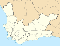
 Dana Baai
Coordinates: 34°11′57″S 22°02′30″E / 34.19917°S 22.04167°ECoordinates: 34°11′57″S 22°02′30″E / 34.19917°S 22.04167°E Country  South Africa
Province Western Cape District municipality Eden Local municipality Mossel Bay Time zone SAST (UTC+2) Dana Baai is a settlement in Eden District Municipality in the Western Cape province of South Africa.

Bitou • George • Hessequa • Kannaland • Knysna • Mossel Bay • Oudtshoorn
Cities and towns Albertinia • Boggomsbaai • Brenton-on-Sea • Buffelsbaai • Calitzdorp • Dana Baai • De Rust • Dysselsdorp • Friemersheim • George • Glentana • Gouritsmond • Groot Brak Rivier • Groot-Jongensfontein • Haarlem • Hartenbos • Heidelberg • Herbertsdale • Herolds Bay • Keurboomsrivier • Keurboomstrand • Klein Brak Rivier • Knysna • Kranshoek • Kurland Estate • Ladismith • Mossel Bay • Nature's Valley • Noetzie • Oudtshoorn • Pacaltsdorp • Plettenberg Bay • Port Beaufort • Rheenendal • Riversdale • Sedgefield • Slangrivier • Stilbaai • Uniondale • Volmoed • Victoria Bay • Wilderness • Wittedrift • Zoar
Categories:- Western Cape geography stubs
- Populated places in the Eden District Municipality


Wikimedia Foundation. 2010.