- Knysna Local Municipality
Zamuni
code= WC048
location=Eden District Municipality ,Western Cape Province 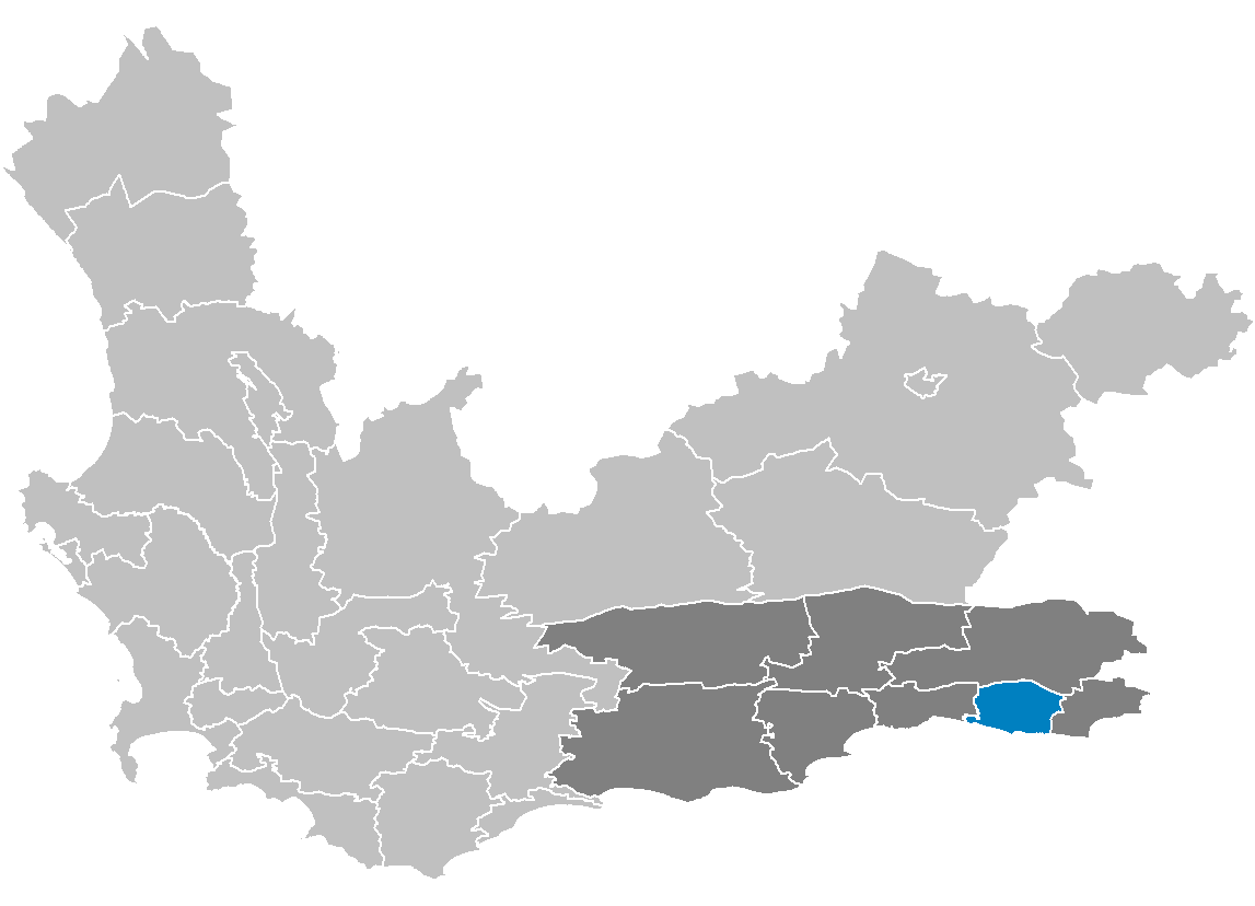
area= 1,059
seat = Knysna
neighbours=
mayor= Eleanore Bouw-Spies (ANC)
population= 51,468 [ [http://www.demarcation.org.za/municprofiles2003/index.asp Municipal Profiles] ]
population density= 48.60
habitations=14,733
habitation density=13.91
races=Black African 31.91%,Coloured 44.14%,India n/Asia n 0.14%, White 23.81%
languages=Afrikaans ,English language ,Xhosa language
website= [http://www.knysnamunicipality.co.za knysnamunicipality.co.za]Knysna Local Municipality is a municipality part of Eden District Municipality located in the
Western Cape Province ofSouth Africa . As of2001 , the population is 51,468. Its municipal code is WC048.Government
The executive mayor of the municipality is Eleanore Bouw-Spies of the ANC who became mayor in May 2007 after the short-lived DA-led multi-party coalition led by Doris Wakeford-Brown had collapsed following the withdrawal of a local civic party (Knysna Civic Alliance) which has now sided with the ANC. In the September 2007 floor crossing window the two civic party councillors defected to the ANC, giving the party an outright majority of 9 seats out of 16.
Wakeford-Brown became executive mayor in December 2006 after Joy Cole of the ANC resigned to pursue another career. Cole had formed a broad-based coalition of the ANC and DA after the March 2006 local government elections when neither party had obtained an outright majority.
Joy Cole was first elected mayor under the DA in December 2000 but defected in the September 2004 floor-crossing to become an ANC-aligned independent and reconstituted the council under ANC control.
Prior to this the Knysna Local Municipality was governed by the ANC since the first democratic local government elections in November 2005.
It is divided into eight wards with a total of sixteen councillors.
Mayors
*
Eleanore Bouw-Spies (May 2007- Present) (ANC)
*Doris Wakeford-Brown (December 2006 to May 2007) (DA)
*Joy Cole (March 2006 to December 2006) (ANC)
*Joy Cole (September 2004 to March 2006) Independent
*Joy Cole (December 2000 to September 2004) (ANC)Geography
The municipality has a total area of 1,059 km².
Adjacent municipalities
*
South Cape Municipality, Western Cape (north)
*Plettenberg Bay Municipality, Western Cape (east)
*George Municipality, Western Cape (west)The municipality also borders the
Indian Ocean on the south.Demographics
As of the
census of2001 , there are 51,468 people and 14,733 households residing in the municipality. Thepopulation density is 48.60/km². The density of households is 13.91/km². The racial makeup of the municipality is Black African 31.91%,Coloured 44.14%,India n/Asia n 0.14%, White 23.81%.17.7% of all households are made up of individuals. The average household size is 3.49.
In the municipality the population is spread out with 26.2% under the age of 15, 18.1% from 15 to 24, 31.8% from 25 to 44, 16.7% from 45 to 64, and 7.2% who are 65 years of age or older. The median age is 27 years. For every 100 females there are 97.2 males. For every 100 females age 18 and over, there are 96.2 males.
In the municipality 55.3% of residents speak
Afrikaans at home, 14.4% speak English, 0.0% speak Ndebele, 29.0% speak Xhosa, 0.4% speak Zulu, 0.0% speak Northern Sotho, 0.2% speak Sotho, 0.0% speak Tswana, 0.0% speak Swati, 0.0% speak Venda, and 0.0% speak Tsonga. 0.4% of the population speaks a non-official language at home.86.7% of residents are Christian, 10.7% have no religion, 0.1% are Muslim, 0.1% are Jewish, and 0.0% are Hindu. 2.4% have other or undetermined beliefs.
4.9% of residents aged 20 and over have received no schooling, 18.5% have had some
primary school , 8.6% have completed only primary school, 32.5% have had somehigh school education, 24.4% have finished only high school, and 11.2% have an education higher than the high school level. Overall, 35.6% of residents have completed high school.57.9% of housing units have a
telephone and/orcell-phone in the dwelling, 40.8% have access to a phone nearby, and 1.3% have access that is not nearby or no access. 69.0% of households have a flush or chemicaltoilet . 91.7% haverefuse removed by the municipality at least once a week and 0.9% have no rubbish disposal. 51.3% have running water inside their dwelling, 66.9% have running water on their property, and 96.6% have access to running water. 61.7% of households useelectricity for cooking, 58.7% for heating, and 80.5% for lighting. 79.7% of households have aradio , 67.6% have atelevision , 16.4% own acomputer , 64.5% have arefrigerator , and 39.3% have acell-phone .18.7% of the population aged 15-65 is unemployed. Of the unemployed persons, 59.0% are Black African, 38.5% are Coloured, 0.0% are Indian/Asian, and 2.5% are White. 32.6% of Black Africans are unemployed, 16.8% of Coloureds, 0.0% of Indians/Asians, and 2.0% of Whites.
The median annual income of working adults aged 15-65 is R 15 448 ($2,301). Males have a median annual income of R 16 142 ($2,404) versus R 14 406 ($2,145) for females. The median annual income by race is R 12 044 ($1,794) for Black Africans, R 13 143 ($1,957) for Coloureds, R 30 267 ($4,507) for Indians/Asians, and R 43 431 ($6,468) for Whites. The annual income distribution in Knysna Municipality is:
*No income 3.1%
*R 12 – R 4,800 ($2 - $721) 6.3%
*R 4,812 – R 9,600 ($723 - $1,443) 19.6%
*R 9,612 – R 19,200 ($1,445 – $2,886) 34.5%
*R 19,212 – R 38,400 ($2,888 - $5,772) 17.3%
*R 38,412 – R 76,800 ($5,774 - $11,543) 11.1%
*R 76,812 – R 153,600 ($11,545 - $23,087) 5.2%
*R 153,612 – R 307,200 ($23,089 - $46,174) 2.0%
*R 307,212 – R 614,400 ($46,176 - $92,348) 0.5%
*R 614,412 or more ($92,350+) 0.4%[http://www.statssa.gov.za/census01/Census/Database/Census%202001/Census%202001.asp Statistics South Africa Census 2001]
Cities and towns
*Belvidere Estate
*Bongani
*Brenton-on-Sea
*Buffelsbaai
*Concordia
*Dam se Bos
*Eastford
*Flenters
*Hornlee
*Hunters Home
*Joodse Kamp
*Khayalethu South
*Kingfisher Creek
*Knoetzie
*Knysna
*Knysna Central
*Knysna Municipal Forest
*Leisure Island
*Meedingsride
*Mount Joy
*Nekkies
*Noetzie
*Old Place Township
*Ou Plaas
*Rheenedal
*Rhobololo
*Sedgefield
*Smutsville
*Sunridge
*Swartvlei
*The Heads
*Thesens Island
*West Hill
*Witlokasie
*XolweniExternal links
* [http://www.knysnamunicipality.co.za Knysna Municipality official site]
* [http://www.naturbilder.de/jenskuhfs/html/gross_12.html Jens Kuhfs photography]
Wikimedia Foundation. 2010.