- Kannaland Local Municipality
Zamuni
code= WC041
location=Eden District Municipality ,Western Cape Province 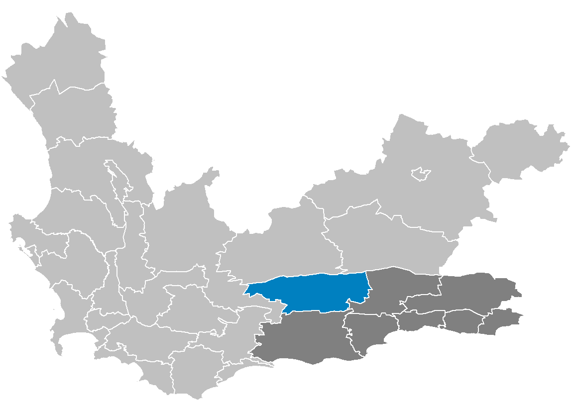
area= 4,759
seat= Ladismith
neighbours=
mayor= Jeffrey Donson (NNP)
population= 23,971 [ [http://www.demarcation.org.za/municprofiles2003/index.asp Municipal Profiles] ]
population density= 5.04
habitations=6,066
habitation density=1.27
races=Black African 2.49%,Coloured 84.49%,India n/Asia n 0.09%, White 12.93%
languages=Afrikaans ,English language ,Xhosa language
website= [http://www.kannaland.co.za/ kannaland.co.za]Kannaland Municipality is a municipality located in the
Western Cape Province ofSouth Africa . As of2001 , the population is 23,971. Its municipality code is WC041.Government
The mayor of the municipality is Jeffrey Donson of the NPP. The NPP took control of the council following the controversial floor-crossing window in September 2007. The NPP is led by controversial Cape Town city councillor Badih Chabaan who is accused of corruption in offering monetary and patronage bribes to Western Cape councillors to cross the floor to join his new party. The previous coalition of the DA and ICOSA collapsed when 2 ICOSA and 3 ANC councillors crossed the floor giving the NNP 5 seats out of 9 in the council or an outright majority (the only such council in SA that is governed by this fledgling new party). The previous DA/ICOSA coalition took power in August 2006 when the short-lived ANC-led coalition pact with the DA collapsed. The ANC/DA coalition had taken power after the local government elections in March 2006 local government elections. The DA refuses to recognize the new NPP-led council administration as it alleges that the 2 ICOSA defectors were sacked prior to the floor-crossing window being open and is currently challenging the council recomposition in the Cape High Court. As such its former mayor has refused to "step down" pending the outcome of the case, a prospect that the uncertainty and instability of this beleaguered council will continue. Kannaland has been beset by mismanagement and corruption since the ANC took control of the council in March 2001 when the single PAC councillor withdrew his support for a short-lived DA-led coalition that took power after the December 2000 local government elections.Fact|date=November 2007
It is divided into five wards with a total of nine councillors.
Geography
The municipality has a total area of 4,759 km².
Adjacent municipalities
*
Laingsburg Municipality, Western Cape (north)
*Prince Albert Municipality, Western Cape (north)
*Oudtshoorn Municipality, Western Cape (east)
*Langeberg Municipality, Western Cape (south)
*Breede River Municipality, Western Cape (west)Demographics
As of the
census of2001 , there are 23,971 people and 6,066 households residing in the municipality. Thepopulation density is 5.04/km². The density of households is 1.27/km². The racial makeup of the municipality is Black African 2.49%,Coloured 84.49%,India n/Asia n 0.09%, and White 12.93%.13.3% of all households are made up of individuals. The average household size is 3.95.
In the municipality the population is spread out with 32.5% under the age of 15, 15.5% from 15 to 24, 28.1% from 25 to 44, 16.7% from 45 to 64, and 7.2% who are 65 years of age or older. The median age is 26 years. For every 100 females there are 92.9 males. For every 100 females age 18 and over, there are 87.6 males.
In the municipality 98.0% of residents speak
Afrikaans at home, 1.3% speak English, 0.0% speak Ndebele, 0.4% speak Xhosa, 0.0% speak Zulu, 0.0% speak Northern Sotho, 0.0% speak Sotho, 0.0% speak Tswana, 0.0% speak Swati, 0.0% speak Venda, and 0.0% speak Tsonga. 0.0% of the population speaks a non-official language at home.97.1% of residents are Christian, 1.2% have no religion, 0.0% are Muslim, 0.0% are Jewish, and 0.0% are Hindu. 1.5% have other or undetermined beliefs.
11.9% of residents aged 20 and over have received no schooling, 31.4% have had some
primary school , 11.7% have completed only primary school, 27.4% have had somehigh school education, 12.1% have finished only high school, and 5.5% have an education higher than the high school level. Overall, 17.6% of residents have completed high school.38.7% of housing units have a
telephone and/orcell-phone in the dwelling, 51.6% have access to a phone nearby, and 9.7% have access that is not nearby or no access. 65.0% of households have a flush or chemicaltoilet . 58.8% haverefuse removed by the municipality at least once a week and 4.5% have no rubbish disposal. 67.2% have running water inside their dwelling, 84.6% have running water on their property, and 93.9% have access to running water. 62.1% of households useelectricity for cooking, 49.7% for heating, and 81.3% for lighting. 73.5% of households have aradio , 58.2% have atelevision , 7.5% own acomputer , 54.9% have arefrigerator , and 19.4% have acell-phone .6.9% of the population aged 15-65 is unemployed. Of the unemployed persons, 1.6% are Black African, 93.3% are Coloured, 0.0% are Indian/Asian, and 5.1% are White. 4.4% of Black Africans are unemployed, 7.7% of Coloureds, 0.0% of Indians/Asians, and 2.7% of Whites.
The median annual income of working adults aged 15-65 is R 8 020 ($1,203). Males have a median annual income of R 8 379 ($1,257) versus R 7 184 ($1,078) for females. The median annual income by race is R 7 227 ($1,084) for Black Africans, R 7 308 ($1,096) for Coloureds, R 14 406 ($2,161) for Indians/Asians, and R 36 580 ($5,488) for Whites. The annual income distribution in Kannaland Municipality is:
*No income 2.0%
*R 12 – R 4,800 ($2 - $721) 20.8%
*R 4,812 – R 9,600 ($723 - $1,443) 40.6%
*R 9,612 – R 19,200 ($1,445 – $2,886) 13.1%
*R 19,212 – R 38,400 ($2,888 - $5,772) 12.2%
*R 38,412 – R 76,800 ($5,774 - $11,543) 6.9%
*R 76,812 – R 153,600 ($11,545 - $23,087) 3.4%
*R 153,612 – R 307,200 ($23,089 - $46,174) 0.5%
*R 307,212 – R 614,400 ($46,176 - $92,348) 0.4%
*R 614,412 or more ($92,350+) 0.2%[http://www.statssa.gov.za/census01/Census/Database/Census%202001/Census%202001.asp Statistics South Africa Census 2001]
Cities and towns
*Amalienstein
*Bergsig
*Bleshoek
*Calitzdorp
*Droevlei
*Ladismith
*Ladismith East
*Swartberg State Forest
*Towerkop State Forest
*ZoarReferences
Wikimedia Foundation. 2010.