- Seedamm
-
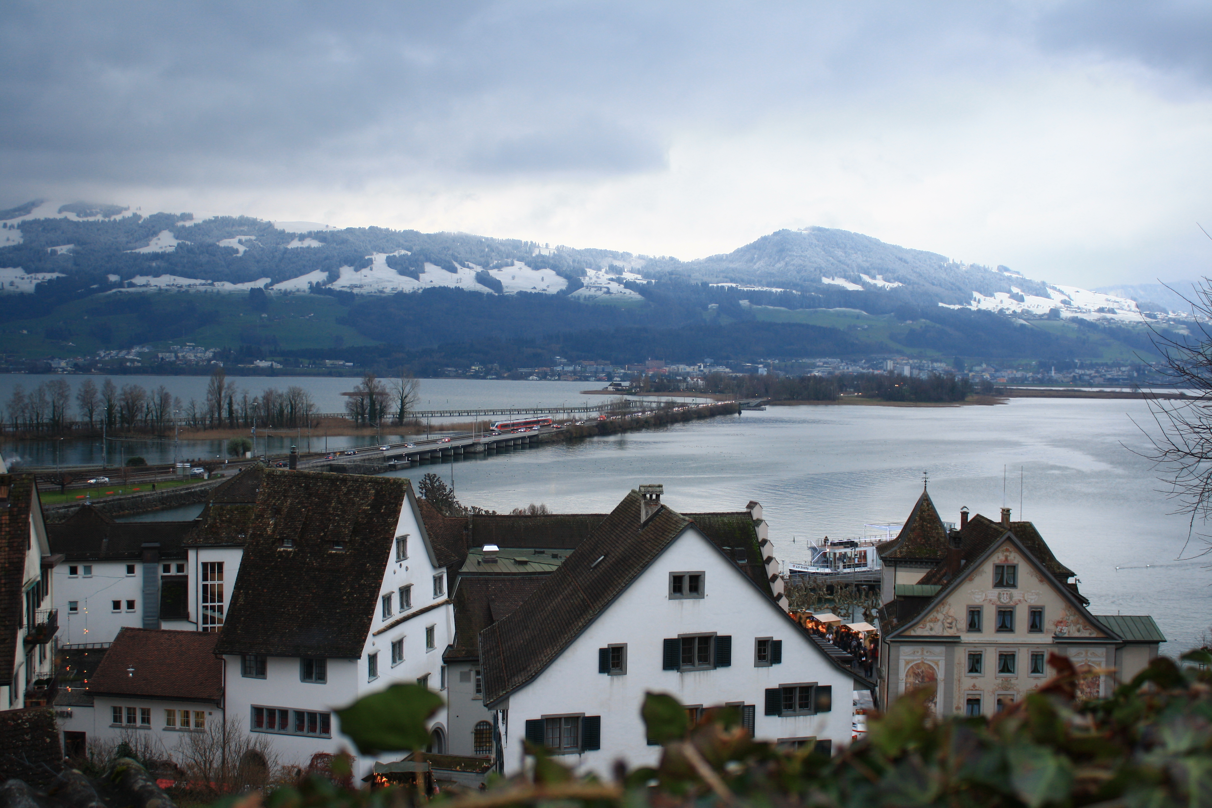
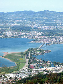 Seedamm and upper Lake Zürich: Pfäffikon and Hurden in the foreground, and Kempraten (to the left), Rapperswil and Bachtel mountain in the background, as seen from Etzel mountain (2008)
 Seedamm, Etzel in the background, as seen from Lindenhof nearby Schloss Rapperswil (2009)
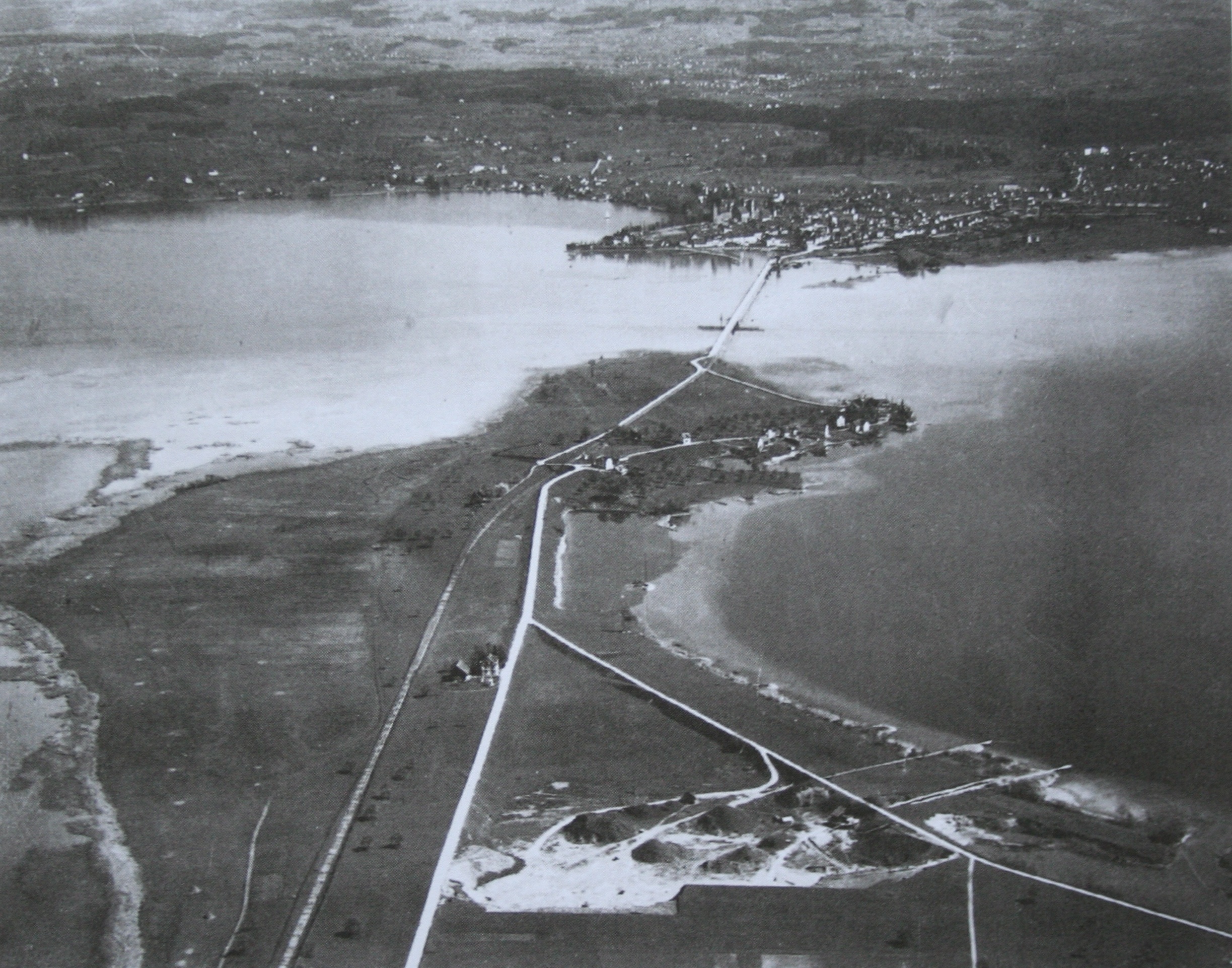
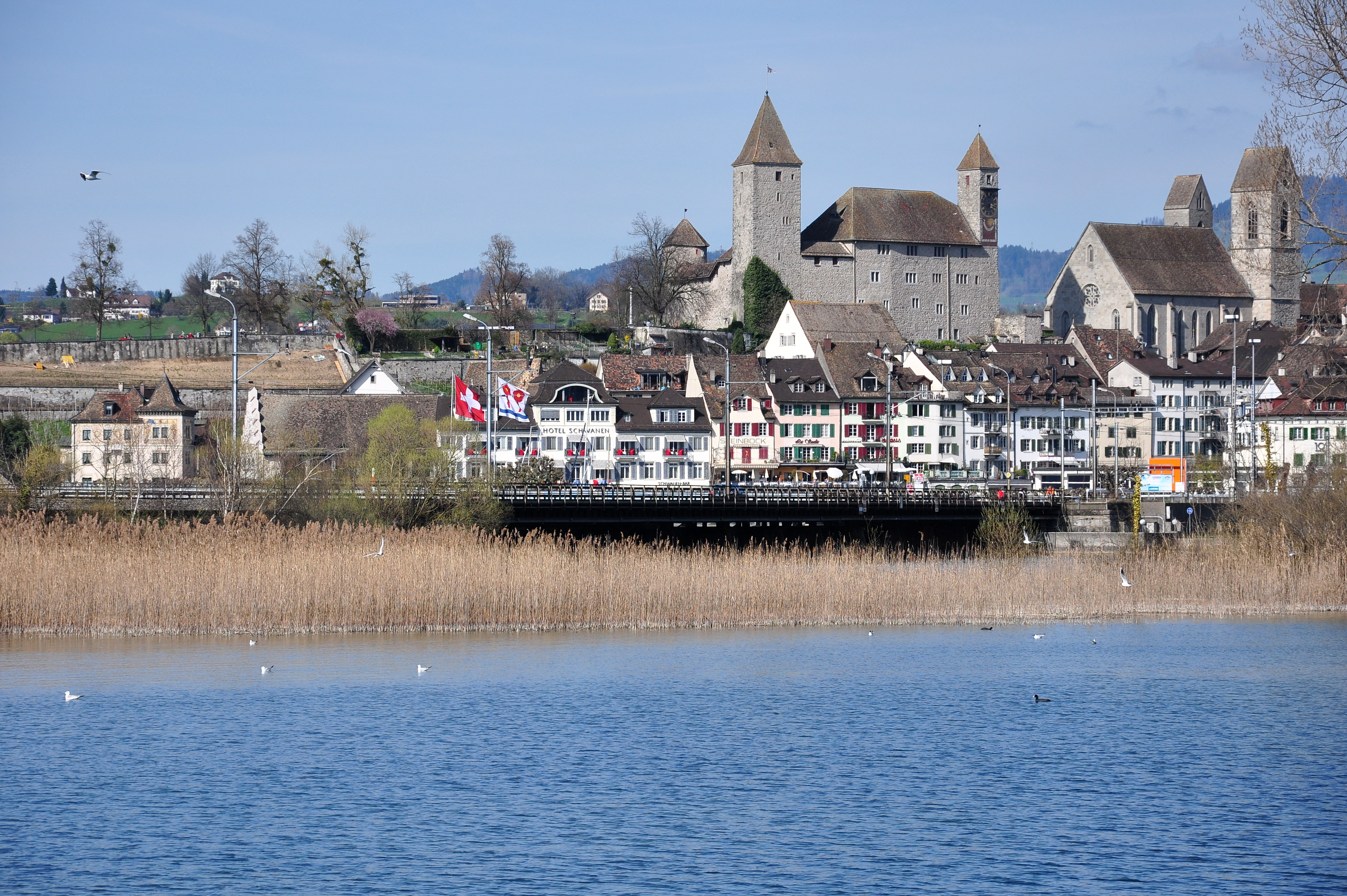
 S-Bahn Zürich line S5 crossing Seedamm, Rapperswil Castle, Altstadt and St. John's Church, as seen from the Holzbrücke Rapperswil-Hurden (wooden bridge) crossing Obersee (2009)
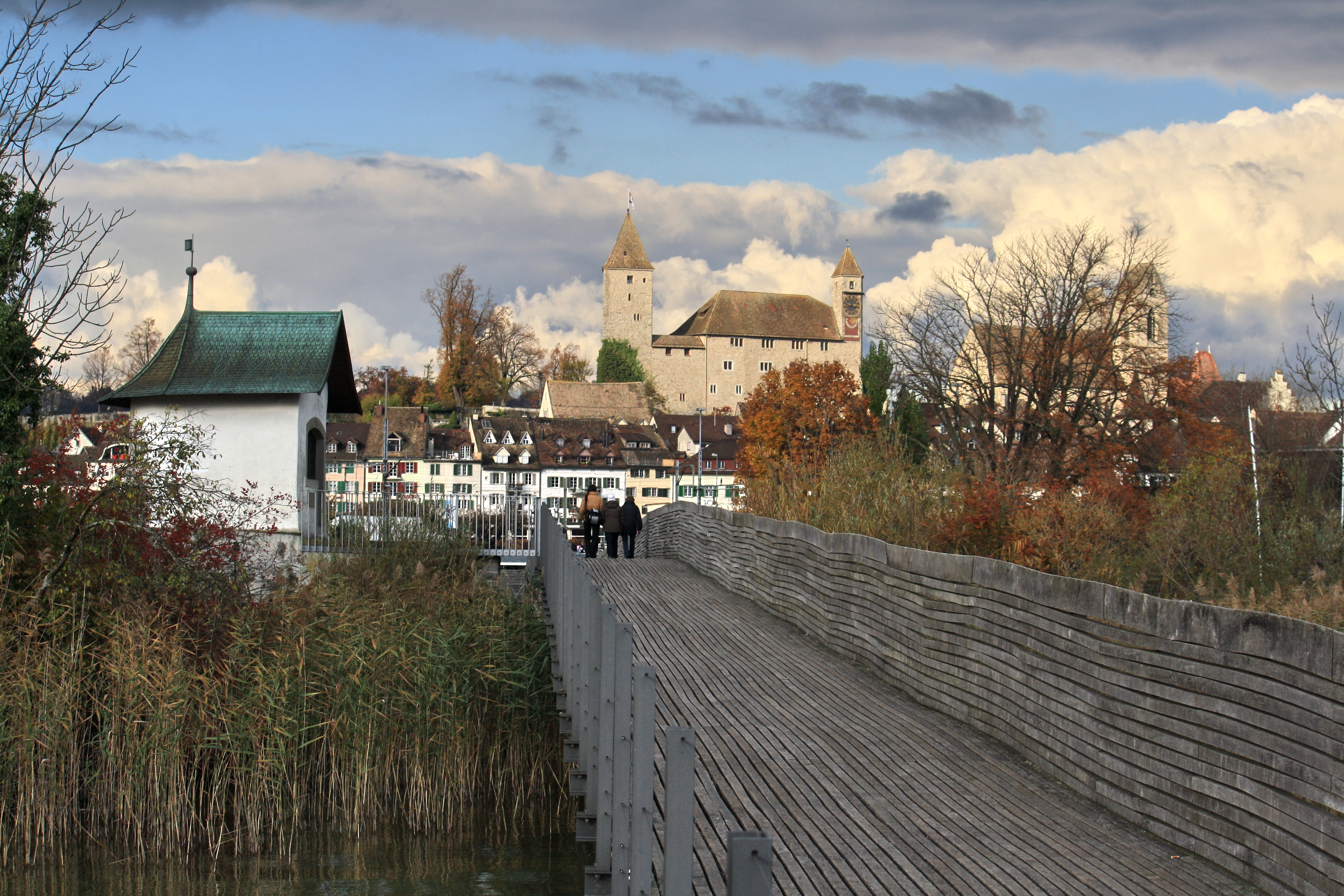
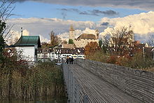 Reconstructed medieval wooden bridge and Heilig Hüsli (bridge chapel), Seedamm to the left, Rapperswil in the background (2009)
Seedamm is the partially artificial dam and bridge at the most narrow area of Lake Zurich, between Hurden (SZ) and Rapperswil (SG).
Contents
Geography and location
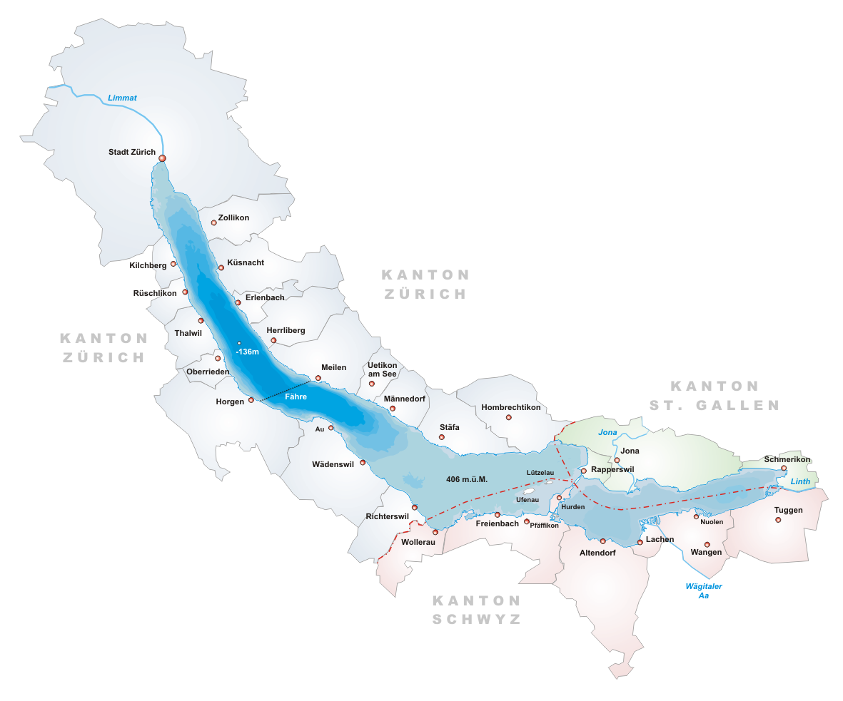
The Seedam bases on an Ice age moraine, forming a peninsula located at the village Hurden (SZ) and a small island at Rapperswil, dividing Lake Zürich and its upper part (the so-called Obersee). The dam is located between the three Swiss cantons of Schwyz, St. Gallen and Zürich. To the east of the artificial dam, there is the Holzbrücke Rapperswil-Hurden (wooden bridge for pedestrians), built in 2001 as a reconstruction of the first bridge between eastern and western lakesides around 1650 B.C.
The two bridges in the northeast and in the southwest measure 1 kilometre (0.62 mi) in all and are wide enough for a road and a railway line. The railway is used by the S5 line of the S-Bahn Zürich and by the Südostbahn Voralpen Express. Near Hurden there is a stop on the railway line S40. The southern Sternenbrücke bridge towards Hurden was built in 1942 and will be renewed between March 15 and November 2010 to allow 40 ton trucks to cross the Seedamm.[1]
History
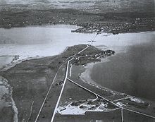
Around 1650 B.C., a first wooden footbridge led across Lake Zurich followed by several reconstructions at least until late 2nd century AD when the Roman Empire built 6 m wide wooden bridge under Empire Marcus Aurelius (161-180).[2][3] At Kempraten's Lake Zurich bay, the Roman transshipment harbour for goods was located that have been transported on the Roman streets, on the wooden bridge Rapperswil-Hurden and on the waterway Zurich-Walensee. In 981, a ferry to the Ufenau island is mentioned, probably there was a ferry to the other lakeside, too. By 1358, ferry services between Rapperswil and Hurden are mentioned. Between 1358 and 1360, Rudolf IV, Duke of Austria, built a wooden bridge across the lake that has been used to 1878 – measuring approximately 1,450 metres (4,760 ft) in length and 4 metres (13 ft) wide; 546 oak piles have been installed. A small wooden bridge from Ufenau island to Hurden is mentioned around 1430, so-called «Kilchweg in die Uffnow».[4][5]
In 1873, the Swiss federal parliament approved the construction of the today's stone dam and bridge. Construction works have been begun in 1875 and finished in 1878 (in the same year the wooden bridge was broken). The construction costs the sum of 1,462,000 Swiss francs, of wihich 1,100,000 have been paid by the city of Rapperswil. In 1878, the Gotthardbahn established the railway line from Rapperswil train station via Seedamm. In 1939 and 1951, the now called Seedamm was reinforced to met the growing demands. Beginning of the 21st century, an average of 24,000 vehicles and about 75 passenger trains daily are crossing the dam.
In 2001, a new wooden footbridge was opened alongside the dam for the first 840 metres (2,760 ft) meters of the crossing. It was built in quite the same place as the original bridge linking Rapperswil with the nearby bridge chapel (Heilig Hüsli) built in 1551. This connection, for centuries has been part of old pilgrimage routes, the so-called Jakobsweg to the Einsiedeln Abbey.
The Seedamm area including the remains of the prehistoric wooden bridges respectively stilt house settlements is listed as Swiss heritage sites of national significance.[6]
References
- ^ Tages-Anzeiger (March 9, 2010): Seedamm wird saniert
- ^ Website Unterwasserarchäologische Projekte Kanton St. Gallen
- ^ Neue Zürcher Zeitung (January 20/21, 2001): Die Brücke auf dem Grund des Zürichsees
- ^ Hurden: History
- ^ Website Holzsteg Rapperswil
- ^ Swiss inventory of cultural property of national and regional significance
Literature
- Geneviève Lüscher: Brücken und Wege der Bronzezeit. Schweizerischer Nationalfonds. In: Horizonte, März 2005.
- Beat Eberschweiler: Ur- und frühgeschichtliche Verkehrswege über den Zürichsee: Erste Ergebnisse aus den Taucharchäologischen Untersuchungen beim Seedamm. In: Mitteilungen des Historischen Vereins des Kantons Schwyz, No. 96, Schwyz 2004.
- Hans Rathgeb: Brücken über den See. Arbeitsgemeinschaft Fussgänger-Holzsteg Rapperswil-Hurden, Rapperswil 2001. ISBN 3-9522511-1-9
External links
 Media related to Seedamm at Wikimedia Commons
- Holzsteg Rapperswil (German)
Lake Zurich (Zürichsee)
Switzerland Canton of Zurich (Horgen · Meilen · Zurich) · Canton of St. Gallen (See-Gaster) · Canton of Schwyz (Höfe · March)Settlements Altendorf · Au · Bäch · Bollingen · Erlenbach · Feldbach · Feldmeilen · Freienbach · Herrliberg · Horgen · Hurden · Jona · Kehlhof · Kempraten · Kilchberg · Küsnacht · Lachen · Männedorf · Meilen · Nuolen · Oberrieden · Pfäffikon · Rapperswil · Richterswil · Rüschlikon · Schmerikon · Stäfa · Thalwil · Uerikon · Uetikon am See · Wädenswil · Zollikon · Zurich

Islands Au peninsula · Lützelau · UfenauRivers Valleys Limmattal · SihltalMountains Landmarks Transportation Categories:- Canton of Schwyz
- Canton of St. Gallen
- Canton of Zurich
- Geography of Switzerland
- Transport in Switzerland
- Cultural property of national significance in the canton of St. Gallen
- Cultural property of national significance in the canton of Schwyz
- Rapperswil-Jona

Wikimedia Foundation. 2010.