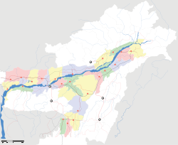
- Dabaka
-
Doboka
Dabaka
— town — Coordinates 26°7′0″N 92°52′0″E / 26.116667°N 92.866667°ECoordinates: 26°7′0″N 92°52′0″E / 26.116667°N 92.866667°E Country India State Assam District(s) Nagaon Nearest city Hojai Parliamentary constituency 10 Nagaon parliamentary Civic agency Krishak Mukti Sangram Samiti(KMSS) Population 11,043 (2001[update]) Time zone IST (UTC+05:30) Area
• Elevation
• Coastline
• 61 metres (200 ft)
• 0 kilometres (0 mi)Website http://www.helal7star.webs.com/ Doboka is a town in Nagaon district, Assam, India.
Contents
Demographics
As of 2001[update] India census,[1] Doboka had a population of 11,043. Males constitute 52% of the population and females 48%. Doboka has an average literacy rate of 58%, lower than the national average of 59.5%: male literacy is 64% and, female literacy is 51%. In Doboka, 18% of the population is under 6 years of age. NH 36 is go by the Doboka town.Various tourist spot nearby Doboka as 'AKASHIGANGA' 5 K.M from Doboka Town a popular picnic place,Switch gate on the Buriganga river at Nahargaon near by Doboka hill is water flowing from up is also a very famous picnic place.This place finds mention in the Allahabad Inscription of Gupta Emperor, (Samudra Gupta) in about 7th century.In doboka there are several school,college,madrassas in both public and private sector.Jamuna river, a sub river of kopili of sub rivrer of India's longest river Brahmaputra is gone through the Doboka town.Come to doboka to see the beauty on nature and variety.
Geography
It is located at 26°7′0″N 92°52′0″E / 26.116667°N 92.866667°E at an elevation of 61 m above MSL.[2]
Location
Doboka is connected by National Highway 36 to Nagaon and Dimapur.
Places of interest
'AKASHIGANGA' waterfall is near Doboka. Ruins of many ancient temples are also found in the area.
References
- ^ "Census of India 2001: Data from the 2001 Census, including cities, villages and towns (Provisional)". Census Commission of India. Archived from the original on 2004-06-16. http://web.archive.org/web/20040616075334/http://www.censusindia.net/results/town.php?stad=A&state5=999. Retrieved 2008-11-01.
- ^ http://www.fallingrain.com/world/IN/3/Nam_Dabaka.html Map and weather of Dabaka
External links
Categories:- Cities and towns in Nagaon district
- Assam geography stubs
Wikimedia Foundation. 2010.


