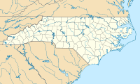
Marks Knob — Coordinates: 35°40′47″N 83°14′55″W / 35.67982°N 83.24873°W / 35.67982; 83.24873 … Wikipedia
Blue Knob (Pennsylvania) — Geobox|Summit name = Blue Knob native name = other name = other name1 = topo maker = USGS topo range = Allegheny Mountains parent = Allegheny Front category = image caption = Blue Knob Mountain. etymology type = etymology = country = United… … Wikipedia
Pilot Knob (Austin, Texas) — Pilot Knob is a hill that is part of an extinct volcano located seven miles south of central Austin, Texas near Austin Bergstrom International Airport and McKinney Falls State Park.IntroductionPilot Knob is one of around 75 late Cretaceous Period … Wikipedia
Tricorner Knob — is a mountain in the Great Smoky Mountains, located in the Southeastern United States. It has an elevation of 6,120 feet (1,865 meters), with 160 feet (48 meters) of clean prominence. [http://www.peakbagger.com/peak.aspx?pid=7774] The Appalachian … Wikipedia
Bickle Knob — Geobox|Summit name = Bickle Knob native name = other name = other name1 = topo maker = USGS topo range = Allegheny Mountains parent = category = image caption = View looking southwest from Bickle Knob etymology type = etymology = country = United … Wikipedia
Puffin crossing — A puffin crossing (pedestrian user friendly intelligent crossing) is a type of pedestrian crossing in use in the United Kingdom. It differs from a pelican crossing in that the lights controlling the pedestrians are on the near side of the road,… … Wikipedia
Roan Mountain (Roan Highlands) — Roan Mountain Roan Mountain, looking northwest from Grassy Ridge Bald Elevation 6,285 ft … Wikipedia
Snake Den Ridge Trail — Infobox Hiking trail Name=Snake Den Ridge Trail Photo=Snake den ridge trailhead1.jpg Caption=Snake Den Ridge Trailhead at Cosby Campground Location=Great Smoky Mountains National Park, Tennessee, United States Length=convert|5.3|mi|km Start/End… … Wikipedia
Chattanooga Campaign — Maj. Gen. Ulysses S. Grant and Gen. Braxton Bragg, commanding generals of the Chattanooga Campaign … Wikipedia
Appalachian Trail by state — The Appalachian National Scenic Trail spans fourteen U.S. states during its journey that is 2,179 miles (3,507 km) long, including Georgia, North Carolina, Tennessee, Virginia, West Virginia, Maryland, Pennsylvania, New Jersey, New York,… … Wikipedia

