- Strachur
-
Coordinates: 56°09′59″N 5°04′03″W / 56.1664°N 5.0675°W
Strachur
 Strachur shown within Argyll and Bute
Council area Argyll and Bute Country Scotland Sovereign state United Kingdom Dialling code 01369 Police Strathclyde Fire Strathclyde Ambulance Scottish EU Parliament Scotland List of places: UK • Scotland • Strachur (Scottish Gaelic: Srath Chura) and Strathlachlan (Scottish Gaelic: Srath Lachlainn) are united parishes in the west side of Cowal, Argyll, Scotland. Strachur is the postal station, and the parish is traversed by the shortest line of communication between Inverary and Glasgow, via the St.Catherine's ferry on Loch Fyne. The name 'Strachur' comes from the Gaelic for 'Glen of the Heron'
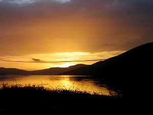
 Loch Fyne near Strachur, looking toward Inveraray
Contents
District & boundaries
It is an area bordering the Loch Lomond and the Trossachs National Park. The parish is bounded along its north-west side by Loch Fyne - Strachur forming its north-western district, and Strathlachlan its south-western one; and it is bounded on other sides by the parishes of Lochgoilhead, Kilmun, Dunoon, and Kilmadan. Its length north-westward, or parallel to Loch Fyne, is 18 miles, and its breadth varies from three to eight miles. It is mostly uplands, and altitudes rise to 3000 feet.
Loch Eck touches the parish for three miles on the south-east.
The parish church of Strachur dates from 1789 and can accommodate 400. That of Strathlachlan was built in 1792 and can hold 150. The parishes were united in 1650.
Famous residents
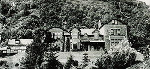
By tradition, Strachur has been held as one of the original strongholds of Clan Campbell, and in 1870 the principal landowners of the parish were Campbell of Strachur and McLachlan of that Ilk. The principle country houses there at that time were Strachur Park, Castle Lachlan, Strachurmore, Glenshellis, Balliemore, and Glenbranter.
Probably the most famous “son of Strachur” was John Campbell of Strachur, although Sir Harry Lauder was the laird of the Glenbranter estate, between Lock Eck and Strachur, in the first half of the twentieth century. Much of the Glenbranter estate was subsequently acquired by the Forestry Commission, who encourage public access to the land. During the 1930s, the Ministry of Labour opened a work camp on the estate for young unemployed men. Known as Instructional Centres, the camp regime sought to 'harden' the unemployed, many of whom came from industrial West of Scotland and had previously worked in mining or other industries hit by depression, and prepare them for work elsewhere. The Glenbranter camp hit the headlines in 1935 when the trainees organised public walk-outs, and again in 1936 when there was a mass meeting to protest against conditions.
Sport
Strachur is also the name of the local Shinty team. They reached the Camanachd Cup final in 1983, losing to local rivals Kyles Athletic 3-2.[citation needed] They have also won the shinty world cup 8 times.[citation needed]
The 2008 UK swamp football championships were held in Strachur in June 2008.[1]
Populations
For the mid-19th century:
Strachur (101 houses):
- 1831 was 633
- 1851 was 518
Strathlachlan (167 houses):
- 1831 was 450
- 1861 was 872
References
- Wilson, Rev.John Marius, The Imperial Gazetteer of Scotland, Fullarton & Co., London & Edinburgh, n/d but c1872, p.761.
- Wallace, William, Harry Lauder in the Limelight, Lewes, Sussex, 1988.
- Field, John, Learning through Labour: Training, unemployment and the state, 1890-1939, University of Leeds, 1992
External links
Categories:- Villages in Argyll and Bute
- Argyll and Bute geography stubs
Wikimedia Foundation. 2010.


