Tandora County

Tandora County
Tandora
New South Wales
Tandora NSW.PNG
Location in New South Wales
Lands administrative divisions around Tandora
Mootwingee Mootwingee Young
Yancowinna Tandora Livingstone
Menindee Menindee Livingstone

Tandora County is one of the 141 Cadastral divisions of New South Wales. It is located to the north west of the Darling River, to the area to the north (but not including) Menindee.

The name Tandora is of unknown origin.[1]

Parishes within this county

A full list of parishes found within this county; their current LGA and mapping coordinates to the approximate centre of each location is as follows:

Parish LGA Coordinates
Bellar Unincorporated 32°08′34″S 142°16′15″E / 32.14278°S 142.27083°E / -32.14278; 142.27083 (Bellar)
Burke Unincorporated 31°56′18″S 142°24′03″E / 31.93833°S 142.40083°E / -31.93833; 142.40083 (Burke)
Burnayto Unincorporated 31°44′00″S 142°13′48″E / 31.7333333°S 142.23°E / -31.7333333; 142.23 (Burnayto)
Eckerboon Unincorporated 31°34′55″S 142°24′09″E / 31.58194°S 142.4025°E / -31.58194; 142.4025 (Eckerboon)
Hartung Unincorporated 32°17′21″S 142°05′46″E / 32.28917°S 142.09611°E / -32.28917; 142.09611 (Hartung)
Herbert Unincorporated 32°00′56″S 142°24′28″E / 32.01556°S 142.40778°E / -32.01556; 142.40778 (Herbert)
Hume Central Darling Shire 32°18′43″S 142°22′37″E / 32.31194°S 142.37694°E / -32.31194; 142.37694 (Hume)
Kars Unincorporated 32°15′05″S 142°13′34″E / 32.25139°S 142.22611°E / -32.25139; 142.22611 (Kars)
Maiden Central Darling Shire 32°08′50″S 142°26′36″E / 32.14722°S 142.44333°E / -32.14722; 142.44333 (Maiden)
Malakoff Unincorporated 31°52′42″S 142°35′02″E / 31.87833°S 142.58389°E / -31.87833; 142.58389 (Malakoff)
Malta Unincorporated 31°56′28″S 142°03′24″E / 31.94111°S 142.05667°E / -31.94111; 142.05667 (Malta)
Mulga Gaari Central Darling Shire 31°57′37″S 142°41′32″E / 31.96028°S 142.69222°E / -31.96028; 142.69222 (Mulga Gaari)
Mulga Unincorporated 32°03′22″S 142°16′15″E / 32.05611°S 142.27083°E / -32.05611; 142.27083 (Mulga)
Mutlow Unincorporated 31°34′59″S 142°33′08″E / 31.58306°S 142.55222°E / -31.58306; 142.55222 (Mutlow)
Nadbuck Unincorporated 31°34′53″S 142°13′53″E / 31.58139°S 142.23139°E / -31.58139; 142.23139 (Nadbuck)
Nelia Gaari Central Darling Shire unknown
Pamamaroo Central Darling Shire 32°05′29″S 142°35′06″E / 32.09139°S 142.585°E / -32.09139; 142.585 (Pamamaroo)
Patterson Unincorporated 31°56′36″S 142°13′40″E / 31.94333°S 142.22778°E / -31.94333; 142.22778 (Patterson)
Quondong Unincorporated 32°16′02″S 141°58′40″E / 32.26722°S 141.97778°E / -32.26722; 141.97778 (Quondong)
Silistria Unincorporated 32°08′46″S 142°05′15″E / 32.14611°S 142.0875°E / -32.14611; 142.0875 (Silistria)
Sturt Unincorporated 31°43′56″S 142°24′07″E / 31.73222°S 142.40194°E / -31.73222; 142.40194 (Sturt)
Tandore Central Darling Shire 32°15′43″S 142°36′27″E / 32.26194°S 142.6075°E / -32.26194; 142.6075 (Tandore)
Titabaira Central Darling Shire 32°15′01″S 142°28′48″E / 32.25028°S 142.48°E / -32.25028; 142.48 (Titabaira)
Topar Unincorporated 31°44′57″S 142°03′07″E / 31.74917°S 142.05194°E / -31.74917; 142.05194 (Topar)
Weinteriga Central Darling Shire 32°10′01″S 142°39′54″E / 32.16694°S 142.665°E / -32.16694; 142.665 (Weinteriga)
Wills Unincorporated 31°36′18″S 142°03′32″E / 31.605°S 142.05889°E / -31.605; 142.05889 (Wills)
Worungil Unincorporated 31°43′42″S 142°32′56″E / 31.72833°S 142.54889°E / -31.72833; 142.54889 (Worungil)

References

  1. ^ Geographical Names Board of NSW

Wikimedia Foundation. 2010.

Игры ⚽ Нужна курсовая?

Look at other dictionaries:

  • Tandora County, New South Wales — Infobox Australian cadastral name = Tandora state = New South Wales caption = Location in New South Wales near nw = Mootwingee near n = Mootwingee near ne = Young near e = Livingstone near se = Livingstone near s = Menindee near sw = Menindee… …   Wikipedia

  • Yancowinna County, New South Wales — Infobox Australian cadastral name = Yancowinna state = New South Wales caption = Location in New South Wales near nw = South Australia near n = Farnell near ne = Mootwingee near e = Tandora near se = Tandora near s = Menindee near sw = South… …   Wikipedia

  • Yancowinna County — Map of all coordinates from Google Map of all coordinates from Bing Export all coordinates as KML …   Wikipedia

  • Livingstone County, New South Wales — Map of all coordinates from Google Map of all coordinates from Bing Export all coordinates as KML …   Wikipedia

  • Young County, New South Wales — Infobox Australian cadastral name = Young state = New South Wales caption = Location in New South Wales near nw = Mootwingee near n = Yungnulgra near ne = Killara near e = Werunda near se = Livingstone near s = Livingstone near sw = Tandora near… …   Wikipedia

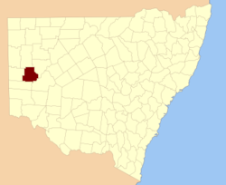
  • Menindee County, New South Wales — Infobox Australian cadastral name = Menindee state = New South Wales caption = Location in New South Wales near nw = South Australia near n = Yancowinna near ne = Tandora near e = Livingstone near se = Perry near s = Windeyer near sw = South… …   Wikipedia

  • Mootwingee County, New South Wales — Infobox Australian cadastral name = Mootwingee state = New South Wales caption = Location in New South Wales near nw = Evelyn near n = Yantara near ne = Yantara near e = Yungnulgra near se = Young near s = Tandora near sw = Yancowinna near w =… …   Wikipedia

  • Menindee County — Map of all coordinates from Google Map of all coordinates from Bing Export all coordinates as KML …   Wikipedia

  • Mootwingee County — Map of all coordinates from Google Map of all coordinates from Bing Export all coordinates as KML …   Wikipedia

  • Lands administrative divisions of New South Wales — The 141 counties of New South Wales, with the original Nineteen shown in pink …   Wikipedia

Share the article and excerpts

Direct link
Do a right-click on the link above
and select “Copy Link”