Nicholson County

Nicholson County
Nicholson
New South Wales
Nicholson NSW.PNG
Location in New South Wales
Lands administrative divisions around Nicholson
Franklin Franklin Blaxland
Waljeers Nicholson Dowling
Waradgery Sturt Cooper

Nicholson County is one of the 141 Cadastral divisions of New South Wales. It contains the towns of Hillston, Goolgowi, Gunbar, Merriwagga, Goorawin and Langtree. The Lachlan River is its north-western boundary.

Nicholson County is named in honour of the statesman, Sir Charles Nicholson (1808-1903).[1]

Parishes within this county

A full list of parishes found within this county; their current LGA and mapping coordinates to the approximate centre of each location is as follows:

Parish LGA Coordinates
Amoilla North Carrathool Shire Council 33°5354S 145°1204E / 33.89833°S 145.20111°E / -33.89833; 145.20111 (Amoilla North)
Amoilla Hay Shire Council 34°0654S 145°1004E / 34.115°S 145.16778°E / -34.115; 145.16778 (Amoilla)
Beaconsfield Carrathool Shire Council 33°5954S 145°3004E / 33.99833°S 145.50111°E / -33.99833; 145.50111 (Beaconsfield)
Belaley Carrathool Shire Council 34°0154S 145°1104E / 34.03167°S 145.18444°E / -34.03167; 145.18444 (Belaley)
Bellingerambil East Carrathool Shire Council 33°2954S 145°4304E / 33.49833°S 145.71778°E / -33.49833; 145.71778 (Bellingerambil East)
Bellingerambil South Carrathool Shire Council 33°3554S 145°3904E / 33.59833°S 145.65111°E / -33.59833; 145.65111 (Bellingerambil South)
Bellingerambil Carrathool Shire Council 33°2954S 145°3804E / 33.49833°S 145.63444°E / -33.49833; 145.63444 (Bellingerambil)
Berangerine Carrathool Shire Council 34°0354S 145°1704E / 34.065°S 145.28444°E / -34.065; 145.28444 (Berangerine)
Bogia Carrathool Shire Council 33°3754S 145°5104E / 33.63167°S 145.85111°E / -33.63167; 145.85111 (Bogia)
Bolton Carrathool Shire Council 33°5854S 149°4004E / 33.98167°S 149.66778°E / -33.98167; 149.66778 (Bolton)
Booligal Hay Shire Council 33°5254S 144°5604E / 33.88167°S 144.93444°E / -33.88167; 144.93444 (Booligal)
Bootheragandra Carrathool Shire Council 33°3254S 145°5104E / 33.54833°S 145.85111°E / -33.54833; 145.85111 (Bootheragandra)
Bouyaree Carrathool Shire Council 33°4454S 145°1104E / 33.74833°S 145.18444°E / -33.74833; 145.18444 (Bouyaree)
Bowerabine Carrathool Shire Council 34°0054S 145°1904E / 34.015°S 145.31778°E / -34.015; 145.31778 (Bowerabine)
Bulgura Hay Shire Council 34°0154S 145°0104E / 34.03167°S 145.01778°E / -34.03167; 145.01778 (Bulgura)
Bunda East Carrathool Shire Council 33°4254S 145°5104E / 33.715°S 145.85111°E / -33.715; 145.85111 (Bunda East)
Bunda North Carrathool Shire Council 33°3654S 145°4504E / 33.615°S 145.75111°E / -33.615; 145.75111 (Bunda North)
Bunda Carrathool Shire Council 33°4154S 145°4604E / 33.69833°S 145.76778°E / -33.69833; 145.76778 (Bunda)
Burgess Carrathool Shire Council 33°4454S 145°3004E / 33.74833°S 145.50111°E / -33.74833; 145.50111 (Burgess)
Caninganima Carrathool Shire Council 33°3754S 145°2004E / 33.63167°S 145.33444°E / -33.63167; 145.33444 (Caninganima)
Carilla Carrathool Shire Council 33°2754S 145°5104E / 33.465°S 145.85111°E / -33.465; 145.85111 (Carilla)
Chirnside Carrathool Shire Council 33°4954S 145°2404E / 33.83167°S 145.40111°E / -33.83167; 145.40111 (Chirnside)
Coowerrawine Carrathool Shire Council 33°5954S 145°0704E / 33.99833°S 145.11778°E / -33.99833; 145.11778 (Coowerrawine)
East Marowie Carrathool Shire Council 33°2654S 145°4404E / 33.44833°S 145.73444°E / -33.44833; 145.73444 (East Marowie)
Elliott Carrathool Shire Council 33°5454S 145°3704E / 33.915°S 145.61778°E / -33.915; 145.61778 (Elliott)
Eurella Carrathool Shire Council 33°5954S 145°1304E / 33.99833°S 145.21778°E / -33.99833; 145.21778 (Eurella)
Eurugabah Hay Shire Council 34°0254S 145°0504E / 34.04833°S 145.08444°E / -34.04833; 145.08444 (Eurugabah)
Fox Carrathool Shire Council 33°4654S 145°5704E / 33.78167°S 145.95111°E / -33.78167; 145.95111 (Fox)
Gonowlia Carrathool Shire Council 34°0054S 145°2604E / 34.015°S 145.43444°E / -34.015; 145.43444 (Gonowlia)
Goolgowi South Carrathool Shire Council 33°5415S 145°4911E / 33.90417°S 145.81972°E / -33.90417; 145.81972 (Goolgowi South)
Goolgowi West Carrathool Shire Council 33°4354S 145°4504E / 33.73167°S 145.75111°E / -33.73167; 145.75111 (Goolgowi West)
Goolgowi Carrathool Shire Council 33°4354S 145°5104E / 33.73167°S 145.85111°E / -33.73167; 145.85111 (Goolgowi)
Griffiths Carrathool Shire Council 33°5043S 145°3645E / 33.84528°S 145.6125°E / -33.84528; 145.6125 (Griffiths)
Honuna North Hay Shire Council 33°4954S 145°1204E / 33.83167°S 145.20111°E / -33.83167; 145.20111 (Honuna North)
Honuna Carrathool Shire Council 34°0254S 145°2304E / 34.04833°S 145.38444°E / -34.04833; 145.38444 (Honuna)
Hopwood Carrathool Shire Council 33°4854S 145°1904E / 33.815°S 145.31778°E / -33.815; 145.31778 (Hopwood)
Huntawong Carrathool Shire Council 33°2354S 145°4004E / 33.39833°S 145.66778°E / -33.39833; 145.66778 (Huntawong)
Ivanhoe Carrathool Shire Council 33°4354S 145°3804E / 33.73167°S 145.63444°E / -33.73167; 145.63444 (Ivanhoe)
Lachlan Carrathool Shire Council 33°3954S 145°5504E / 33.665°S 145.91778°E / -33.665; 145.91778 (Lachlan)
Lake Gunbar Carrathool Shire Council 33°5354S 145°1904E / 33.89833°S 145.31778°E / -33.89833; 145.31778 (Lake Gunbar)
Langtree Carrathool Shire Council 33°3354S 145°3004E / 33.565°S 145.50111°E / -33.565; 145.50111 (Langtree)
Loughnan Carrathool Shire Council 33°2954S 145°4604E / 33.49833°S 145.76778°E / -33.49833; 145.76778 (Loughnan)
Mea Mia North Carrathool Shire Council 33°4254S 145°1304E / 33.715°S 145.21778°E / -33.715; 145.21778 (Mea Mia North)
Mea Mia South Carrathool Shire Council 33°4454S 145°2404E / 33.74833°S 145.40111°E / -33.74833; 145.40111 (Mea Mia South)
Mea Mia Carrathool Shire Council 33°4354S 145°1804E / 33.73167°S 145.30111°E / -33.73167; 145.30111 (Mea Mia)
Melbergen South Carrathool Shire Council 33°5054S 145°5904E / 33.84833°S 145.98444°E / -33.84833; 145.98444 (Melbergen South)
Melbergen Carrathool Shire Council 33°4354S 145°5904E / 33.73167°S 145.98444°E / -33.73167; 145.98444 (Melbergen)
Molesworth Carrathool Shire Council 33°3954S 145°3004E / 33.665°S 145.50111°E / -33.665; 145.50111 (Molesworth)
Moncton Carrathool Shire Council 33°4954S 145°3004E / 33.83167°S 145.50111°E / -33.83167; 145.50111 (Moncton)
Moon Moon Hay Shire Council 33°4454S 145°0604E / 33.74833°S 145.10111°E / -33.74833; 145.10111 (Moon Moon)
Mulla Mulla Hay Shire Council 33°4854S 145°0504E / 33.815°S 145.08444°E / -33.815; 145.08444 (Mulla Mulla)
Mullion Carrathool Shire Council 33°3954S 145°2504E / 33.665°S 145.41778°E / -33.665; 145.41778 (Mullion)
Naradhun Carrathool Shire Council 33°3454S 145°2804E / 33.58167°S 145.46778°E / -33.58167; 145.46778 (Naradhun)
Neobine Hay Shire Council 33°5254S 145°0504E / 33.88167°S 145.08444°E / -33.88167; 145.08444 (Neobine)
Parker Carrathool Shire Council 33°4154S 145°3904E / 33.69833°S 145.65111°E / -33.69833; 145.65111 (Parker)
Redbank Carrathool Shire Council 33°2954S 145°3304E / 33.49833°S 145.55111°E / -33.49833; 145.55111 (Redbank)
Russell Carrathool Shire Council 33°5354S 145°2404E / 33.89833°S 145.40111°E / -33.89833; 145.40111 (Russell)
South Marowie Carrathool Shire Council 33°2654S 145°3604E / 33.44833°S 145.60111°E / -33.44833; 145.60111 (South Marowie)
Stackpoole Carrathool Shire Council 33°5054S 145°5204E / 33.84833°S 145.86778°E / -33.84833; 145.86778 (Stackpoole)
Synnot Carrathool Shire Council 33°5454S 145°3004E / 33.915°S 145.50111°E / -33.915; 145.50111 (Synnot)
Tambalana Hay Shire Council 33°5654S 144°5604E / 33.94833°S 144.93444°E / -33.94833; 144.93444 (Tambalana)
Townsend Carrathool Shire Council 33°3254S 145°5504E / 33.54833°S 145.91778°E / -33.54833; 145.91778 (Townsend)
Wallanthery Carrathool Shire Council 33°2354S 145°5004E / 33.39833°S 145.83444°E / -33.39833; 145.83444 (Wallanthery)
Warrabalong Carrathool Shire Council 33°5954S 145°3604E / 33.99833°S 145.60111°E / -33.99833; 145.60111 (Warrabalong)
Weenya Carrathool Shire Council 33°2254S 145°4504E / 33.38167°S 145.75111°E / -33.38167; 145.75111 (Weenya)
Weepool Carrathool Shire Council 33°3454S 145°2404E / 33.58167°S 145.40111°E / -33.58167; 145.40111 (Weepool)
Weerie Carrathool Shire Council 33°5154S 145°4204E / 33.865°S 145.70111°E / -33.865; 145.70111 (Weerie)
Whealbah South Carrathool Shire Council 33°3954S 145°1704E / 33.665°S 145.28444°E / -33.665; 145.28444 (Whealbah South)
Yandumblin Hay Shire Council 33°4754S 144°5904E / 33.79833°S 144.98444°E / -33.79833; 144.98444 (Yandumblin)
Yurdyilla Hay Shire Council 34°0554S 145°0404E / 34.09833°S 145.06778°E / -34.09833; 145.06778 (Yurdyilla)

References

  1. ^ Geographical Names Board of NSW

Wikimedia Foundation. 2010.

Игры ⚽ Нужно решить контрольную?

Look at other dictionaries:

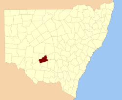
  • Nicholson County, New South Wales — Infobox Australian cadastral name = Nicholson state = New South Wales caption = Location in New South Wales near nw = Franklin near n = Franklin near ne = Blaxland near e = Dowling near se = Cooper near s = Sturt near sw = Waradgery near w =… …   Wikipedia

  • Nicholson — Family name Meaning derived from Son of Nichol Region of origin England, Scotland Footnotes: [1] Nicholson is a surname of northern E …   Wikipedia

  • Nicholson — ist der Familienname folgender Personen: Alfred Osborn Pope Nicholson (1808–1876), US amerikanischer Politiker Arthur Nicholson (1947–1985), Major der US Army, das letzte Opfer des Kalten Krieges Ben Nicholson (1894–1982), britischer Maler und… …   Deutsch Wikipedia

  • Nicholson-Rand House — U.S. National Register of Historic Places …   Wikipedia

  • Nicholson House — may refer to: in the United States (by state then city) Nicholson House (Oyster Bay, Alabama), listed on the National Register of Historic Places in Baldwin County, Alabama Grace Nicholson Building, Pasadena, California, listed on the NRHP in… …   Wikipedia

  • Nicholson, Kentucky — Nicholson is an unincorporated community in Kenton County, Kentucky, United States, located directly south of Independence. Contents 1 Geography 2 Government 3 Library 4 …   Wikipedia

  • Nicholson Township, Pennsylvania — Nicholson Township is the name of some places in the U.S. state of Pennsylvania: Nicholson Township, Fayette County, Pennsylvania Nicholson Township, Wyoming County, Pennsylvania This disambiguation page lists articles about distinct geographical …   Wikipedia

  • Nicholson (Georgia) — Nicholson Ciudad de los Estados Unidos …   Wikipedia Español

  • County Durham local elections — County Durham Unitary Council is elected every four years. Since becoming a unitary authority in 2008, 126 councillors have been elected from 63 wards.[1] Contents 1 Political control 2 Council elections …   Wikipedia

  • Nicholson —   [ nɪklsn],    1) Ben, britischer Maler und Grafiker, * Denham (County Buckinghamshire) 10. 4. 1894, ✝ London 6. 2. 1982; Ȋ 1932 51 mit Barbara Hepworth. Entscheidend für seine Entwicklung wurde 1921 die Begegnung mit P. Picasso sowie der… …   Universal-Lexikon

Share the article and excerpts

Direct link
https://en-academic.com/dic.nsf/enwiki/11583920 Do a right-click on the link above
and select “Copy Link”