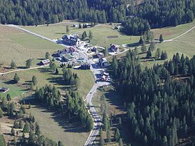
- Karerpass
-
Karerpass (Passo di Costalunga)
KarerpassElevation 1,745 m (5,725 ft) Location Location South Tyrol,  Italy
ItalyCoordinates 46°24′24″N 11°36′25″E / 46.40667°N 11.60694°E The Karerpass (Italian: Passo di Costalunga; Ladin: Jouf de Ciareja; German: Karerpass) (1745 m) is a high mountain pass in the province of South Tyrol in Italy. It connects Bolzano through the Eggental and the Welschnofen Valley with the Fassa Valley. Just below the pass on the Welschnofen Valley side is the stunningly blue Karersee lake.
See also
- List of highest paved roads in Europe
- List of mountain passes
Coordinates: 46°24′24″N 11°36′25″E / 46.40667°N 11.60694°E
Categories:- Mountain passes of the Alps
- Mountain passes of South Tyrol
- Trentino-Alto Adige/Südtirol geography stubs
Wikimedia Foundation. 2010.

