- Cordillera de la Ramada
-
Cordillera de la Ramada Range 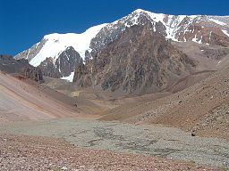 Mercedario (6,720 m)
Name origin: Spanish for "Range of the Shelter" Country Argentina Part of Andes Highest point Mercedario - elevation 6,720 m (22,047 ft) The Cordillera de la Ramada (Spanish for "Range of the Shelter", also called Cordón de la Ramada, in which cordón means 'ribbon' or 'rope', is a mountain range in the San Juan province of Argentina, bordering on Chile, forming part of the Andes. Its highest peak is Mercedario at 6,720 metres (22,050 ft).
The first ascents of several peaks in the range were achieved by a Polish expedition of 1934 organized by the Tatra Society and led by Konstanty Jodko-Narkiewicz, whose party consisted of S. W. Daszynski, J. K. Dorawski, A. Karpinski, S. Osiecki, and W. Ostrowski.[1] They climbed Mercedario, Alma Negra, Pico Polaco, La Mesa, and Cerro Ramada.[2]
The range is clearly visible from the better-known Aconcagua, the highest mountain in the Americas at 6,962 metres (22,840 ft), which is 100 km south of Mercedario, with the result that some of the many climbers who frequent Aconcagua move on to this range, although the area is less easy to access.
Thanks to heavy cloud cover, the whole range has formed large glaciers which come to their lower ends at about 4,000 metres (13,120 ft). [3] La Mesa, at 6,200 metres (20,340 ft),[4] has especially huge glaciers and is not often climbed. Long ridge traverses are necessary to climb it.
Temperatures can be extreme in summer and winter, but the climate is stable in the autumn and the spring.[5] The best time of year for climbing in the range is from mid-December to the end of February.[2]
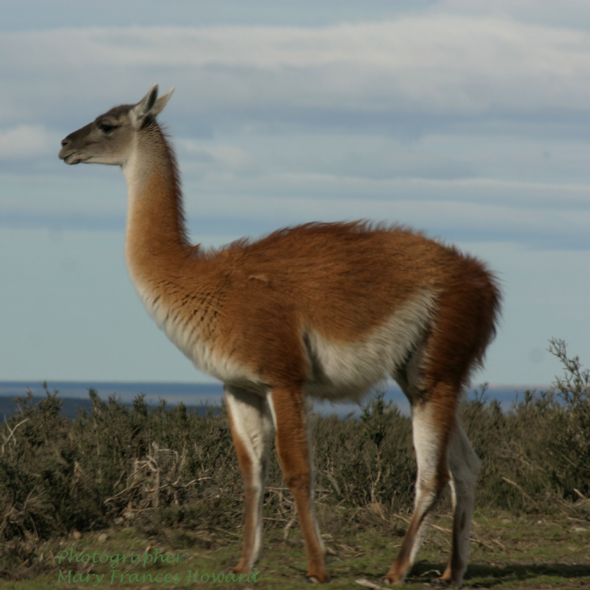
In the lower country beneath the range there are substantial mining industries, producing limestone, dolomite, bentonite, marble, aggregates, calcite and feldspar, as well as silver and gold. Paleontologists have found fossils here of some of the earliest dinosaurs, including the Herrerasaurus and Eoraptor lunensis. Local wildlife includes condors, rheas, guanacos and vicuña.[5]
Mountains
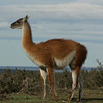

The guanaco, which runs wild in the area. - Mercedario, 6,720 metres (22,050 ft), the eighth highest mountain of the Andes, known in Chile as El Ligua.[2]
- Ramada Norte, 6,500 metres (21,330 ft)
- Cerro del Nacimiento, 6,493 metres (21,300 ft)[6]
- Alma Negra, 6,290 metres (20,640 ft)[7]
- Cerro Ramada, Argentina and Chile, 6,200 metres (20,340 ft)[8]
- La Mesa, 6,200 metres (20,340 ft)
- Pico Polaco, 6,001 metres (19,690 ft)[7]
Notes
- ^ S. W. Daszynski, "A Polish Expedition to the High Andes," The Geographical Journal 84 (1934): 215-223. ISSN 1475-4959. JSTOR 1785755. OCLC 51205408. "This concluded the mountaineering programme of the expedition in the Cordillera de la Ramada. All the peaks were climbed for the first time and mapped to a fair degree of accuracy. Cairns were erected on the summits of Mercedario, Cerro Ramada, and Alma Negra. There remained only the last point of the programme, the climbing of the Aconcagua, which was some 80 miles in a straight line to the south of the Ramada."
- ^ a b c Christabelle Dilks, Footprint Argentina , p. 242 online
- ^ Anales de la Universidad de Chile (1928), p. 620: "...debido a los cerros gigantescos, se han formado grandes glaciares que terminan a 4000 m."
- ^ Dilks, op. cit., p. 212
- ^ a b San Juan, tierra del sol at argentina.ar, accessed 12 November 2010 (in Spanish)
- ^ Norris McWhirter, The Guinness Book of Answers (1985), p. 15
- ^ a b Frédéric Hartemann, Robert Hauptman, The mountain encyclopedia: an A-Z compendium of more than 2,300 terms, concepts, ideas, and people (Scarecrow Press, 2005), p. 18: "Alma Negra 6290 m, 20636 ft... Pico Polaco 6001 m, 19688 ft"
- ^ Hartemann & Hauptman, op. cit., p. 255: "Cerro Ramada 6410 m, 21020 ft, Andes, Argentina & Chile"
See also
- List of mountains in the Andes
Categories:- Andes
- Mountain ranges of Argentina
- Mountain ranges of Chile

Wikimedia Foundation. 2010.