- Clear Creek, Lassen County, California
-
Clear Creek — census-designated place — Location in California
 Clear Creek
Coordinates: 40°17′53″N 121°02′55″W / 40.29806°N 121.04861°WCoordinates: 40°17′53″N 121°02′55″W / 40.29806°N 121.04861°W Country  United States
State  California
County Lassen County Area[1] - Total 1.139 sq mi (2.949 km2) - Land 1.133 sq mi (2.934 km2) - Water 0.006 sq mi (0.015 km2) 0.52% Elevation[2] 4,970 ft (1,515 m) Population (2010) - Total 169 - Density 148.4/sq mi (57.3/km2) Time zone Pacific (PST) (UTC-8) - Summer (DST) PDT (UTC-7) ZIP Code GNIS feature IDs 1658289; 2611428 U.S. Geological Survey Geographic Names Information System: Clear Creek, Lassen County, California; U.S. Geological Survey Geographic Names Information System: Clear Creek, Lassen County, California Clear Creek is a census-designated place (CDP)[3] in Lassen County, California.[2] It is located 2.5 miles (4 km) west-southwest of Westwood,[4] at an elevation of 4970 feet (1515 m).[2] The population was 169 at the 2010 census.
Geography
According to the United States Census Bureau, the CDP has a total area of 1.1 square miles (2.9 km²), of which, over 99% of it is land.
Demographics
The 2010 United States Census[5] reported that Clear Creek had a population of 169. The population density was 148.4 people per square mile (57.3/km²). The racial makeup of Clear Creek was 149 (88.2%) White, 0 (0.0%) African American, 5 (3.0%) Native American, 0 (0.0%) Asian, 2 (1.2%) Pacific Islander, 1 (0.6%) from other races, and 12 (7.1%) from two or more races. Hispanic or Latino of any race were 15 persons (8.9%).
The Census reported that 169 people (100% of the population) lived in households, 0 (0%) lived in non-institutionalized group quarters, and 0 (0%) were institutionalized.
There were 73 households, out of which 17 (23.3%) had children under the age of 18 living in them, 35 (47.9%) were opposite-sex married couples living together, 7 (9.6%) had a female householder with no husband present, 6 (8.2%) had a male householder with no wife present. There were 5 (6.8%) unmarried opposite-sex partnerships, and 0 (0%) same-sex married couples or partnerships. 18 households (24.7%) were made up of individuals and 4 (5.5%) had someone living alone who was 65 years of age or older. The average household size was 2.32. There were 48 families (65.8% of all households); the average family size was 2.69.
The population was spread out with 29 people (17.2%) under the age of 18, 9 people (5.3%) aged 18 to 24, 26 people (15.4%) aged 25 to 44, 71 people (42.0%) aged 45 to 64, and 34 people (20.1%) who were 65 years of age or older. The median age was 49.7 years. For every 100 females there were 101.2 males. For every 100 females age 18 and over, there were 118.8 males.
There were 162 housing units at an average density of 142.3 per square mile (54.9/km²), of which 55 (75.3%) were owner-occupied, and 18 (24.7%) were occupied by renters. The homeowner vacancy rate was 5.2%; the rental vacancy rate was 14.3%. 124 people (73.4% of the population) lived in owner-occupied housing units and 45 people (26.6%) lived in rental housing units.
References
- ^ U.S. Census
- ^ a b c U.S. Geological Survey Geographic Names Information System: Clear Creek, Lassen County, California
- ^ U.S. Geological Survey Geographic Names Information System: Clear Creek, Lassen County, California
- ^ Durham, David L. (1998). California's Geographic Names: A Gazetteer of Historic and Modern Names of the State. Quill Driver Books. p. 365. ISBN 9781884995149.
- ^ All data are derived from the United States Census Bureau reports from the 2010 United States Census, and are accessible on-line here. The data on unmarried partnerships and same-sex married couples are from the Census report DEC_10_SF1_PCT15. All other housing and population data are from Census report DEC_10_DP_DPDP1. Both reports are viewable online or downloadable in a zip file containing a comma-delimited data file. The area data, from which densities are calculated, are available on-line here. Percentage totals may not add to 100% due to rounding. The Census Bureau defines families as a household containing one or more people related to the householder by birth, opposite-sex marriage, or adoption. People living in group quarters are tabulated by the Census Bureau as neither owners nor renters. For further details, see the text files accompanying the data files containing the Census reports mentioned above.
Municipalities and communities of Lassen County, California City 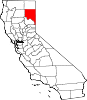
CDPs Unincorporated
communitiesAvila Place | Belfast | Big Valley | Brockman | Buntingville | Calneva | Coppervale | Crest | Dan Ryan Place | Dixie | Evans Place | Hallelujah Junction | Halls Flat | Hayden Hill | Herlong Junction | Horse Lake | Hot Springs | Jellico | Karlo | Lasco | Leavitt | Leonard | Little Valley | Madeline | Moran | Norvell | Omira | Pine Town | Pinnio | Plumas | Pumpkin Center | Ravendale | Reno Junction | Robbers Creek | Sage Hen | Scotts | Scotty Place | Sheepshead | Shumway | Stacy | Standish | Stones Landing | Termo | The Crossing | Viewland | Wendel | Westwood Junction
Indian reservation Susanville Indian Rancheria
Ghost towns Addington | Antelope | Argusville | Ashton | Atola | Bunnel | Camero | Chats | Clinton | Conman | Constantia | Cromwell | Cuba | Datura | Dayton | Dewitt | Edgemont | Evan's Ranch | Fredonia | Gest | Glade | Goumaz | Hillside | Hausen | Junction House | Juniper | Lake Greeno | Lake Nokopen | Long Valley | Madeline | Mapes | Molitor | Moll Ranch | Murray | Plumas Junction | Prockmans | Purser | Rayl | Red Camp | Roscoe | Sellicks Springs | Secret Springs | Sheep Springs | Soldier's Bridge | Tiptons Springs | Waverly | Wheaton
Categories:- Census-designated places in Lassen County, California
- Unincorporated communities in California


Wikimedia Foundation. 2010.