- Sultanate of Cirebon
-
This article is part of the
History of Indonesia series
See also:
Timeline of Indonesian History Prehistory Early kingdoms Kutai (4th century) Tarumanagara (358–669) Kalingga (6th–7th century) Srivijaya (7th–13th centuries) Sailendra (8th–9th centuries) Sunda Kingdom (669–1579) Medang Kingdom (752–1045) Kediri (1045–1221) Singhasari (1222–1292) Majapahit (1293–1500) The rise of Muslim states Spread of Islam (1200–1600) Sultanate of Ternate (1257–present) Malacca Sultanate (1400–1511) Sultanate of Demak (1475–1548) Aceh Sultanate (1496–1903) Sultanate of Banten (1526–1813) Mataram Sultanate (1500s–1700s) European colonization The Portuguese (1512–1850) Dutch East India Co. (1602–1800) Dutch East Indies (1800–1942) The emergence of Indonesia National awakening (1908–1942) Japanese occupation (1942–45) National revolution (1945–50) Independent Indonesia Liberal democracy (1950–57) Guided Democracy (1957–65) Start of the New Order (1965–66) The New Order (1966–98) Reformasi era (1998–present) The Sultanate of Cirebon (Indonesian: Kesultanan Cirebon, Sundanese: Kasultanan Cirebon) was a sultanate in West Java founded in the sixteenth century. It is said to have been founded by Sunan Gunungjati, who also established the Sultanate of Banten.
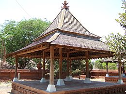
The sultanate lay in the vicinity of the modern-day city of Cirebon on Java's north coast. Today there is four kratons (palaces) in Cirebon; Kraton Kasepuhan, Kraton Kanoman, Kraton Kacirebonan, and Kraton Keprabonan.
History
Cirebon was part of Sunda kingdom as stated on travel records of Prince Bujangga Manik, a Hindu Sundanese monk who visited all of the holy Hindu sites in Java and Bali at the beginning of the sixteenth century. In his lontar manuscripts, which are saved in the Bodleian Library of Oxford University in England since the sixteenth century, the border of the Sunda kingdom in the west is Sunda Streats and in the east is Cipamali river (present day kali Brebes) and Ciserayu river (present day Serayu River) in Central Java Province.[1]
One source proclaiming the fact is a report from Tomé Pires, a Portuguese explorer. He wrote in his report:
Some people affirm that the Sunda kingdom take up half of the whole island of Java; others, to whom more authority is attributed, say that the Sunda kingdom must be a third part of the island and an eight more. It ends at the river chi Manuk. The river intersects the whole island from sea to sea in such away that when the people of Java describe their own country, they say that it is bounded to the west by island of Sunda. The people hold that whoever passes this strait (the river Cimanuk) into the South Sea is carried off by violent currents and unable to return.[2]
Pires also wrote that:
The people of Sunda are said to be truthful. They, with great city of Dayo, the town and lands and port of Bantam, the port of Pontang, the port of Cheguide, the port of Tangaram, the Port of Tangaram, the port of Calapa, the port of chi Manuk.
Footnotes
- ^ Ekajati, Edi S. (2005). Kebudayaan Sunda Jaman Pajajaran. Yayasan Cipta Loka Caraka.
- ^ SJ, Adolf Heuken (1999). Sumber-sumber asli sejarah Jakarta, Jilid I: Dokumen-dokumen sejarah Jakarta sampai dengan akhir abad ke-16. Cipta Loka Caraka. p. 34.
See also

Indonesia portal - History of Indonesia
- List of monarchs of Java
Categories:- Pre-colonial States of Indonesia
- Cirebon
- Islamic states in Indonesia

Wikimedia Foundation. 2010.