- Innisfil
-
- Not to be confused with Innisfail
Town of Innisfil Town hall Motto: Where Opportunity Meets Prosperity Coordinates: 44°18′N 79°35′W / 44.3°N 79.583°WCoordinates: 44°18′N 79°35′W / 44.3°N 79.583°W Country  Canada
Province  Ontario
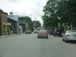
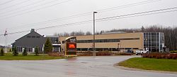
County Simcoe Incorporated Government – Mayor Barb Baguley – Governing Body – MPs Peter Van Loan – MPPs Julia Munro Area – Total 284.18 km2 (109.7 sq mi) Population (2006) – Total 31,175 – Density 109.7/km2 (284.1/sq mi) Time zone Eastern (EST) (UTC-5) – Summer (DST) EDT (UTC-4) Postal code span Website www.innisfil.ca  Highway 89 through Cookstown
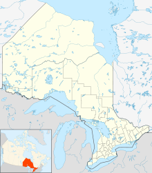
Innisfil is a town in Ontario, Canada, located on the western shore of Lake Simcoe in Simcoe County, immediately south of Barrie and 80 kilometres north of Toronto. It has historically been a rural area, but growth in the Barrie area and the Greater Toronto Area has meant greater residential development in Innisfil.
Contents
History
The history of Innisfil spans a period in excess of 170 years. The Town was hewn from almost unbroken virgin forests which had been home to the Huron Indians, and was first surveyed in 1820. The area encompassed 68,653 acres (278 km²), including the villages of Allandale, Tollendal, Painswick, Minets Point, and Holly at the time.
The first settlers were the Hewson & Soules families who came by way of the East Holland River and Lake Simcoe to settle at Point Endeavour that they then renamed Hewson's Point (later named Big Bay Point). The Hewsons settled on March 30, 1820 and the Soules in 1822. The Warnica family settled the following year, in 1823, in the area now known as Painswick. The first sawmill in the Township was built at Tollendal by George McMullen in 1829. At this time James Soules owned a sawmill on the south half of lot 26 concession fourteen (Big Bay Point), Innisfil where he made the lumber for the construction of the first frame house in Innisfil for Lewis J. Clement.
John and George Warnica completed the clearing of the bush between Barrie and Churchill. John Cayton had won the contract to open the road between Churchill and the 12th line of West Gwillimbury, known as Cayton's Corners but owing to his slight acquaintance with the forest, he sub-let the work to John and George Warnica who completed Cayton's contract between Churchill and the 12th line of West Gwillimbury, north of Bradford. This opened the land route, known as Penetanguishene Road, which later became Highway 11 and is now Yonge Street. This route between York (now Toronto) and Barrie was completed in the fall of 1825.
Along this road the settlers came, and spread out along the concession lines to clear the lands and develop their farms. There had been those who came ahead by way of the river and the lake; many settled near the shores of Lake Simcoe and Kempenfelt Bay. The only channels of communication were the public roads, and these were scant and poor.
The pioneer farms cut from the forest were mostly self-sustaining. What few products there were for sale found a market in nearby Barrie, which was then little more than a village. Distant York was reached in the winter when the ice and snow made for better roads.
During this period, post offices, churches, and stores were established, also a form of local government performed by commissioners was appointed under a provincial act. The first post office, then called Innisfil, was located at what is now called Barclay's Corners. The first school was built in 1838 and located at Myers Corners, later called Victoria (now the community of Stroud). The first church was also at Victoria, and was of Methodist denomination.
Milling in Innisfil was first done at Tollendal in 1835. The need for a grist mill to grind wheat is an indication of the progress toward an agricultural community.
The earliest official record of a census shows that by 1842 the population of Innisfil was 762.[1]
Establishment of Innisfil
The year 1850 marked the end of the old commissioners rule. The population had increased to 1,807 nearly tripling in under a decade. The first municipal council was established, replacing the government of appointed commissioners. The Corporation of the Township of Innisfil was born.
The settlement of Allandale became more prominent with the construction of the Ontario, Simcoe and Huron Railway (later the Northern Railway) from Toronto to Collingwood. The first train from Toronto arrived in Allandale on October 11, 1853.
The continued building of public roads, together with the railway and the lake navigation, resulted in the establishment of more flourishing hamlet settlements.
Belle Ewart was formed in 1854. Henry's Corners, now Thornton, was formed in 1833. Perry's Corners, now Cookstown, was formed around 1859. Hamlet settlement also resulted in a burgeoning resort development along the entire shoreline.
In 1891, 500 acres (2 km²) of Innisfil became incorporated as the Village of Allandale, now part of the City of Barrie. Barrie annexed a further 500 acres (2 km²) in 1897.
Innisfil flourished over the years and by 1950, had a population of 3500. However, paved roads, the automobile (the first recorded in the town was 1912), the price of fuel, and the cost of housing outside Toronto encouraged commuter residents. This in turn gradually changed the nature of our shoreline development. Seasonal housing evolved to permanent residential. Now, about 90% of the shoreline is permanent residences.
Modern development
Cookstown, at the south-west extremity of the township, became an incorporated village in 1962, with 100 acres (400,000 m²) of Innisfil becoming part of Cookstown.
In 1967, 597 acres (2.4 km²) were annexed from Innisfil by the City of Barrie to accommodate the establishment of the Formosa Spring Brewery. This facility was purchased by Molson's and has since been closed and sub-let to other businesses.
On January 1, 1982, 8623 acres (35 km²) were annexed to the City of Barrie, with a further 737 acres (3 km²) to be annexed January 1, 1987. As a result of the annexations, Innisfil's population was reduced by approximately 26.7% to 12,153 permanent residents, and its total assessment was reduced by 20.4%.
On January 1, 1991, by virtue of the South Simcoe Act, the Township of Innsifil, a north section of the Township of West Gwillimbury, and the Village of Cookstown were amalgamated and incorporated as the Town of Innisfil.
In 1993, the Ontario Stockyards livestock facility, located for a long time in Toronto, relocated to just east of the Cookstown town site, on Highway 89.
The County of Simcoe Act provided for further restructuring of Simcoe County on January 1, 1994 when the Village of Thornton was amalgamated with the Township of Essa and a small section of the Township of Essa, adjacent to Cookstown, was amalgamated with Innisfil.
As of 2006, Innisfil had a total permanent population of 31,175 and an estimated seasonal population of 4,000 people. Having begun as a community of seasonal homes for people living in Toronto, it is now a popular place for permanent residents, mostly families and empty nesters, and, indeed, most of the "cottages" along the lake shore have since been converted into year-long homes.
Georgian Downs Harness racetrack and casino is located on the 5th Sideroad near the Highway 400 interchange at Innisfil Beach Road.
The Province of Ontario has enacted legislation that will enable the city of Barrie to annex 2,293 acres (9.28 km2) from the town of Innisfil as of January 1, 2010.[2] The land in question extends south beyond 10th line west of the 10th Sideroad, and as far south as Lockhart Road on the east side of the 10th Sideroad.[3] Innisfil retains the community of Stroud, but the community of St. Pauls will shift to Barrie.
Demographics
According to the Canada 2006 Census:
- Population: 31,175
- % Change (2001–2006): 8.8%
- Dwellings: 12,822
- Area (km².): 284.18
- Density (persons per km².): 109.7
Neighbourhoods
The township comprises the communities of Alcona, Simcoe Beach, Alderslea, Barclay, Bear Point, Belle Ewart, Belle Air Beach, Bethesda, Big Bay Point, Big Cedar Point, Cedar Mount, Churchill, Cookstown, De Grassi Point, Fennell, Gilford, Glenhaven Beach, Glenwood Beach, Innisfil Heights, Killarney Beach, Lefroy, Maple Grove, Mooselanka Beach, Nantyr, Nantyr Park, Sandy Cove, Sandy Cove Acres and Stroud.
Government
Town council is composed of the mayor, deputy mayor, and seven councillors who are elected on a ward basis. The council members are as follows, as elected in October 2010:
- Mayor: Barb Baguley
- Deputy Mayor: Dan Davidson
- Councillor, Ward 1: Doug Lougheed
- Councillor, Ward 2: Richard Simpson
- Councillor, Ward 3: Ken Simpson
- Councillor, Ward 4: Rod Boynton
- Councillor, Ward 5: Bill Loughead
- Councillor, Ward 6: Maria Baier
- Councillor, Ward 7: Lynn Dollin
The mayor and deputy mayor represent Innisfil at Council meetings of Simcoe County.
The town is part of the riding of York—Simcoe, represented federally by Peter Van Loan of the Conservative Party and provincially by Julia Munro of the Progressive Conservative Party of Ontario.
Policing in Innisfil is provided by the South Simcoe Police Service.
Culture
Cookstown is a hub of antique specialty stores and outlet shopping, and is known as the antique capital of southern Ontario. Cookstown is also known for its annual garage sale called "Wing-Ding" which occurs the first weekend of June every year. The Cookstown Fair is held annually, usually in September.
Cookstown is the birthplace of Emily Murphy, a noted Canadian women's rights activist. In 1916, she became the first woman police magistrate in Alberta, and in the British Empire. She is best known for her contributions to Canadian feminism, specifically to the question of whether women were "persons" under Canadian law.[4]
A TV movie, Murder She Purred: A Mrs. Murphy Mystery was filmed in Cookstown in 1998.[5]
Alcona hosts Summerfest and Winterfest at Innisfil Beach road in the early summer and mid winter, each year at Innisfil Beach located at the end of Innisfil Beach Rd (8th Line).
Sports
- Innisfil Lakers of the Greater Metro Junior A Hockey League
- Innisfil Wolfpack of the Ontario Junior C Lacrosse League
- Innisfil Soccer Club
- Innisfil Skating Club
- Innisfil Jr. Broomball
References
A History of Simcoe County by Andrew Frederick Hunter
External links

Barrie, Kempenfelt Bay / Oro-Medonte Lake Simcoe 
Essa 
Cook's Bay of Lake Simcoe / Georgina  Innisfil

New Tecumseth Bradford West Gwillimbury Cities 1 Towns Bradford West Gwillimbury • Collingwood • Innisfil • Midland • New Tecumseth • Penetanguishene • Wasaga BeachTownships First Nations reserves Christian Island 30 • Christian Island 30A • Mnjikaning First Nation 32See also: Communities in Simcoe County • Census divisions of Ontario
1 Separated municipalities but remain a census subdivision of the countyCategories:- Municipalities in Simcoe County, Ontario
- Towns in Ontario
Wikimedia Foundation. 2010.


