- Oro-Medonte, Ontario
Infobox Settlement
official_name = Township of Oro-Medonte
native_name =
nickname =
motto =
imagesize =
image_caption =
image_
image_dot_
imagesize =
image_caption =
image_
image_dot_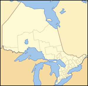
dot_mapsize = 250px
dot_map_caption = Location of Oro-Medonte, Ontario
dot_x = 184 |dot_y = 187
mapsize =
map_caption =
subdivision_type = Country
subdivision_type1 = Province
subdivision_type2 = County
subdivision_name =Canada
subdivision_name1 =Ontario
subdivision_name2 = Simcoe
leader_title = Mayor
leader_name =Harry Hughes
leader_title1 = Governing Body
leader_name1 =
leader_title2 = MPs
leader_name2 =
leader_title3 = MPPs
leader_name3 =
established_title = Incorporated
established_date = 1994
established_title2 =
established_date2 =
established_title3 =
established_date3 =
area_magnitude =
area_total_km2 = 586.65
area_total_sq_mi =
area_land_km2 =
area_land_sq_mi =
area_water_km2 =
area_water_sq_mi =
area_water_percent =
area_urban_km2 =
area_urban_sq_mi =
area_metro_km2 =
area_metro_sq_mi =
population_as_of = 2006
population_note =
population_total = 20,031
population_density_km2 = 34.1
population_density_sq_mi =
population_metro =
population_density_metro_km2 =
population_density_metro_sq_mi =
population_urban =
timezone = Eastern (EST)
utc_offset = -5
timezone_DST = EDT
utc_offset_DST = -4
elevation_m =
elevation_ft =
postal_code_type = Postal code span
postal_code =
website = [http://www.oro-medonte.ca/ Township Of Oro-Medonte]
footnotes =Oro-Medonte is a township in south-central
Ontario ,Canada on the northwestern shores ofLake Simcoe in Simcoe County.Oro-Medonte was previously two neighbouring townships, brought together in 1994, under a restructuring of Simcoe County. It is divided into lines based on the
concession system implemented by the British colonial government in the mid-1700s. Currently there are 15 lines that are now streets and highway exits off Highway 11.Communities
The township comprises the communities of Barrillia Park, Bass Lake Park, Baywood Park, Big Cedar Estates, Carley, Carthew Bay, Cedarmont Beach, Coulson, Craighurst, Creighton, Crown Hill, Eady, East Oro, Edgar, Eight Mile Point, Fair Valley, Fergus Hill Estate, Forest Home, Foxmead, Guthrie, Hawkestone, Hawkestone Beach, Hobart, Horseshoe Valley, Jarratt, Lakeview, Martinville, Mitchell Square, Moons Beach, Moonstone, Mount St. Louis, Oro Beach, Oro Lea Beach, Oro Park, Oro Station, Palm Beach, Parkside Beach, Prices Corners, Roberta Park, Rugby, Shanty Bay, Simcoeside, Sugar Bush, Waddington Beach and Warminster.
History
First Nations had long established encampments and trails on the bank of Hawkestone Creek, Ridge Road and throughout the Township of Oro-Medonte. In the 1830s Richard Hodges established a landing for settlers, mainly from theBritish Isles , who after arriving by lake steamer, onLake Simcoe , followed these trails to their settlement in search of independence and land ownership.Craighurst started as a small community on the
Penetanguishene Road in the 1830s. Its post office was established in the 1850s, at its peak in the late 1800s, Craighurst had 4 hotels, three churches, and a school house.A thriving community of a tavern, hotel, store and the first post office was located near the lake east of the creek at Hodges' Landing. The first postmaster was Charles Bell. Two dams and 3 mills sawed logs and ground grains. It is thought that the first mill was established by John Williamson who subsequently built the large brick house on the North-East corner of the Ridge Road and Line #11 South. In 1856 a new wharf was constructed and the name was changed from Hodges' Landing to Hawkestone.
The establishment of Shanty Bay was strongly influenced by the
Underground Railroad . Many African-American refugees first settled near the water in shanties (small homes), contributing toward the name of the village.Lucius Richard O'Brien (1832-1899), the noted Canadian oil and watercolour landscape painter was from Shanty Bay. His father founded the village. [Reid, Dennis. "A Concise History of Canadian Painting." 2nd Edition. Toronto: Oxford University Press, 1988. ISBN 019540663X.] Shanty Bay also has one of Canada's oldest surviving churches, St. Thomas Anglican Church, built between 1838 and 1841 and dedicated in 1842.In 1866-67 a drill-shed was erected by the Oro Company, 35th
Battalion the Simcoe Foresters. At this time when theFenian raids were alarming the country, eight company drill-sheds where built in Simcoe County, the county paying $390 and the government $250 for each. The company was manned by pioneer men of Oro, local Wm.E. O'Brien of Shanty Bay became Lieutenant Colonel of the Battalion in 1882. This building served Oro Company until the turn of the century and was dismantled around 1918.During 1871 the railroad reached Hawkestone. An extensive "station" evolved with a freight shed, stockyards and a massive water tower to supply the requirements of the
steam locomotives . Many types of products were shipped out and supplies shipped in. Another branch of theCanadian Pacific Railway was built through Craighurst in the early 1900s, opening from Bolton to Craighurst in November 1906, when a station was opened. On July 19, 1907 the track was extended to Bala and by June 1908, the line was completed to Sudbury. This is now part of the railway's main line between the east and west.Edgar was the site of a cold war radar site from 1952 to 1964. [ [http://www.pinetreeline.org/photos/edgar/edgar68.jpgDirections to Edgar] ]
In 1959 the
Ukrainian National Federation (UNF) purchased the "Pugsley Farm" property located on the East half of LOT 23 and Lot 24 in Hawkestone. The 200+ Acres were developed into a large Recreation Area and Children's Camp where Members of the UNF and their families have spent their summers on the shores of Lake Simcoe. A portion of the property was subdivided into 100 half acre lots, and sold to members of the UNF who built summer homes and cottages adjacent to the UNF. The entire property was named "Sokil", which is the Ukrainian word for "Hawk" in reference to the village of Hawkestone where the community was established. Today the private subdivision is maintained by the "Sokil Property Owners Association" (www.sokilvillage.com)which manages the non-municipal water system, roads and other related issues. The UNF still maintains the Recreation Area and Children's Camp, where three children's summer camps run throughout the summer, as well as weekend overnight camping area, seasonal cabin rentals and a seasonal trailer park. St. John the BaptistUkrainian Catholic chapel also conducts services each Sunday throughout the summer season.Government
The township council is comprised of a mayor, deputy mayor, and five councillors who each represent one of five wards. The members of council [ [http://www.oro-medonte.ca/CommunityInfo/ContactUs/2006-2010Council/ViewContacts/index.htm Township of Oro-Medonte] ] from the elections of 2006 through 2010 are:
* Mayor: Harry Hughes
* Deputy Mayor: Ralph Hough
* Councillor Ward 1: Mel Coutanche
* Councillor Ward 2: Terry Allison
* Councillor Ward 3: Sandy Agnew
* Councillor Ward 4: John Crawford
* Councillor Ward 5: Dwight EvansThe mayor and deputy mayor also represent the township at meetings of Simcoe County Council.
Recreation
The last Canadian National train passed through in September 1996. In 1998 the railway land through the township was acquired by council for a shared-use recreational trail stretching from Barrie to Orillia. Sections are used in the winter season by the Ontario Federation of Snowmobile Clubs.
Bass Lake Provincial Park and theCopeland Forest Resources Management Area are located within the township. Two major ski resorts,Mount St. Louis-Moonstone andHardwood Hills , are also located within Oro-Medonte.Transportation
Highway 400, Highway 11 and Highway 12 pass through Oro-Medonte.
Penetanguishene Road , a historic colonization road and a former part of Highway 93, defines most of Oro-Medonte's boundary with the neighbouring township of Springwater.The
Lake Simcoe Regional Airport is located in the township near the community of Guthrie.Population
According to the 2006
Statistics Canada Census:
*Population: 20,031 (18,315)
*% Change (2001-2006): 9.4
*% Change (1996-2001): 9.7
*Dwellings: 7,667
*Area (km².): 586.65
*Density (persons per km².): 34.1References
External links
* [http://www.oro-medonte.ca/ Township Of Oro-Medonte]
Geographic Location (8-way)
Centre = Oro-Medonte
North =

Wikimedia Foundation. 2010.