- Church of St Peter, West Huntspill
-
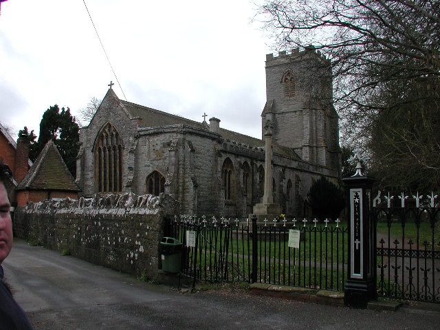
Church of St Peter 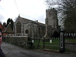
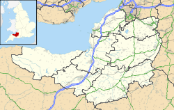
 Location within Somerset
General information Town or city West Huntspill Country England Coordinates 51°12′15″N 2°59′44″W / 51.2043°N 2.9956°W Completed c. 1400 The Church of St Peter in West Huntspill, Somerset, England was established by 1208, rebuilt around 1400, and extended in the early to mid 15th century. It was gutted by fire in 1878 and restored over the next two years. It has been designated as a Grade I listed building.[1]
Before the Norman Conquest the Christian community at West Huntspill was given by Offa of Mercia to Glastonbury Abbey. In the 13th century it was given to Tickford Priory at Newport Pagnell until it was taken under the control of the Bishop of Wells.[2] Since the 18th century the patronage has been held by Balliol College, Oxford.[3] The church's original dedication was to All Saints which changed to St Peter around 1872 and then in the 1950s the dedication to St Peter and All Hallows was adopted.[4]
The church has a five bay nave and chancel and four stage west tower.[1] The tower holds six beels which date from 1879 when they replaced the previous five the oldest of which was cast in 1693.[4]
The church underwent extensive Victorian restoration between 1878 and 1880,[2] following a major fire,[1] which gutted the interior and roof leaving only the stonework still standing.[5]
Refurbishment work to glass the lady chapel and the north door during 2011 was delayed when the company carrying out the work went into receivership.[6]
The parish is part of the Huntspill and East Huntspill benefice within the Axbridge deanery.[2]
See also
- List of Grade I listed buildings in Sedgemoor
- List of towers in Somerset
References
- ^ a b c "Church of St Peter". Images of England. English Heritage. http://www.imagesofengland.org.uk/Details/Default.aspx?id=269501. Retrieved 20 February 2009.
- ^ a b c "St Peter & All Hallows, West Huntspill". Church of England. http://www.achurchnearyou.com/huntspill-st-peter-all-hallows/. Retrieved 18 November 2011.
- ^ "West Huntspill, St Peter and All Hallows". Open Churches Trust. http://www.openchurchestrust.org.uk/Churches/WestHuntspill.htm. Retrieved 18 November 2011.
- ^ a b Robert Dunning (Editor) (2004). "Huntspill". A History of the County of Somerset: Volume 8: The Poldens and the Levels. Institute of Historical Research. http://www.british-history.ac.uk/report.aspx?compid=15110#s32. Retrieved 18 November 2011.
- ^ "St Peter & All Hallows, West Huntspill, Somerset.". West Huntspill Church. http://www.stpeterandallhallows.blogspot.com/. Retrieved 18 November 2011.
- ^ "West Huntspill church refurbishment hit by firm in administration". Burnham on Sea. http://burnham-on-sea.com/news/2011/west-huntspill-refurb-13-10-11.php. Retrieved 18 November 2011.
Categories:- Church of England churches in Somerset
- 15th-century architecture
- Grade I listed churches
- Grade I listed buildings in Somerset
- Sedgemoor

Wikimedia Foundation. 2010.