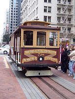
Church and 14th Street — Church and 14th Station statistics Coordinates 37°46′04″N 122°25′44″W … Wikipedia
Church and 18th Street — Church and 18th Station statistics Coordinates 37°45′41″N 122°25′42″W … Wikipedia
16th Street Northwest (Washington, D.C.) — Infobox nrhp name = Sixteenth Street Historic District nrhp type =hd |150px caption = 16th Street at R Street NW location = 16th St. between Scott Cir. and Florida Ave. NW nearest city = lat degrees = lat minutes = lat seconds = lat direction =… … Wikipedia
16th Street Baptist Church bombing — The four girls killed in the bombing (Clockwise from top left, Addie Mae Collins, Cynthia Wesley, Carole Robertson and Denise McNair) Location 16th Street Baptist Church, Birmingham, Alabama … Wikipedia
16th Street Baptist Church — Infobox nrhp | name =Sixteenth Street Baptist Church nrhp type =nhl caption =Sixteenth Street Baptist Church in 2005 location= Birmingham, AL lat degrees = 33 | lat minutes = 30 | lat seconds = 59.69 | lat direction = N long degrees = 86 | long… … Wikipedia
Church Street Station (San Francisco) — For other places with the same name, see Church Street Station (disambiguation). Church Street Muni Metro light rail … Wikipedia
Church of St Peter, Great Berkhamsted — Church of St Peter, Great Berkhamstead Coordinates … Wikipedia
Church of St. Luke and The Epiphany (Philadelphia) — Church of St. Luke and The Epiphany Church of St. Luke and The Epiphany … Wikipedia
Street of the Prophets — Street sign from the British Mandate era. Street of the Prophets (Hebrew: רחוב הנביאים, Rehov HaNevi im) is an east west axis road in Jerusalem beginning outside Damascus Gate and ending at Davidka Square. Located to the north of Jaffa Road … Wikipedia
Church Avenue (BMT Brighton Line) — Church Avenue … Wikipedia

