- Churapchinsky District
-
Churapchinsky Ulus (English)
Чурапчинский улус (Russian)
Чурапчы улууһа (Sakha)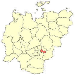
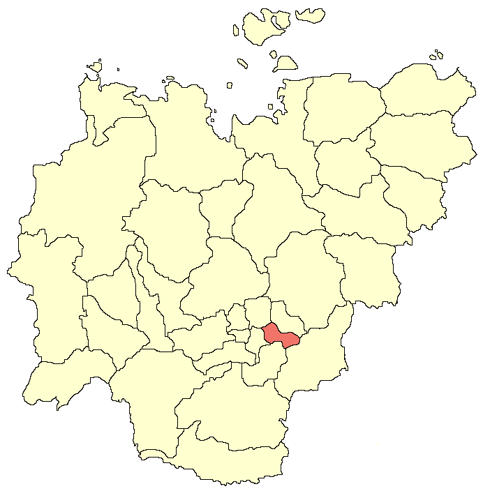
Location of Churapchinsky District in the Sakha RepublicAdministrative status (as of 2007) Country Russia Federal subject Sakha Republic Administrative center selo of Churapcha[citation needed] # of cities/towns —[citation needed] # of urban-type settlements —[citation needed] # of selsoviets 17[citation needed] # of rural localities 30[citation needed] - Leader Alexey Shadrin[citation needed] - Representative body Churapchinsky Ulus Assembly[citation needed] - # of urban settlements —[citation needed] - # of rural settlements 17[citation needed] Statistics Area 12,600 km2 (4,900 sq mi)[citation needed] Population (2002 Census) 19,466 inhabitants[1] - Urban population — - Rural population 100% Density 2 /km2 (5.2 /sq mi)[2] Time zone YAKST (UTC+10:00)[3] Established March 25, 1930[citation needed] Churapchinsky District (Russian: Чурапчинский улус; Sakha: Чурапчы улууһа) is a district of the Sakha Republic, Russia, located in the central part of the Republic. It is bordered in the north by Aldansky District, in the east by Tattinsky and Tomponsky Districts, in the south by Ust-Maysky and the Amginsky Districts, and in the west by Megino-Kangalassky District. The administrative center of the district is the rural locality (a selo) of Churapcha. The district has a surface area of 12,600 square kilometers (4,900 sq mi).[4]
The main businesses in the ulus include agriculture and the raising of cattle and horses.[4]
Administrative divisions
The district' is administratively divided into seventeen naslegs:[5]
- Alagarsky (Алагарский)
- Administrative center: selo of Chyappara (Чыаппара)
- Arylakhsky (Арылахский)
- Administrative center: selo of Arylakh (Арылах)
- Bakhsytsky (Бахсытский)
- Administrative center: selo of Tolon (Bakhsytsky Nasleg) (Толон)
- Boltoginsky (Болтогинский)
- Administrative center: selo of Kharbala 2-ya (Харбала 2-я)
- Bolugursky (Болугурский)
- Administrative center: selo of Myndagay (Мындагай)
- Kytanakhsky (Кытанахский)
- Administrative center: selo of Kilyanki (Килянки)
- Mugudaysky (Мугудайский)
- Administrative center: selo of Maralayy (Маралайы)
- Ozhulunsky (Ожулунский)
- Administrative center: selo of Dyabyla (Дябыла)
- Solovyovsky (Соловьёвский)
- Administrative center: selo of Myryla (Мырыла)
- Sylansky (Сыланский)
- Administrative center: selo of Usun-Kyuyol (Усун-Кюёль)
- Tyolyoysky (Тёлёйский)
- Administrative center: selo of Diring (Tyolyoysky Nasleg) (Диринг)
- Khadarsky (Хадарский)
- Administrative center: selo of Yuryung-Kyuyol (Юрюнг-Кюёль)
- Khatylinsky (Хатылинский)
- Administrative center: selo of Kharbala 1-ya (Харбала 1-я)
- Khayakhsytsky (Хаяхсытский)
- Administrative center: selo of Tuora-Kyuyol (Туора-Кюёль)
- Khoptoginsky (Хоптогинский)
- Administrative center: selo of Diring (Khoptoginsky Nasleg) (Диринг)
- Chakyrsky (Чакырский)
- Administrative center: selo of Tolon (Chakyrsky Nasleg) (Толон)
- Churapchinsky (Чурапчинский)
- Administrative center: selo of Churapcha (Чурапча)
References
- ^ Федеральная служба государственной статистики (Federal State Statistics Service) (2004-05-21). "Численность населения России, субъектов Российской Федерации в составе федеральных округов, районов, городских поселений, сельских населённых пунктов – районных центров и сельских населённых пунктов с населением 3 тысячи и более человек (Population of Russia, its federal districts, federal subjects, districts, urban localities, rural localities—administrative centers, and rural localities with population of over 3,000)" (in Russian). Всероссийская перепись населения 2002 года (All-Russia Population Census of 2002). Federal State Statistics Service. http://www.perepis2002.ru/ct/doc/1_TOM_01_04.xls. Retrieved 2010-03-23.
- ^ The value of density was calculated automatically by dividing the 2002 Census population by the area specified in the infobox. Please note that this value may not be accurate as the area specified in the infobox does not necessarily correspond to the area of the entity proper or is reported for the same year as the population.
- ^ Правительство Российской Федерации. Постановление №725 от 31 августа 2011 г. «О составе территорий, образующих каждую часовую зону, и порядке исчисления времени в часовых зонах, а также о признании утратившими силу отдельных Постановлений Правительства Российской Федерации». Вступил в силу по истечении 7 дней после дня официального опубликования. Опубликован: "Российская Газета", №197, 6 сентября 2011 г. (Government of the Russian Federation. Resolution #725 of August 31, 2011 On the Composition of the Territories Included into Each Time Zone and on the Procedures of Timekeeping in the Time Zones, as Well as on Abrogation of Several Resolutions of the Government of the Russian Federation. Effective as of after 7 days following the day of the official publication).
- ^ a b Yakutiatravel.com. Information about Churapchinsky Ulus
- ^ Charter of the Municipal Formation of "Churapchinsky Ulus (District)" of the Sakha (Yakutia) Republic, adopted on September 29, 2002
External links
Categories:- Districts of the Sakha Republic
- Alagarsky (Алагарский)
Wikimedia Foundation. 2010.