- Chhend Colony
-
Chhend Colony — neighbourhood — Coordinates 22°14′N 84°50′E / 22.24°N 84.83°ECoordinates: 22°14′N 84°50′E / 22.24°N 84.83°E Country India State Orissa District(s) Sundargarh Population
• Density
2,05,000 (2010[update])
• 90 /km2 (233 /sq mi)
Time zone IST (UTC+05:30) Area
24 square kilometres (9.3 sq mi)
• 219 metres (719 ft)
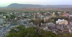 Chhend Colony
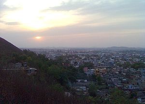 Chhend Colony Sunset view
Chhend Colony is a middle income group commercial-cum-residential area in the West Rourkela, of Sundergarh district.And is one of the largest Colony in Asia.Chhend Colony of Rourkela is situated in Trans Urban area of Rourkela.It is most known for the Management college of Rourkela Institute of Management Studies & Biju Patnaik University of Technology, Rourkela.
Contents
Overview
Chhend Colony is surrounded by other colony of Kalinga Vihar, Gopabandhu Nagar & Madhusudan Nagar and is close to Rourkela Airstip & Rourkela Steel Plant.The area is famous for the private residential plot's and Management Institute of Rourkela Institute of Management Studies, Pharmacy College of Kanak Manjari Institute of Pharmaceutical Sciences & Universities of Biju Patnaik University of Technology .The area is one of the most congested colony with a population of around 3.5 lakhs.[1]
Residential colonies
- Kalinga Vihar
- Gopabandhu Nagar
- Madhusudan Nagar
Education
- Biju Patnaik University of Technology
- Rourkela Institute of Management Studies
- Kanak Manjari Institute of Pharmaceutical Sciences
- Chinmaya Vidyalaya EM School
- Utkalmani Gopabandhu Institute of Engineering, Rourkela
- Government ITI
- Hrushikesh Ray Mahavidyalya
- Music Circle
Nearest Station
Stations Distance Rourkela Railway Station 5km Rourkela Bus Stand 8km See Also
Reference
- ^ Rourkela Tourism Guide Book
Categories:- Sundargarh district
- Kosal
- Rourkela


Wikimedia Foundation. 2010.