- Chavornay, Switzerland
-
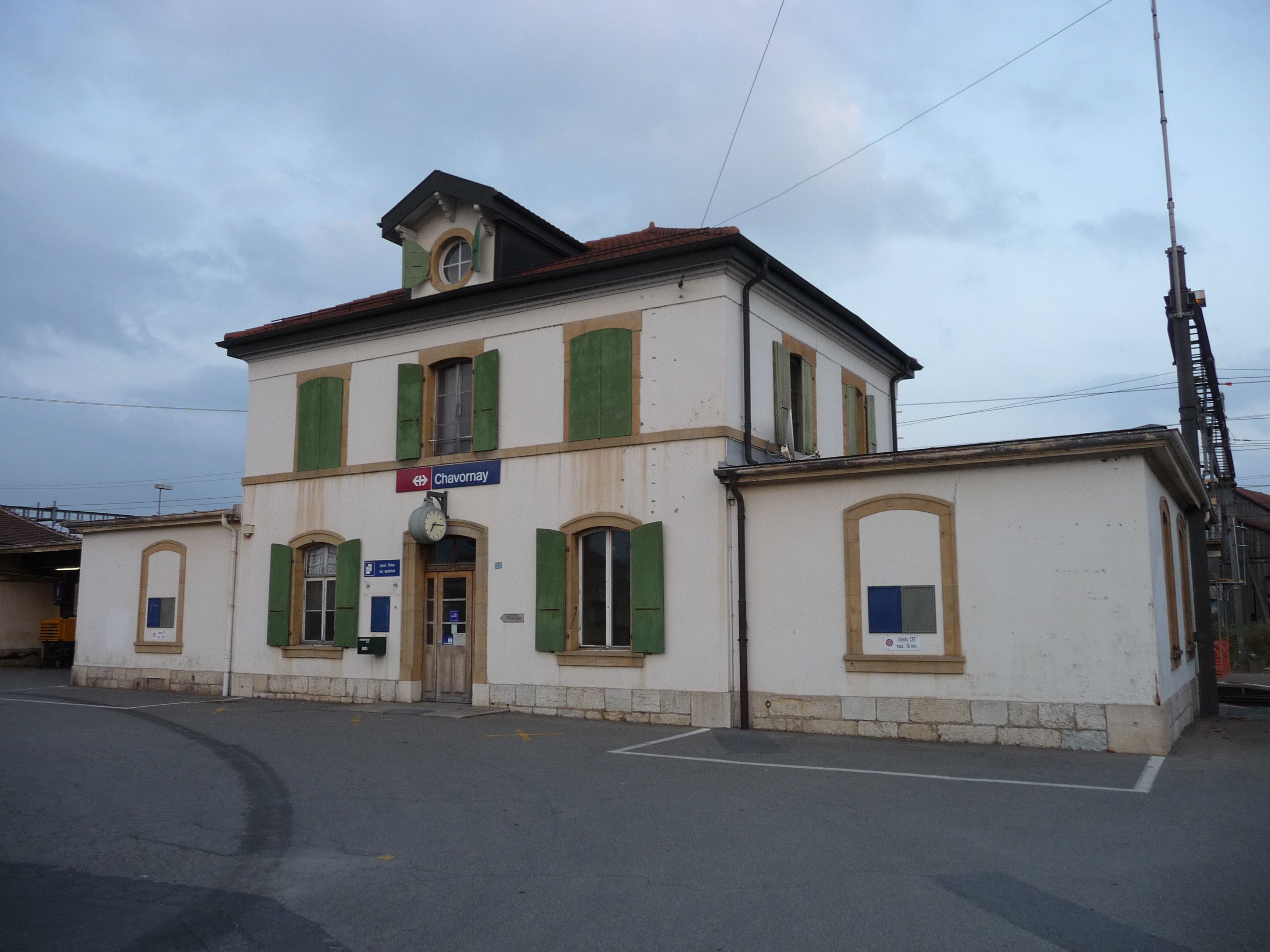
Chavornay Chavornay train station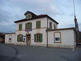
Country Switzerland 
Canton Vaud District Jura-Nord Vaudois 46°42′N 06°34′E / 46.7°N 6.567°ECoordinates: 46°42′N 06°34′E / 46.7°N 6.567°E Population 3,493 (Dec 2009)[1] - Density 316 /km2 (817 /sq mi) Area 11.07 km2 (4.27 sq mi) Elevation 452 m (1,483 ft) Postal code 1373 SFOS number 5749 Surrounded by Arnex-sur-Orbe, Bavois, Corcelles-sur-Chavornay, Essert-Pittet, Orbe, Penthéréaz, Suchy Website www.chavornay.ch
Profile, SFSO statistics
 Chavornay
View map of Chavornay Chavornay is a municipality in the district of Jura-Nord Vaudois in the canton of Vaud in Switzerland.
Contents
History
Chavornay is first mentioned in 927 as Cavorniacum. In 1228 it was mentioned as Chavornai.[2]
Geography
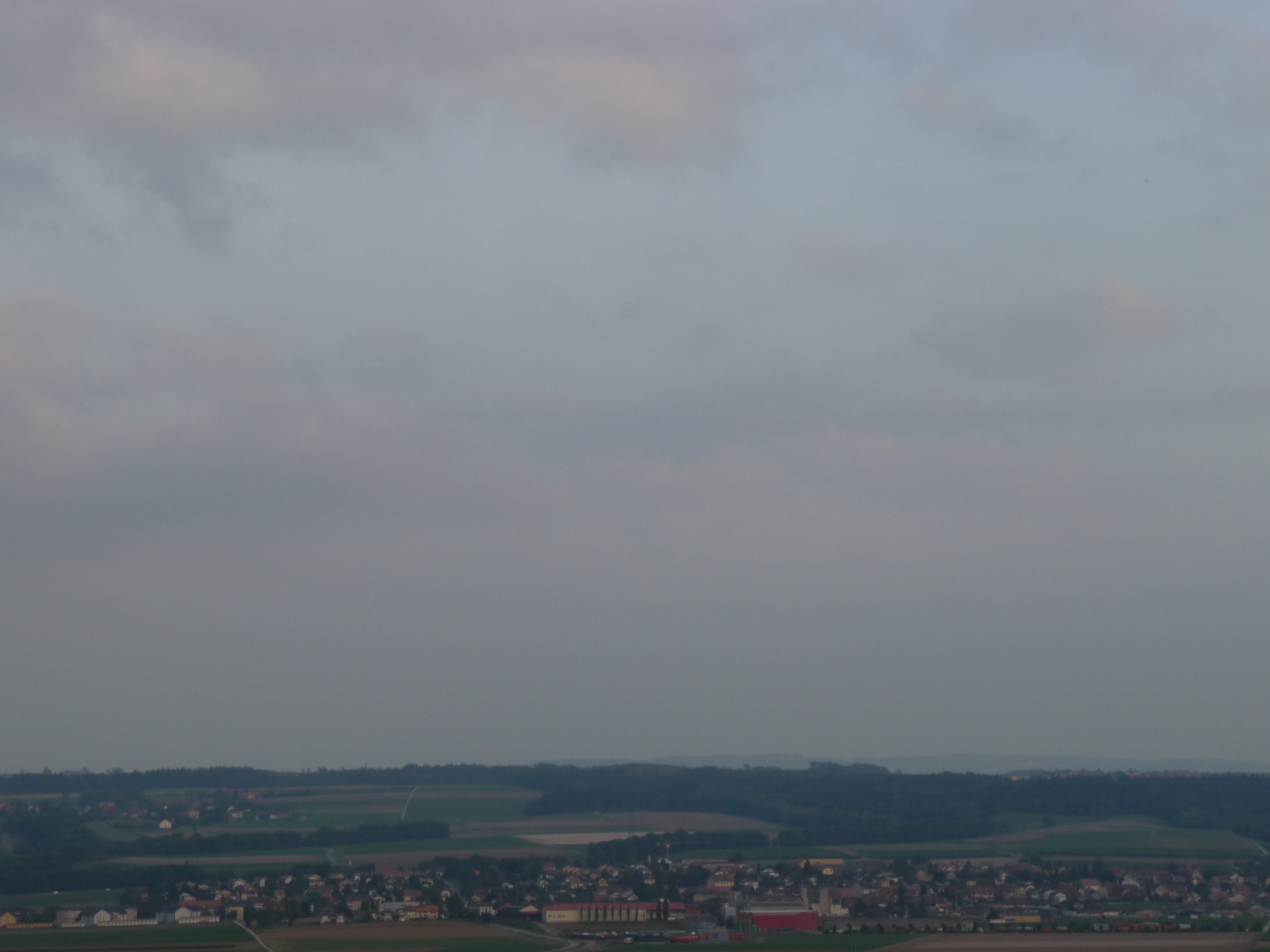
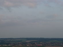 Chavornay and surroundings
Chavornay has an area, as of 2009[update], of 11.1 square kilometers (4.3 sq mi). Of this area, 7.27 km2 (2.81 sq mi) or 65.8% is used for agricultural purposes, while 1.73 km2 (0.67 sq mi) or 15.7% is forested. Of the rest of the land, 1.64 km2 (0.63 sq mi) or 14.8% is settled (buildings or roads), 0.29 km2 (0.11 sq mi) or 2.6% is either rivers or lakes and 0.14 km2 (35 acres) or 1.3% is unproductive land.[3]
Of the built up area, industrial buildings made up 2.1% of the total area while housing and buildings made up 6.1% and transportation infrastructure made up 5.9%. Out of the forested land, 14.2% of the total land area is heavily forested and 1.4% is covered with orchards or small clusters of trees. Of the agricultural land, 58.7% is used for growing crops and 5.9% is pastures, while 1.2% is used for orchards or vine crops. Of the water in the municipality, 0.7% is in lakes and 1.9% is in rivers and streams.[3]
The municipality was part of the Orbe District until it was dissolved on 31 August 2006, and Chavornay became part of the new district of Jura-Nord Vaudois.[4]
The municipality is located on the eastern edge of the Orbe valley, on the right side of the Talent river.
Coat of arms
The blazon of the municipal coat of arms is Per pale Argent and Gules, overall a Crown Or ornamented Vert and Azure.[5]
Demographics
Chavornay has a population (as of December 2009[update]) of 3,493.[1] As of 2008[update], 21.9% of the population are resident foreign nationals.[6] Over the last 10 years (1999–2009 ) the population has changed at a rate of 28.5%. It has changed at a rate of 21% due to migration and at a rate of 8.2% due to births and deaths.[7]
Most of the population (as of 2000[update]) speaks French (2,468 or 88.6%), with German being second most common (104 or 3.7%) and Portuguese being third (62 or 2.2%). There are 40 people who speak Italian.[8]
The age distribution, as of 2009[update], in Chavornay is; 473 children or 13.6% of the population are between 0 and 9 years old and 468 teenagers or 13.4% are between 10 and 19. Of the adult population, 504 people or 14.4% of the population are between 20 and 29 years old. 525 people or 15.1% are between 30 and 39, 597 people or 17.1% are between 40 and 49, and 406 people or 11.6% are between 50 and 59. The senior population distribution is 283 people or 8.1% of the population are between 60 and 69 years old, 139 people or 4.0% are between 70 and 79, there are 77 people or 2.2% who are between 80 and 89, and there are 16 people or 0.5% who are 90 and older.[9]
As of 2000[update], there were 1,194 people who were single and never married in the municipality. There were 1,294 married individuals, 138 widows or widowers and 159 individuals who are divorced.[8]
As of 2000[update] the average number of residents per living room was 0.64 which is about equal to the cantonal average of 0.61 per room.[7] In this case, a room is defined as space of a housing unit of at least 4 m² (43 sq ft) as normal bedrooms, dining rooms, living rooms, kitchens and habitable cellars and attics.[10] About 33.4% of the total households were owner occupied, or in other words did not pay rent (though they may have a mortgage or a rent-to-own agreement).[11]
As of 2000[update], there were 1,159 private households in the municipality, and an average of 2.4 persons per household.[7] There were 388 households that consist of only one person and 91 households with five or more people. Out of a total of 1,181 households that answered this question, 32.9% were households made up of just one person and there were 7 adults who lived with their parents. Of the rest of the households, there are 300 married couples without children, 383 married couples with children There were 66 single parents with a child or children. There were 15 households that were made up of unrelated people and 22 households that were made up of some sort of institution or another collective housing.[8]
In 2000[update] there were 307 single family homes (or 57.2% of the total) out of a total of 537 inhabited buildings. There were 103 multi-family buildings (19.2%), along with 92 multi-purpose buildings that were mostly used for housing (17.1%) and 35 other use buildings (commercial or industrial) that also had some housing (6.5%).[12]
In 2000[update], a total of 1,143 apartments (89.0% of the total) were permanently occupied, while 92 apartments (7.2%) were seasonally occupied and 49 apartments (3.8%) were empty.[12] As of 2009[update], the construction rate of new housing units was 5.4 new units per 1000 residents.[7] The vacancy rate for the municipality, in 2010[update], was 1.11%.[7]
The historical population is given in the following chart:[2][13]

Heritage sites of national significance
The Swiss Reformed Church of Saint-Maurice is listed as a Swiss heritage site of national significance.[14]
Politics
In the 2007 federal election the most popular party was the SVP which received 23.66% of the vote. The next three most popular parties were the SP (21.07%), the FDP (17.78%) and the LPS Party (10.86%). In the federal election, a total of 720 votes were cast, and the voter turnout was 36.4%.[15]
Economy
As of 2010[update], Chavornay had an unemployment rate of 7.5%. As of 2008[update], there were 92 people employed in the primary economic sector and about 27 businesses involved in this sector. 302 people were employed in the secondary sector and there were 23 businesses in this sector. 538 people were employed in the tertiary sector, with 95 businesses in this sector.[7] There were 1,402 residents of the municipality who were employed in some capacity, of which females made up 42.5% of the workforce.
In 2008[update] the total number of full-time equivalent jobs was 851. The number of jobs in the primary sector was 79, of which 74 were in agriculture and 5 were in fishing or fisheries. The number of jobs in the secondary sector was 292 of which 228 or (78.1%) were in manufacturing and 52 (17.8%) were in construction. The number of jobs in the tertiary sector was 480. In the tertiary sector; 146 or 30.4% were in the sale or repair of motor vehicles, 191 or 39.8% were in the movement and storage of goods, 25 or 5.2% were in a hotel or restaurant, 3 or 0.6% were in the information industry, 5 or 1.0% were the insurance or financial industry, 24 or 5.0% were technical professionals or scientists, 10 or 2.1% were in education and 11 or 2.3% were in health care.[16]
In 2000[update], there were 528 workers who commuted into the municipality and 1,038 workers who commuted away. The municipality is a net exporter of workers, with about 2.0 workers leaving the municipality for every one entering. About 9.1% of the workforce coming into Chavornay are coming from outside Switzerland.[17] Of the working population, 13.8% used public transportation to get to work, and 68.3% used a private car.[7]
Religion
From the 2000 census[update], 682 or 24.5% were Roman Catholic, while 1,394 or 50.1% belonged to the Swiss Reformed Church. Of the rest of the population, there were 42 members of an Orthodox church (or about 1.51% of the population), and there were 140 individuals (or about 5.03% of the population) who belonged to another Christian church. There was 1 individual who was Jewish, and 101 (or about 3.63% of the population) who were Islamic. There were 7 individuals who were Buddhist, 4 individuals who were Hindu and 6 individuals who belonged to another church. 357 (or about 12.82% of the population) belonged to no church, are agnostic or atheist, and 118 individuals (or about 4.24% of the population) did not answer the question.[8]
Weather
Chavornay has an average of 116.5 days of rain or snow per year and on average receives 847 mm (33.3 in) of precipitation. The wettest month is June during which time Chavornay receives an average of 92 mm (3.6 in) of rain or snow. During this month there is precipitation for an average of 10.7 days. The month with the most days of precipitation is May, with an average of 11.8, but with only 77 mm (3.0 in) of rain or snow. The driest month of the year is April with an average of 58 mm (2.3 in) of precipitation over 9.3 days.[18]
Education
In Chavornay about 1,043 or (37.5%) of the population have completed non-mandatory upper secondary education, and 281 or (10.1%) have completed additional higher education (either University or a Fachhochschule). Of the 281 who completed tertiary schooling, 53.7% were Swiss men, 23.8% were Swiss women, 14.6% were non-Swiss men and 7.8% were non-Swiss women.[8]
In the 2009/2010 school year there were a total of 515 students in the Chavornay school district. In the Vaud cantonal school system, two years of non-obligatory pre-school are provided by the political districts.[19] During the school year, the political district provided pre-school care for a total of 578 children of which 359 children (62.1%) received subsidized pre-school care. The canton's primary school program requires students to attend for four years. There were 282 students in the municipal primary school program. The obligatory lower secondary school program lasts for six years and there were 229 students in those schools. There were also 4 students who were home schooled or attended another non-traditional school.[20]
As of 2000[update], there were 62 students in Chavornay who came from another municipality, while 228 residents attended schools outside the municipality.[17]
References
- ^ a b Swiss Federal Statistical Office, MS Excel document – Bilanz der ständigen Wohnbevölkerung nach Kantonen, Bezirken und Gemeinden (German) accessed 25 August 2010
- ^ a b Chavornay in German, French and Italian in the online Historical Dictionary of Switzerland.
- ^ a b Swiss Federal Statistical Office-Land Use Statistics 2009 data (German) accessed 25 March 2010
- ^ Nomenklaturen – Amtliches Gemeindeverzeichnis der Schweiz (German) accessed 4 April 2011
- ^ Flags of the World.com accessed 27-July-2011
- ^ Swiss Federal Statistical Office - Superweb database - Gemeinde Statistics 1981-2008 (German) accessed 19 June 2010
- ^ a b c d e f g Swiss Federal Statistical Office accessed 27-July-2011
- ^ a b c d e STAT-TAB Datenwürfel für Thema 40.3 - 2000 (German) accessed 2 February 2011
- ^ Canton of Vaud Statistical Office (French) accessed 29 April 2011
- ^ Eurostat. "Housing (SA1)" (pdf). Urban Audit Glossary. 2007. p. 18. http://www.bfs.admin.ch/bfs/portal/en/index/international/22/lexi.Document.116365.pdf. Retrieved 12 February 2010.
- ^ Urban Audit Glossary pg 17
- ^ a b Swiss Federal Statistical Office STAT-TAB - Datenwürfel für Thema 09.2 - Gebäude und Wohnungen (German) accessed 28 January 2011
- ^ Swiss Federal Statistical Office STAT-TAB Bevölkerungsentwicklung nach Region, 1850-2000 (German) accessed 29 January 2011
- ^ "Kantonsliste A-Objekte" (in German). KGS Inventar. Federal Office of Civil Protection. 2009. http://www.bevoelkerungsschutz.admin.ch/internet/bs/de/home/themen/kgs/kgs_inventar/a-objekte.html. Retrieved 25 April 2011.
- ^ Swiss Federal Statistical Office, Nationalratswahlen 2007: Stärke der Parteien und Wahlbeteiligung, nach Gemeinden/Bezirk/Canton (German) accessed 28 May 2010
- ^ Swiss Federal Statistical Office STAT-TAB Betriebszählung: Arbeitsstätten nach Gemeinde und NOGA 2008 (Abschnitte), Sektoren 1-3 (German) accessed 28 January 2011
- ^ a b Swiss Federal Statistical Office - Statweb (German) accessed 24 June 2010
- ^ "Temperature and Precipitation Average Values-Table, 1961-1990" (in German, French, Italian). Federal Office of Meteorology and Climatology - MeteoSwiss. http://www.meteoswiss.admin.ch/web/de/klima/klima_schweiz/tabellen.html. Retrieved 8 May 2009., the Chavornay weather station elevation is 439 meters above sea level.
- ^ Organigramme de l'école vaudoise, année scolaire 2009-2010 (French) accessed 2 May 2011
- ^ Canton of Vaud Statistical Office - Scol. obligatoire/filières de transition (French) accessed 2 May 2011
External links
Categories:- Municipalities of the canton of Vaud
- Municipalities of Switzerland
- Cultural property of national significance in the canton of Vaud


Wikimedia Foundation. 2010.