- Chapman River
-
Chapman River[1] 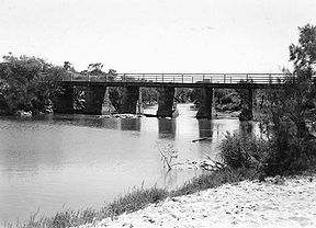
Bridge over the Chapman River, Geraldton, 1946Origin Victoria Plateau Mouth Bluff Point Basin countries Australia Length 105 kilometres (65 mi) Source elevation 270 metres (886 ft)[2] Basin area 1,644 square kilometres (635 sq mi)[3] Chapman River is a river in the Mid West region of Western Australia.
Contents
Course
The river arises on the Victoria Plateau east of Northampton. It flows in a southerly direction, passing through the town of Nabawa in the Shire of Chapman Valley, and continuing south to about the latitude of Geraldton. It then descends to the coastal plain, turning to the west-northwest and disgorging into the Indian Ocean at Bluff Point in Champion Bay.[4] Tributaries of the river include Chapman River East, Skelton Gully, Una Brook and Rushy Gully.
Hydrology
Most of the Chapman River's 1,160 km² catchment consists of cleared agricultural land. This land is heavily fertilised and subject to soil erosion, so the river carries high concentrations of nitrogen, phosphorus and chlorophyll a. This, together with the encroachment of urban areas into the river's riparian zone, has resulted in a degraded river system with eutrophic lower reaches.[4]
The river generally does not flow in summer, but always flows in winter. From the mouth to about 1.5 km upriver, the river is estuarine. This stretch always contains some water. The mouth itself is usually closed by a sandbar, but this opens at the onset of heavy flow, and closes after flow has receded. When the sandbar is open, sea water enters the estuary, mildly affecting its salinity.[4]
During periods of very high rainfall, soils are washed into the river and carried out to sea. Following heavy rains in June and July 1986, it is estimated that: the Chapman River washed 39,000 tons of suspended sediment into the ocean; that at peak flow a ton of sediment entered the ocean every seven seconds; and that this loss of sediment represented the loss of some A$73,000 of soil nitrogen.
Conservation
The Chapman River's riparian zone is now managed as part of the Chapman Regional Wildlife Corridor Project, and much of it is afforded some protection by the declaration of regional parks within the zone, Such as Spalding Park.[4]
History
It was discovered and named by George Grey in 1839, and may have been named after John Chapman, a British Conservative Member of Parliament (MP) and then deputy chairman of the Western Australian Land Company.[5]
References
- ^ "Chapman River". Gazetteer of Australia online. Geoscience Australia, Australian Government. http://www.ga.gov.au/bin/gazd01?rec=264455.
- ^ "Bonzle Digital Atlas - Map of Chapman River, WA". 2008. http://maps.bonzle.com/c/a?a=p&cmd=sp&zix=r&p=210600&st=&s=Chapman%20River&pg=1&m=0&nudge=1&c=1&x=126%2E887165&y=%2D16%2E362735&w=91788. Retrieved 2008-11-23.
- ^ "Ribbons of Blue - Mid West Region". 2008. http://www.ribbonsofblue.wa.gov.au/mid-west-region/background-information.html. Retrieved 2009-03-12.
- ^ a b c d Brearley, Anne (2005). Ernest Hodgkin's Swanland: Estuaries and coastal lagoons of Southwestern Australia. University of Western Australia Press. pp. 278–279. ISBN 1-920694-38-2.
- ^ Western Australian Land Information Authority. "History of river names". http://www.landgate.wa.gov.au/corporate.nsf/web/History+of+river+names. Retrieved 2007-05-01.
Categories:- Rivers of Western Australia
- Mid West (Western Australia)

Wikimedia Foundation. 2010.