- Chamni District
-
Chamni
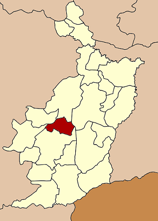
ชำนิ— Amphoe — Amphoe location in Buriram Province
Coordinates: 14°47′18″N 102°50′30″E / 14.78833°N 102.84167°ECoordinates: 14°47′18″N 102°50′30″E / 14.78833°N 102.84167°E Country  Thailand
Province Buriram Seat Mueang Yang Tambon Muban Amphoe established Area – Total 243.1 km2 (93.9 sq mi) Population (2005) – Total 33,646 – Density 138.4/km2 (358.5/sq mi) Time zone THA (UTC+7) Postal code 31110 Geocode 3118 Chamni (Thai: ชำนิ) is a district (Amphoe) in the central part of Buriram Province, northeastern Thailand.
Contents
Geography
Neighboring districts are (from the north clockwise) Lam Plai Mat, Mueang Buriram, Nang Rong, Nong Ki and Nong Hong of Buriram Province.
History
The minor district (King Amphoe) was created on April 1 1992, when the five tambon Chamni, Cho Phaka, Laluat, Mueang Yang and Nong Plong were split off from Nang Rong district.[1] It was upgraded to a full district on December 5 1996.[2]
Administration
The district is subdivided into 6 subdistricts (tambon), which are further subdivided into 64 villages (muban). There are no municipal (thesaban) areas, and 6 Tambon administrative organizations (TAO).
No. Name Thai name Villages Inh. 1. Chamni ชำนิ 8 4,644 2. Nong Plong หนองปล่อง 10 5,480 3. Mueang Yang เมืองยาง 14 7,248 4. Cho Phaka ช่อผกา 13 6,856 5. Laluat ละลวด 11 5,759 6. Khok Sanuan โคกสนวน 8 3,659 References
- ^ "ประกาศกระทรวงมหาดไทย เรื่อง แบ่งเขตท้องที่อำเภอนางรอง จังหวัดบุรีรัมย์ ตั้งเป็นกิ่งอำเภอชำนิ" (in Thai). Royal Gazette 109 (53 ง special): 15. April 22 1992. http://www.ratchakitcha.soc.go.th/DATA/PDF/2535/D/053/15.PDF.
- ^ "พระราชกฤษฎีกาตั้งอำเภอเหนือคลอง อำเภอนายายอาม อำเภอท่าตะเกียบ อำเภอขุนตาล อำเภอแม่ฟ้าหลวง อำเภอแม่ลาว อำเภอรัษฎา อำเภอพุทธมณฑล อำเภอวังน้ำเขียว อำเภอเจาะไอร้อง อำเภอชำนิ อำเภอโนนดินแดง อำเภอปางมะผ้า อำเภอสนธิ อำเภอหนองม่วง อำเภอเบญจลักษ์ อำเภอโพนนาแก้ว อำเภอบุ่งคล้า อำเภอดอนมดแดง และอำเภอลืออำนาจ พ.ศ. ๒๕๓๙" (in Thai). Royal Gazette 113 (62 ก): 5–8. November 20 1996. http://www.ratchakitcha.soc.go.th/DATA/PDF/2539/A/062/5.PDF.
External links
Mueang Buriram · Khu Mueang · Krasang · Nang Rong · Nong Ki · Lahan Sai · Prakhon Chai · Ban Kruat · Phutthaisong · Lam Plai Mat · Satuek · Pakham · Na Pho · Nong Hong · Phlapphla Chai · Huai Rat · Non Suwan · Chamni · Ban Mai Chaiyaphot · Non Din Daeng · Ban Dan · Khaen Dong · Chaloem Phra Kiat
Categories:- Amphoe of Buriram
- Isan geography stubs
Wikimedia Foundation. 2010.