- Chaloem Phra Kiat District, Buriram
-
Chaloem Phra Kiat
เฉลิมพระเกียรติ— Amphoe — Amphoe location in Buriram Province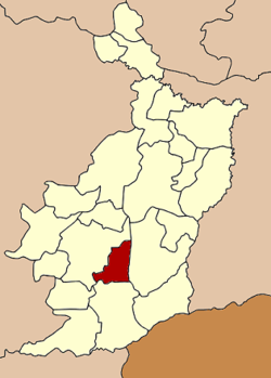
Coordinates: 14°33′30″N 102°55′30″E / 14.55833°N 102.925°ECoordinates: 14°33′30″N 102°55′30″E / 14.55833°N 102.925°E Country  Thailand
Province Buriram Seat Ta Pek Tambon Muban Amphoe established Area – Total 349.7 km2 (135 sq mi) Population (2005) – Total 39,796 – Density 113.8/km2 (294.7/sq mi) Time zone THA (UTC+7) Postal code 31110 Geocode 3123 Chaloem Phra Kiat (Thai: เฉลิมพระเกียรติ) is a district (Amphoe) of Buriram Province, north-eastern Thailand.
Contents
History
The district was created on December 5, 1996, together with four other districts named Chaloem Phra Kiat in celebration of the 50th anniversary of King Bhumibol Adulyadej ascension to the throne.
The district was composed of the tambon Charoen Suk, Ta Pek and Isan Khet of Nang Rong district and tambon Thawon and Yai Yaem Watthana of Lahan Sai[1].
Geography
Neighboring districts are (from the east clockwise) Prakhon Chai, Lahan Sai and Nang Rong.
Administration
The district is subdivided into 5 subdistricts (tambon), which are further subdivided into 71 villages (muban). Phanom Rung is a township (thesaban tambon) which covers almost the complete tambon Ta Pek and parts of tambon Isan Khet. There are further 4 Tambon administrative organizations (TAO).
No. Name Thai name Villages Inh. 1. Charoen Suk เจริญสุข 14 6,483 2. Ta Pek ตาเป๊ก 15 8,872 3. Isan Khet อีสานเขต 15 8,360 4. Thawon ถาวร 11 7,517 5. Yai Yaem Watthana ยายแย้มวัฒนา 16 8,564 References
- ^ "พระราชกฤษฎีกาตั้งอำเภอเฉลิมพระเกียรติ จังหวัดนครราชสีมา อำเภอเฉลิมพระเกียรติ จังหวัดนครศรีธรรมราช อำเภอเฉลิมพระเกียรติ จังหวัดน่าน อำเภอเฉลิมพระเกียรติ จังหวัดบุรีรัมย์ และอำเภอเฉลิมพระเกียรติ จังหวัดสระบุรี พ.ศ. ๒๕๓๙" (in Thai). Royal Gazette 113 (62 ก): 1–4. November 20, 1996. http://www.ratchakitcha.soc.go.th/DATA/PDF/2539/A/062/1.PDF.
External links
Mueang Buriram · Khu Mueang · Krasang · Nang Rong · Nong Ki · Lahan Sai · Prakhon Chai · Ban Kruat · Phutthaisong · Lam Plai Mat · Satuek · Pakham · Na Pho · Nong Hong · Phlapphla Chai · Huai Rat · Non Suwan · Chamni · Ban Mai Chaiyaphot · Non Din Daeng · Ban Dan · Khaen Dong · Chaloem Phra Kiat
Categories:- Amphoe of Buriram
- Isan geography stubs

Wikimedia Foundation. 2010.