- Chambord, Quebec
-
Chambord — Municipality — 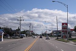

 Chambord
Coordinates: 48°26′N 72°04′W / 48.433°N 72.067°WCoordinates: 48°26′N 72°04′W / 48.433°N 72.067°W Country  Canada
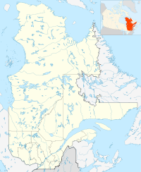
Province  Quebec
Region Saguenay–Lac-Saint-Jean Regional county Le Domaine-du-Roy Settled 1870s Formed December 8, 1972 Government[1] - Mayor Gérard Savard - Federal riding Roberval—Lac-Saint-Jean - Prov. riding Roberval Area[1][2] - Total 157.03 km2 (60.6 sq mi) - Land 121.32 km2 (46.8 sq mi) Population (2006)[2] - Total 1,690 - Density 13.9/km2 (36/sq mi) Time zone EST (UTC-5) - Summer (DST) EDT (UTC-4) Postal Code G0W 1G0 Area code(s) 418 and 581 Website www.chambord.ca Chambord is a municipality in Quebec in the Saguenay-Lac-Saint-Jean region and regional county municipality of Le Domaine-du-Roy. The Chambord meteorite was found near here in 1904.
The municipality also includes the community of Val-Jalbert, located along Quebec Route 169 between the village of Chambord itself and Roberval.
Contents
Transportation
Chambord is at the intersection of Quebec highways 155 and 169, and is also served by the Montreal – Jonquière train passenger train of Via Rail Canada, which operates between Montreal and Jonquière.
Demographics
Population trend:[3]
- Population in 2006: 1690 (2001 to 2006 population change: -0.2 %)
- Population in 2001: 1693
- Population in 1996: 1784
- Population in 1991: 1739
Private dwellings occupied by usual residents: 716 (total dwellings: 1045)
Mother tongue:[2]
- English as first language: 0.6 %
- French as first language: 98.8 %
- English and French as first language: 0.6 %
- Other as first language: 0 %
Tourism
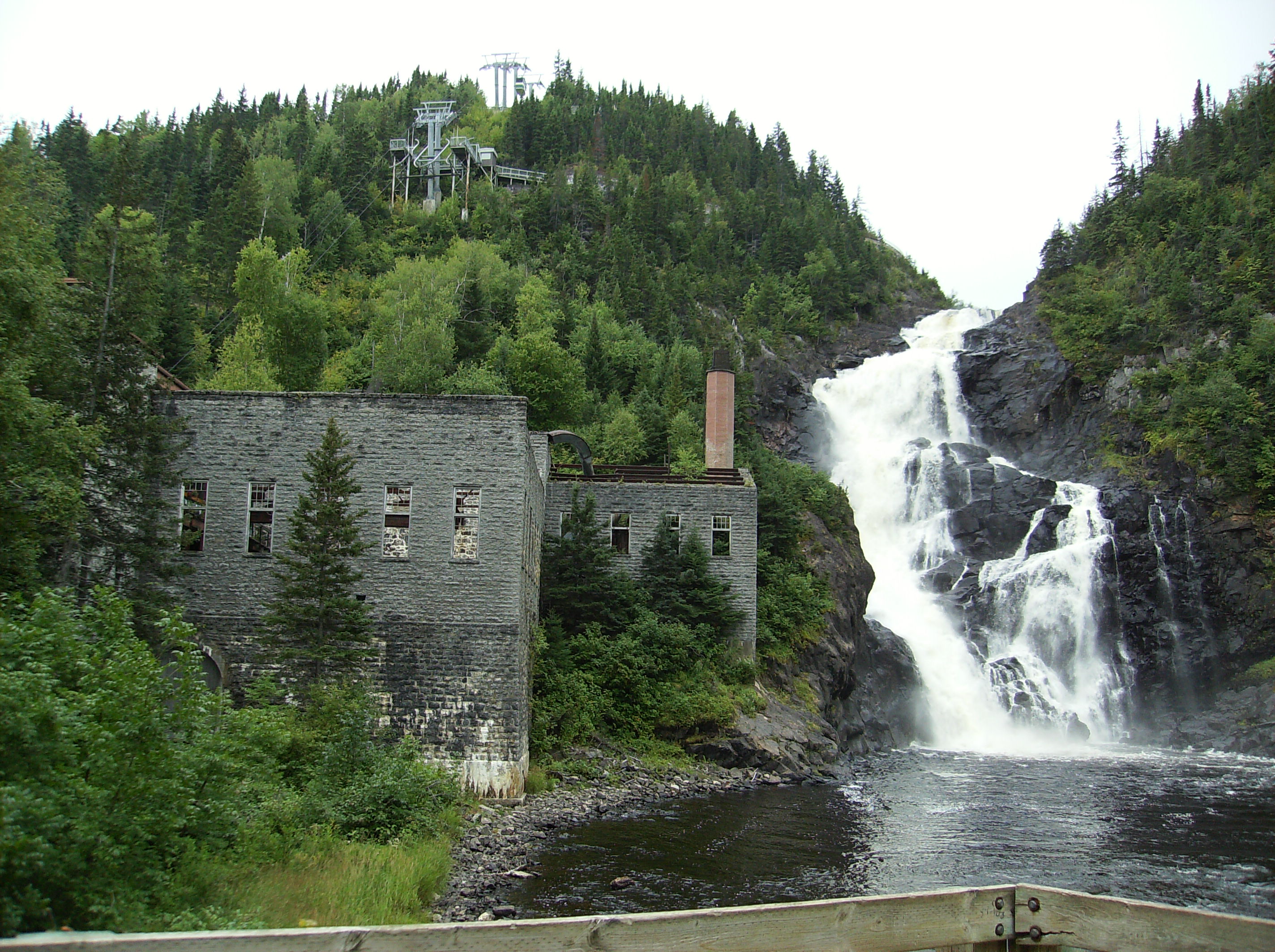
The historical village of Val-Jalbert is Chambord's main tourist attraction. There is also an annual cowboy festival.
 Old mill and waterfall on the Ouiatchouane River in Val-Jalbert.
References
- ^ a b Ministère des Affaires Municipales, Régions et Occupation du territoire - Répertoire des municipalités: Chambord
- ^ a b c "Chambord community profile". 2006 Census data. Statistics Canada. http://www12.statcan.gc.ca/census-recensement/2006/dp-pd/prof/92-591/details/page.cfm?Lang=E&Geo1=CSD&Code1=2491020&Geo2=PR&Code2=24&Data=Count&SearchText=Chambord&SearchType=Begins&SearchPR=01&B1=All&Custom=. Retrieved 2010-12-06.
- ^ Statistics Canada: 1996, 2001, 2006 census
- This article incorporates information from the equivalent article on the French Wikipedia.
External links
 Media related to Chambord (Québec) at Wikimedia Commons
Lac Saint-Jean Roberval 
Desbiens  Chambord

Saint-François-de-Sales Saint-André-du-Lac-Saint-Jean Administrative divisions of Saguenay-Lac-Saint-Jean (Region )Regional county municipalities
and equivalent territoriesMunicipalities Albanel · Alma · L'Anse-Saint-Jean · L'Ascension-de-Notre-Seigneur · Bégin · Chambord · Desbiens · Dolbeau-Mistassini · Ferland-et-Boilleau · Girardville · Hébertville · Hébertville-Station · La Doré · Labrecque · Lac-Bouchette · Lamarche · Larouche · Métabetchouan-Lac-à-la-Croix · Normandin · Notre-Dame-de-Lorette · Péribonka · Petit-Saguenay · Rivière-Éternité · Roberval · Saguenay · Saint-Ambroise · Saint-André-du-Lac-Saint-Jean · Saint-Augustin · Saint-Bruno · Saint-Charles-de-Bourget · Saint-David-de-Falardeau · Saint-Edmond-les-Plaines · Saint-Eugène-d'Argentenay · Saint-Félicien · Saint-François-de-Sales · Saint-Fulgence · Saint-Félix-d'Otis · Saint-Gédéon · Saint-Henri-de-Taillon · Saint-Honoré · Saint-Ludger-de-Milot · Saint-Nazaire · Saint-Prime · Saint-Stanislas · Saint-Thomas-Didyme · Sainte-Hedwidge · Sainte-Jeanne-d'Arc · Sainte-Monique · Sainte-Rose-du-Nord
Administrative divisions of Quebec Categories:- Municipalities in Quebec
- Incorporated places in Saguenay-Lac-Saint-Jean
- Quebec geography stubs


Wikimedia Foundation. 2010.