- Mežakla
-
Mežakla 
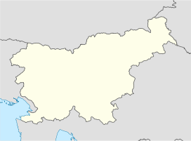
view of Mežakla from JeseniceElevation 1,348 m (4,423 ft) Location Location of Mežakla Location Slovenia Range Julian Alps Coordinates 46°24′06″N 14°02′27″E / 46.40167°N 14.04083°ECoordinates: 46°24′06″N 14°02′27″E / 46.40167°N 14.04083°E Mežakla is a long undulating plateau about 15 km long, in the foothills of the Julian Alps above the town of Jesenice in northwestern Slovenia. It ranges from approximately 1,200 to 1,348 meters high. It is mostly covered with spruce and beech trees. There are many pastures and clear streams on the plateau. Mežakla is part of Triglav National Park but tourism is underdeveloped.
References
External links
Jesenice Settlements Administrative centre: Jesenice
Blejska Dobrava · Hrušica · Javorniški Rovt · Kočna · Koroška Bela · Lipce · Planina pod Golico · Plavški Rovt · Podkočna · Potoki · Prihodi · Slovenski JavornikNeighborhoods Sava · Murova · Plavž · PodmežaklaLandmarks Old Sava · Plavž Memorial Park · Kos Manor · Kasarna · Ruard Manor · Upper Sava Museum · Podmežakla Hall · Pristava · Javornik Falls · Mežakla · Golica · Vintgar · Jesenice Train Station · Karawanken Tunnel (railway) · Karawanken Tunnel (motorway)Places of Worship Church of St. Leonard (Jesenice) · Church of the Assumption of Mary · Church of the Holy Cross · Church of St. Ingenuin and St. Albuin · Jesenice Mosque · Church of St. StephenNotable People Categories:- Plateaus of Slovenia
- Julian Alps
- Triglav National Park
Wikimedia Foundation. 2010.

