- Planina pod Golico
Infobox Settlement
official_name = Planina pod Golico
other_name = Sveti Križ (before 1955)
native_name =
nickname =
settlement_type =
motto =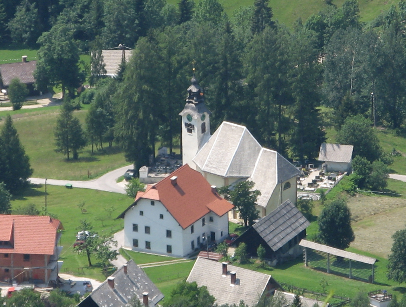
imagesize = 250px
image_caption = View of church in Planina pod Golico from Črni vrh
flag_size =
image_
seal_size =
image_shield =
shield_size =
image_blank_emblem =
blank_emblem_type =
blank_emblem_size =
mapsize =
map_caption =
mapsize1 =
map_caption1 =
image_dot_
dot_mapsize =
dot_map_caption =
dot_x = |dot_y =
pushpin_
pushpin_label_position =bottom
pushpin_map_caption =Location in Slovenia
subdivision_type = Country
subdivision_name =
subdivision_type1 = Region
subdivision_name1 =Upper Carniola
subdivision_type2 = Municipality
subdivision_name2 =Jesenice
subdivision_type3 =
subdivision_name3 =
subdivision_type4 =
subdivision_name4 =
leader_name =
leader_title1 =
leader_name1 =
leader_title2 =
leader_name2 =
leader_title3 =
leader_name3 =
leader_title4 =
leader_name4 =
established_title =
established_date =
established_title2 =
established_date2 =
established_title3 =
established_date3 =
area_magnitude =
area_footnotes =
area_total_km2 =
area_land_km2 =
area_water_km2 =
area_total_sq_mi =
area_land_sq_mi =
area_water_sq_mi =
area_water_percent =
area_urban_km2 =
area_urban_sq_mi =
area_metro_km2 =
area_metro_sq_mi =
area_blank1_title =
area_blank1_km2 =
area_blank1_sq_mi =
population_as_of =2002
population_footnotes =
population_note =
population_total =598
population_density_km2 =
population_density_sq_mi =
population_metro =
population_density_metro_km2 =
population_density_metro_sq_mi =
population_urban =
population_density_urban_km2 =
population_density_urban_sq_mi =
population_blank1_title =Ethnicities
population_blank1 =
population_blank2_title =Religions
population_blank2 =
population_density_blank1_km2 =
population_density_blank1_sq_mi =
timezone =
utc_offset =
timezone_DST =
utc_offset_DST =
latd= 46|latm= 27|lats=24 |latNS=N
longd=14|longm=3 |longs=11 |longEW=E
elevation_footnotes =
elevation_m = 954
elevation_ft =
postal_code_type =
postal_code =
area_code =
blank_name =
blank_info =
blank1_name =
blank1_info =
website =
footnotes = [ [http://www.stat.si/eng/index.asp Statistical Office of the Republic of Slovenia] ]Planina pod Golico is a mountain village in the municipality of
Jesenice , in theUpper Carniola region ofSlovenia .It lies at an altitude of 954 m in the
Karavanke Alps, at the foot of mountGolica . The settlement's name itself means "pasture below Golica." Before 1955 [ [http://www.zrc-sazu.si/zgds/gv77-2-urbancgabrovec.pdf Place names: a testing ground for demonstration of power and a reflection of local identity, article in Geografski vestnik 77-2, 2005 (in Slovene with English abstract)] ] , it was known as Sveti Križ ("Holy Cross"), however the political climate at the time could not tolerate such an explicitly religious name.The settlement was originally linked to
ironworks . In the 14th century smelting ovens were in operation in the village, and the beginnings of mining are documented in an Ortenburg Mining Order dating to 1381, where mining and blast furnace operations at Planina pod Golico are mentioned. A copy of this document is exhibited in the Museum of the History of Steel Production in Jesenice [ [http://www.gornjesavskimuzej.si Jesenice museum site (in Slovene)] ] . After the 15th century, the ironworks were moved further down into the valley, closer to a greater source of water needed for the process, andJesenice became the main industrial and administrative centre.Iron ore was still mined close to the village in the Savske Jame ("Sava Caves") area until the early 20th century.The Church of the Holy Cross (Slovene: "Cerkev Svetega Križa") was built in the late
17th century by the Bucelleni family, theItalian owners of mines in the surrounding area [Ivan Sedej: "Sto najlepših cerkva na Slovenskem", Prešernova družba, Ljubljana, 1996 (in Slovene)] . The village nucleus developed around it; the settlement also derived its original name of Sveti Križ from it.Today the village is more famous as a starting point for hiking routes to nearby scenic peaks such as Golica and Rožca, but especially for the wild white
narcissi that flower in mountain pastures around the village from late April to early May. The plants have been protected by law from 1949 and any picking of them is strictly forbidden. There is a Narcissi festival organized by the local tourist association in May. Thechairlift for theŠpanov vrh ski slope also begins in Planina pod Golico [ [http://www.zsport-jesenice.si/info.php?id=objekti&x=4 Jesenice Sports Association (in Slovene)] ] . There is also a naturalluge track beyond the village in the Savske Jame area [ [http://www.fil-luge.org/tracks/natural-tracks.html International Luge Federation list of natural tracks] ] and competitions are organised by the Jesenice Luge Club here every winter.References
External links
* [http://www.prosoftlab.com/tdgolica/01TDGolica.html Golica tourist association site]
* [http://www.jesenice.si Jesenice municipality site (in Slovene)]
* [http://www.geopedia.si/#L410_F10097894_T105_b4_x428185_y147679_s14 Planina pod Golico on Geopedia]

Wikimedia Foundation. 2010.