- Naubasta
-
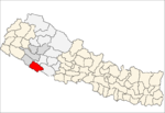
Naubasta — Village development committee — Location in Nepal
 Naubasta
Coordinates: 28°15′N 81°40′E / 28.25°N 81.66°ECoordinates: 28°15′N 81°40′E / 28.25°N 81.66°E Country  Nepal
NepalZone Bheri Zone District Banke District Population (1991) – Total 11,160 Time zone Nepal Time (UTC+5:45) Naubasta is a town in Banke District in the Bheri Zone of south-western Nepal. At the time of the 1991 Nepal census it had a population of 11,160 and had 1663 houses in the town.[1]
Government
The purpose of Village Development Committees like Naubasta is to organise village people structurally at a local level and creating a partnership between the community and the public sector for improved service delivery system. A VDC has a status as an autonomous institution and authority for interacting with the more centralised institutions of governance in Nepal. In doing so, the VDC gives village people an element of control and responsibility in development, and also ensures proper utilization and distribution of state funds and a greater interaction between government officials, NGOs and agencies. The village development committees within a given area will discuss education, water supply, basic health, sanitation and income and will also monitor and record progress which is displayed in census data.[2]
In VDCs there is one elected chief, usually elected with over an 80% majority. From each ward, there is also a chief that is elected along with these there are also four members elected or nominated.[2]
References
- ^ "Nepal Census 2001". Nepal's Village Development Committees. Digital Himalaya. http://www.digitalhimalaya.com/collections/nepalcensus/form.php?selection=1. Retrieved 2008-08-31.
- ^ a b "Village Development Committee". Society for Community Support for Primary Education in Balochistan. http://www.scspeb.sdnpk.org/village_development_committee.htm. Retrieved 2008-11-25.
Bageswari · Banakatawa · Banakatti · Basudevapur · Bejapur · Belahari · Belbhar · Betahani · Bhawaniyapur · Binauna · Chisapani · Ganapur · Gangapur · Hirminiya · Holiya · Indrapur · Jaispur · Kalaphanta · Kamdi · Kanchanapur · Kathkuiya · Khajura Khurda · Khaskarkado · Khaskusma · Kohalpur · Laxmanpur · Mahadevpuri · Manikapur · Matahiya · Narainapur · Naubasta · Parsapur · Phatepur · Piparhawa · Puraina · Puraini · Radhapur · Rajhena · Raniyapur · Saigaun · Samserganj · Sitapur · Sonapur · Titahiriya · Udarapur · Udayapur
 Categories:
- Populated places in Banke District


Wikimedia Foundation. 2010.