- Mid Delta Regional Airport
-
Mid-Delta Regional Airport 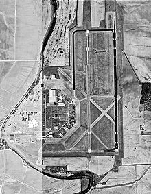
USGS aerial image, 1996 IATA: GLH – ICAO: KGLH – FAA LID: GLH Summary Airport type Public Owner City of Greenville Serves Greenville, Mississippi Elevation AMSL 131 ft / 40 m Coordinates 33°28′58″N 090°59′08″W / 33.48278°N 90.98556°W Website Runways Direction Length Surface ft m 18L/36R 8,001 2,439 Asphalt 18R/36L 7,019 2,139 Asphalt/Concrete Statistics (2009) Aircraft operations 37,295 Based aircraft 17 Source: Federal Aviation Administration[1] 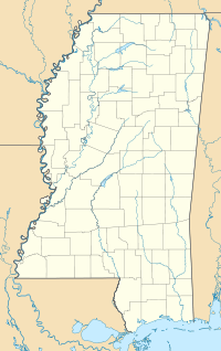
 Mid-Delta RegionalLocation of airport in Mississippi
Mid-Delta Regional Airport[2] (IATA: GLH, ICAO: KGLH, FAA LID: GLH) is a public-use airport owned by the city of Greenville, Mississippi and located in unincorporated Washington County, Mississippi.[3] It is five nautical miles (9 km) northeast of the central business district of Greenville.[1] This airport is included in the FAA's National Plan of Integrated Airport Systems for 2009–2013, which categorized it as commercial service - non-primary.[4] It is served by one commercial airline which is subsidized by the Essential Air Service program. Formerly, the facility was known as Greenville Air Force Base.
Contents
Facilities and aircraft
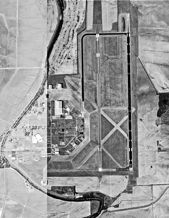
Mid-Delta Regional Airport is the only commercial airport located in the Mississippi Delta.[citation needed] Located approximately 3 miles (4.8 km) north of central Greenville, MDRA is situated on 2,000 acres (810 ha) of land, with a sizable portion in the Mid-Delta Empowerment Zone. A controlled airfield, MDRA has a control tower which is manned from 7:00 a.m. to 7:00 p.m., seven days a week.
The facility has two runways, the primary being 18L/36R which is composed of an asphalt surface 150 feet (46 m) wide by 8,001 feet (2,439 m) long. Runway 18L/36R is a precision approach runway with an Instrument landing System (ILS), medium approach lighting system with rails, (MALSR) approach lights and High Intensity Runway Lights (HIRLs). A parallel runway, 18R/36L, has an asphalt and concrete surface with a width of 150 feet (46 m) and length of 7,019 feet (2,139 m). Runway 18R/36L is a non-precision runway with Medium Intensity Runway Lights, (MIRL). The runways are connected by six taxiways. Ramp space is abundant, with 2,660,000 square feet (247,000 m2) of concrete ramp area.
For the 12-month period ending December 31, 2009, the airport had 37,295 aircraft operations, an average of 102 per day: 47% military, 30% air taxi, 23% general aviation, and <1% scheduled commercial. At that time there were 17 aircraft based at this airport: 88.2% single-engine and 11.8% jet.[1]
Airline and destination
Airlines Destinations Pinnacle Airlines Memphis References
- ^ a b c FAA Airport Master Record for GLH (Form 5010 PDF). Federal Aviation Administration. Effective 29 July 2010.
- ^ "Mid-Delta Regional Airport". City of Greenville. http://www.greenville.ms.us/Airport.html. Retrieved 19 September 2010.
- ^ "Greenville city, Mississippi." U.S. Census Bureau. Retrieved on July 15, 2011.
- ^ National Plan of Integrated Airport Systems for 2009–2013: Appendix A: Part 3 (PDF, 1.28 MB). Federal Aviation Administration. Updated 15 October 2008.
External links
- Mid-Delta Regional Airport at City of Greenville website
- FAA Airport Diagram (PDF), effective 20 October 2011
- FAA Terminal Procedures for GLH, effective 20 October 2011
- Resources for this airport:
- AirNav airport information for KGLH
- ASN accident history for GLH
- FlightAware airport information and live flight tracker
- NOAA/NWS latest weather observations
- SkyVector aeronautical chart for KGLH
- FAA current GLH delay information
Categories:- Airports in Mississippi
- Essential Air Service
- Greenville, Mississippi
- Buildings and structures in Washington County, Mississippi

Wikimedia Foundation. 2010.