- Northeast Alabama Regional Airport
-
Northeast Alabama Regional Airport 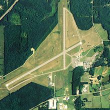
NAIP aerial image, 2006 IATA: GAD – ICAO: KGAD – FAA LID: GAD Summary Airport type Public Owner Gadsden Airport Authority Serves Gadsden, Alabama Elevation AMSL 569 ft / 173 m Coordinates 33°58′22″N 086°05′21″W / 33.97278°N 86.08917°W Website Runways Direction Length Surface ft m 6/24 6,802 2,073 Asphalt 18/36 4,806 1,465 Asphalt Statistics (2009) Aircraft operations 23,886 Based aircraft 95 Source: Federal Aviation Administration[1] Northeast Alabama Regional Airport (IATA: GAD, ICAO: KGAD, FAA LID: GAD) is a public use airport located four nautical miles (7 km) southwest of the central business district of Gadsden, a city in Etowah County, Alabama, United States.[1] It is owned by Gadsden Airport Authority[1] and it was previously known as Gadsden Municipal Airport. According to the FAA's National Plan of Integrated Airport Systems for 2009–2013, it is categorized as a general aviation facility.[2] The airport formerly had scheduled passenger service.
Contents
Facilities and aircraft
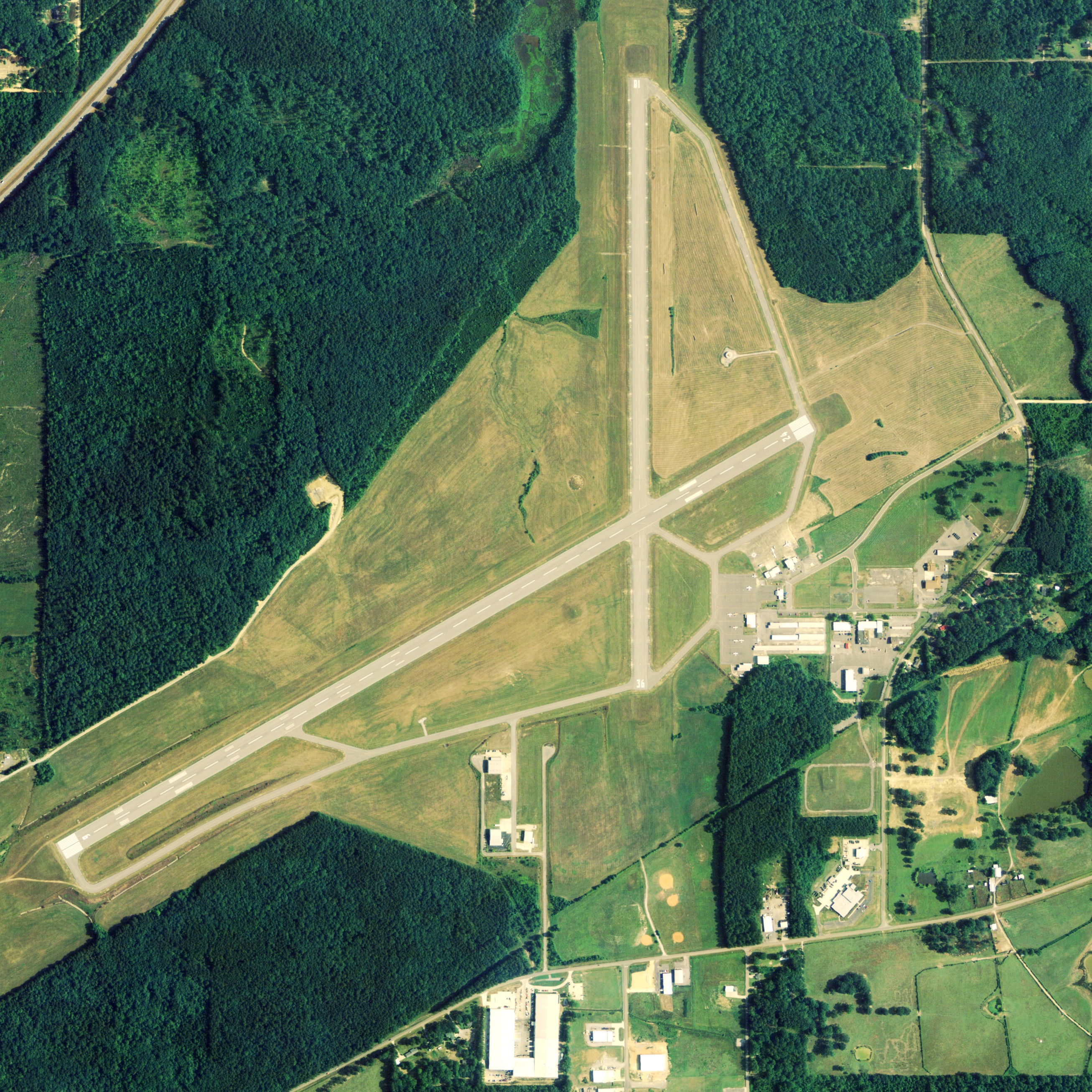
Northeast Alabama Regional Airport covers an area of 1,480 acres (600 ha) at an elevation of 569 feet (173 m) above mean sea level. It has two asphalt paved runways: 6/24 is 6,802 by 150 feet (2,073 x 46 m) and 18/36 is 4,806 by 150 feet (1,465 x 46 m).[1]
For the 12-month period ending April 9, 2009, the airport had 23,886 aircraft operations, an average of 65 per day: 93% general aviation, 5% air taxi and 2% military. At that time there were 95 aircraft based at this airport: 89% single-engine, 4% multi-engine, 3% jet, 2% glider and 1% helicopter.[1]
Former airlines
- Air New Orleans - mid-1980s[3]
- Atlantic Southeast Airlines - early 1990s
Incidents and accidents
- On April 9, 1990, a Delta Connection flight operated by Atlantic Southeast Airlines Embraer EMB-120 (Registration N217AS) as Flight 2254, in route to William B. Hartsfield Atlanta International Airport struck a Cessna 172 mid air just after take-off. The Embraer was able to successfully land the aircraft; however, the Cessna was unable to regain control and crashed to the ground. Of the 7 occupants onboard the Embraer, there were zero fatalities; of the 2 occupants onboard the Cessna, there were two fatalities.[4] The cause of the crash was attributed to pilots of both aircraft inadequately performing a visual lookout in addition to restricted vision caused by the sun's glare.[4]
References
- ^ a b c d e FAA Airport Master Record for GAD (Form 5010 PDF), effective 2009-07-02.
- ^ National Plan of Integrated Airport Systems for 2009–2013: Appendix A: Part 1 (PDF, 1.33 MB). Federal Aviation Administration. Updated 15 October 2008.
- ^ "Air New Orleans". AirTimes: A Collector's Guide to Airline Timetables. http://www.airtimes.com/cgat/usa/airneworleans.htm. Retrieved 2007-10-30.
- ^ a b "Brief of Accident". NTSB. http://www.ntsb.gov/ntsb/GenPDF.asp?id=ATL90FA095A&rpt=fi. Retrieved 2007-10-01.
External links
- Airfield photos for GAD from Civil Air Patrol
- FAA Terminal Procedures for GAD, effective 20 October 2011
- Resources for this airport:
- AirNav airport information for KGAD
- ASN accident history for GAD
- FlightAware airport information and live flight tracker
- NOAA/NWS latest weather observations
- SkyVector aeronautical chart, Terminal Procedures for KGAD
Categories:- Airports in Alabama
- Buildings and structures in Etowah County, Alabama
- Transportation in Etowah County, Alabama
Wikimedia Foundation. 2010.