- Denton, Northamptonshire
-
Coordinates: 52°12′34″N 0°46′46″W / 52.2094°N 0.7794°W
Denton 
St Margaret's church
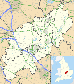
 Denton shown within Northamptonshire
Population 767 (2001 Census)[1]
779 (2010 est)[2])OS grid reference SP8357 - London 63 miles (101 km) District South Northamptonshire Shire county Northamptonshire Region East Midlands Country England Sovereign state United Kingdom Post town Northampton Postcode district NN7 Dialling code 01604 Police Northamptonshire Fire Northamptonshire Ambulance East Midlands EU Parliament East Midlands UK Parliament Northampton South List of places: UK • England • Northamptonshire Denton is a small village and civil parish on the A428 Bedford road about 6 miles (9.7 km) south-east of Northampton. It has a pub, the Red Lion, a village hall, a Parish Church, St Margaret's, and a primary school.
At the time of the 2001 census, the parish population was 767 people.[1]
St Margaret's Church
The church has 13th century origins but mostly rebuilt 1827-8[3].
The interior of the church was decorated with biblical murals by the Northampton artist, Henry Bird. Plans were made for the works in 1960 and work on them took place from February 1975 to the summer of 1976. They are on 16 panels with 31 life-size figures, many based on local people[4][5].
References
- ^ a b Office for National Statistics: Denton CP: Parish headcounts. Retrieved 8 November 2009
- ^ SNC (2010). South Northamptonshire Council Year Book 2010-2011. Towcester NN12 7FA. pp. 39.
- ^ Pevsner, Nikolaus; Cherry, Bridget (revision) (1961). The Buildings of England – Northamptonshire. London and New Haven: Yale University Press. pp. 183–4. ISBN 978-0-300-09632-3.
- ^ Obituary in the Guardian 11 May 2000, accessed 1 January 2011
- ^ Denton: a set of photographs by Jenny Thorpe with text
External links
 Media related to Denton, Northamptonshire at Wikimedia CommonsCategories:
- Villages in Northamptonshire
- Northamptonshire geography stubs
Wikimedia Foundation. 2010.


