- Neft Daşları
-
Coordinates: 40°19′N 50°35′E / 40.317°N 50.583°E
Neft Daşları

Coordinates: 40°19′N 50°35′E / 40.317°N 50.583°E Country  Azerbaijan
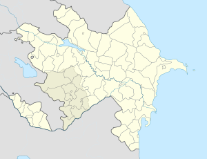
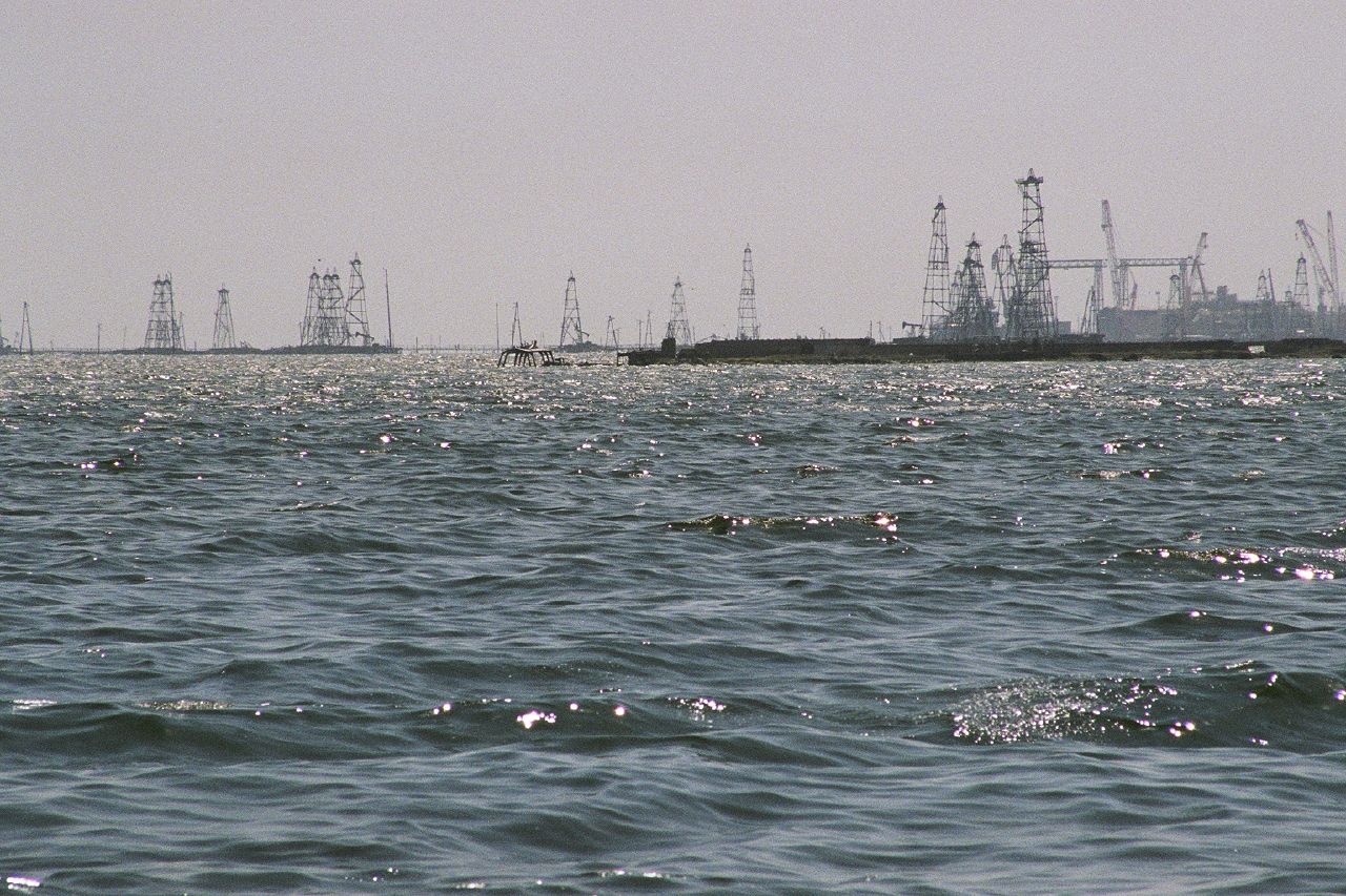
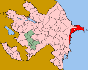
City Baku Raion Əzizbəyov Municipality Çilov-Neft Daşları Population (2008)[1] – Total 933 Time zone AZT (UTC+4) – Summer (DST) AZT (UTC+5) Neft Daşları (Azerbaijani: Neft Daşları, the Oil Rocks, also Neftyanyye Kamni or Nerftekamni in Russian) is an industrial settlement in Baku, Azerbaijan. The settlement forms part of the municipality of Çilov-Neft Daşları in Əzizbəyov raion.[2] It lies 100 km (62 mi) away from the Azeri capital Baku, and 55 km (34 mi) from the nearest shore in the Caspian Sea. A full town on the sea, it was the first oil platform in Azerbaijan, and the first operating offshore oil platform in the world, incorporating numerous drilling platforms.
The settlement began with a single path out over the water and grew into a system of paths and platforms built on the back of ships sunk to serve as the Neft Daşları's foundation.[3] The most distinctive feature of Neft Daşları is that it is actually a functional city with a population of about 5,000 and over 300 km (190 mi) of streets built on piles of dirt and landfill.[4]
Contents
Etymology
The settlement was originally named as Chernie Kamni ("Black Stones"), but was later renamed to Neft Daşları ("Oily Rocks"), replacing the allusion to the black colour of oil with a reference to the substance itself.[5][6]
History
Construction of the settlement
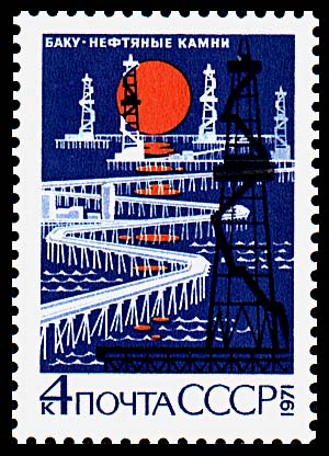
 Soviet 1971 stamp, featuring Oil Rocks.
The first large-scale geological study of the area was conducted in 1945-1948.[7] The settlement of Neft Daşları was built in 1949 after oil was discovered there at 1,100 meters beneath the Caspian sea and it became the world's first offshore oil platform.[8][9]
By 1951, the Neft Daşları was ready for production, equipped with all of the infrastructure needed at the time. Drilling platforms were erected, oil tanks installed, and docks with enclosures for ships were built. The first oil from the Neft Daşları was loaded into a tanker in same year.[10]
In 1952, the systematic construction of trestle bridges connecting the artificial islands was begun. A number of Soviet factories constructed crane assemblies especially for use on the Neft Daşları, along with a crane barge that could carry up to 100 tons of oil. The assemblies were equipped with diesel hammers used to drive piles into the sea floor.[10]
Large-scale construction started on the settlement in 1958, which included nine-story hostels, hotels, cultural palaces, bakery factories and lemonade workshops.[7] The mass development of Neft Daşları continued during 1976-1978 with the building of a five-story dormitory and two oil-gas compressor stations, the installation of a drinking water facility, and the construction of two underwater pipelines to the Dubendi terminal, each with a diameter of 350 millimetres (14 in).[7] In addition, a flyover for vehicular traffic was created.[7] As a result, the area of the settlement grew to around 7 ha in the 1960s, with the length of the steel trestle bridges joining the man-made islands exceeding 200 kilometres (120 mi).[10]
Post-independence
In November 2009, the settlement celebrated its 60th anniversary.[11][12] Over the last 60 years, the oilfields of Neft Daşları have produced more than 170 million tons of oil and 15 billion m³ of associated natural gas.[10] According to present-day estimates by geologists, the volume of recoverable reserves is as high as 30 million tons.[10]
Demography
The population varies from time to time in the settlement as of the 2008 the platforms have a combined population of about 5,000 men, who work in week-long offshore shifts.[13]
Oil extraction
The oil extraction is carried out from the shallow water portion of the Absheron geological trend.
In popular culture
- In 2008, a Swiss documentary crew led by film director Marc Wolfensberger filmed "La Cité du Pétrole / Oil Rocks - City above the Sea" in the settlement, which was released in 2009.[14]
- Neft Daşları featured in one of the scenes of James Bond film The World Is Not Enough (1999).[15][13]
References
- ^ World Gazetteer: Azerbaijan – World-Gazetteer.com
- ^ Belediyye Informasiya Sistemi
- ^ Gale, Timothy. "OIL ROCKS: AN INFRASTRUCTURED SOVIET CITY". http://liquidinfrastructure.info/archives/725. Retrieved 26 December 2010.
- ^ Theroux, Marcel. "The Rock of Ages". http://www.travelandleisure.com/articles/the-rock-of-ages/1. Retrieved 26 December 2010.
- ^ Abbasov, Mehti. "НЕФТЯНЫЕ КАМНИ — 60". Bakinskiy Rabochiy Newspaper. http://br.az/index.php?newsid=2963. Retrieved 26 December 2010.
- ^ Ibrahimov, Seyyad. "THE EARLY DAYS". Azerbaijan International Magazine. http://azer.com/aiweb/categories/magazine/52_folder/52_articles/52_oily.html. Retrieved 26 December 2010.
- ^ a b c d "Baku and Oil. The Soviet Period". window2baku.com. http://www.window2baku.com/eng/9oil3.htm. Retrieved 25 December 2010.
- ^ "OIL PLATFORMS". http://www.solarnavigator.net/oil_rigs.htm. Retrieved 25 December 2010.
- ^ Blair, Betty. "Oil Rocks in the Caspian". azer.com. http://azer.com/aiweb/categories/magazine/ai142_folder/142_articles/142_salahov_oil_rocks.html. Retrieved 25 December 2010.
- ^ a b c d e Igorev, Vladimir. "A MAN-MADE ISLAND OF OIL TREASURES". www.oilru.com. http://www.oilru.com/or/44/925/. Retrieved 25 December 2010.
- ^ "Городу в Каспийском море уже 60 лет". lifenews.ru. http://www.lifenews.ru/news/11508. Retrieved 25 December 2010.
- ^ "Oil Rocks is essential value for Azerbaijani people: president - UPDATE". today.az. http://today.az/news/society/57230.html. Retrieved 25 December 2010.
- ^ a b Turnbull, James. "Oil Rocks". http://googlesightseeing.com/2008/08/oil-rocks/. Retrieved 26 December 2010.
- ^ "Oil Rocks: City Above the Sea". IMDB. http://www.imdb.com/title/tt1528788/.
- ^ Patterson, Jean. "Agent 007 Movie Scenes Shot in Baku". Azerbaijan International Magazine. http://azer.com/aiweb/categories/magazine/73_folder/73_articles/73_bond.html. Retrieved 26 December 2010.
External links
- Travel guide for Oil Rocks
- English Russia: Oil Stones, A Soviet City in the Middle of the Sea
- Link to the film trailer Oil Rocks - City above the Sea
Coordinates: 40°13′N 50°49′E / 40.217°N 50.817°E
Artyom · Badamdar · Bayil · Bakıxanov · Balaxanı · Baş Ələt · Bibiheybət · Biləcəri · Bilgəh · Binə · Bukhta-Ilicha · Bülbülə · Buzovna · Cənubi · Çeyildağ · Chërnyy Gorod · Çilov · Çilov-Neft Daşları · Dənizkənarı · Dübəndi · Dzhabar · Əhmədli · Ələt · Əmircan · Gürgan · Gürgən-Pirallahı · Heybət · Hövsan · İkinci Qala · Imeni Vorovskogo · Jiloy · Kələzağ · Keşlə · Kirov · Korgöz · Kotal · Kürdəxanı · Lökbatan · Maştağa · Mərdəkan · Müşviqabad · Nardaran · Neft Daşları · Pirallahı · Pirsaat · Pirşağı · Puta · Qala · Qaraçuxur · Qaraibad · Qarakosa · Qaya · Qızıldaş · Qobustan · Qoşaqışlaq · Ramana · Rəsulzadə · Sabunçu · Şağan · Sahil · Sahqaya · Sanqaçal · Şıxlar · Şonqar · Stepan Razin · Şubanı · Sulutəpə · Şüvəlan · Türkan · Üçtəpə · Xanlar · Xocəsən · Yeni Ələt · Yeni Günəşli · Yeni Suraxanı · Zabrat · Zağulba Bağları · Zəfəran · Zığ · Zirə
 Categories:
- Oil platforms
- Coastal construction
- Geography of Azerbaijan
- Energy in the Soviet Union
- Populated places in Azerbaijan
- Baku
- Populated places on the Caspian Sea

Wikimedia Foundation. 2010.