- Iacobeni, Sibiu
-
Iacobeni — Commune — 
 Iacobeni
Coordinates: 46°1′N 24°48′E / 46.017°N 24.8°E Country  Romania
County Sibiu County Population (2002)[1] 2,665 Time zone EET (UTC+2) - Summer (DST) EEST (UTC+3) Iacobeni (German: Jakobsdorf; Hungarian: Jakabfalva) is a commune located in Sibiu County, Romania.
Contents
Villages
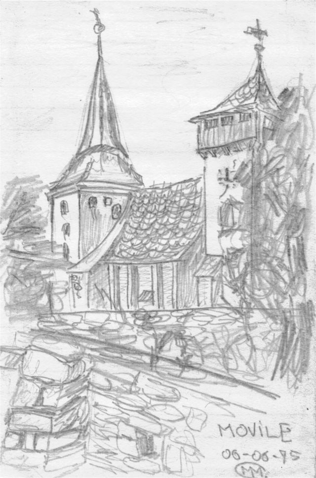
 St. Michael's Church in Movile
The commune is composed of five villages: Iacobeni, Movile (Hundertbücheln; Százhalom), Netuş, Noiştat and Stejărişu. Each of them has a fortified church.
Movile
Movile is a village noted for its medieval fortifications constructed by German immigrants at the behest of the Hungarian King in the 12th and 13th centuries.
In 1910 the population was 247 Saxons. Movile was part of Austria-Hungary until 1918, when it was transferred to Romania. By 1992, all of the Germans had left and the population was made up of 347 ethnic Romanians.
-
Fortified church of Iacobeni village
-

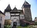
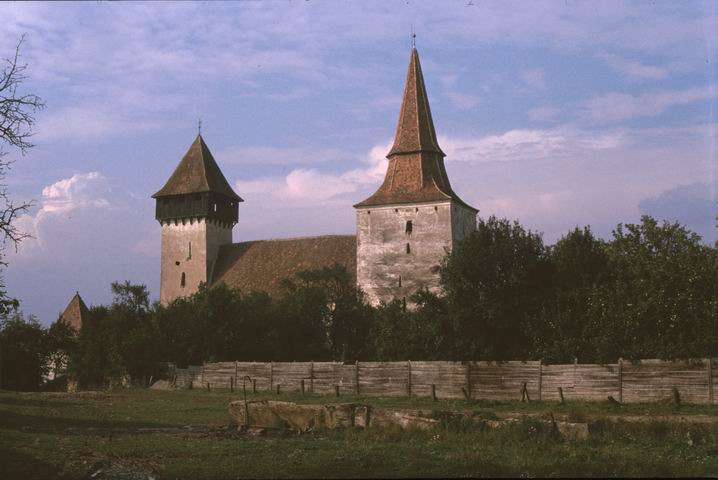
Fortified church of Movile
-
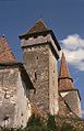
Fortified church of Movile
-
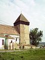
Fortified church of Netuş village
References
- ^ Romanian census data, 2002; retrieved on March 1, 2010
External links
- (Romanian)"Movile" information and photographs
Sibiu County, Romania Cities 
Towns Agnita · Avrig · Cisnădie · Copşa Mică · Dumbrăveni · Miercurea Sibiului · Ocna Sibiului · Sălişte · Tălmaciu
Communes Alma · Alţâna · Apoldu de Jos · Arpaşu de Jos · Aţel · Axente Sever · Bazna · Bârghiş · Biertan · Blăjel · Boiţa · Brateiu · Brădeni · Bruiu · Chirpăr · Cârţa · Cârţişoara · Cristian · Dârlos · Gura Râului · Hoghilag · Iacobeni · Jina · Laslea · Loamneş · Ludoş · Marpod · Merghindeal · Micăsasa · Mihăileni · Moşna · Nocrich · Orlat · Păuca · Poiana Sibiului · Poplaca · Porumbacu de Jos · Racoviţa · Răşinari · Râu Sadului · Roşia · Sadu · Slimnic · Şeica Mare · Şeica Mică · Şelimbăr · Şura Mare · Şura Mică · Tilişca · Târnava · Turnu Roşu · Valea Viilor · Vurpăr
Coordinates: 46°01′16″N 24°47′37″E / 46.0211111111°N 24.7936111111°E
Categories:- Communes in Sibiu County
- Sibiu County geography stubs
-


Wikimedia Foundation. 2010.