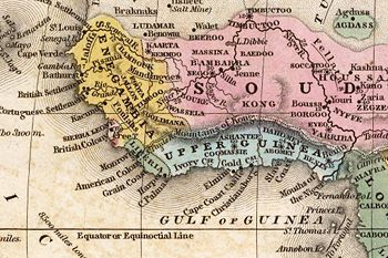
- Mountains of Kong
-
The Mountains of Kong is a non-existent mountain range charted on English maps of Africa from 1798 through the late 1880s.[1] An early map resulting from exploration of the area and showing this west to east mountain range in 1798 was produced by English cartographer James Rennell.[1] The mountains were thought to begin in West Africa near the highland source of the Niger River near Tembakounda in Guinea, then continue east to the also fictitious Central African Mountains of the Moon, thought to be where the White Nile rose. Cartographers stopped including the mountains on maps after French explorer Louis Gustave Binger established that the mountains were fictitious in his 1887-1889 expedition to chart the Niger River from its mouth in the Gulf of Guinea and through Côte d'Ivoire.[1] However, earlier explorers for some time in the nineteenth century had failed to locate this mountain range, but it continued to appear on maps until late in that century.[2]
Various other nineteenth century explorers of West Africa included the range on maps they produced or directed the production of after exploring the area including French explorer René Caillié, who explored the highlands of Guinea, Fouta Djallon, near the source of the Niger, the Cornish explorer Richard Lemon Lander and his younger brother John, and Scottish explorer Hugh Clapperton who also sought the course of the Niger River in its upper reaches.[1]
References
- ^ a b c d Delaney, John, curator. "Evolution of the Map of Central, East & West Africa". To the Mountains of the Moon: Mapping African Exploration, 1541-1880accessdate=2008-08-04. Princeton University. http://libweb5.princeton.edu/visual_materials/maps/websites/africa/maps-central/central.html.
- ^ Stock, Robert (2004). Africa South of the Sahara: A Geographical Interpretation. The Guilford Press. ISBN 1572308680.
Categories:- History of Africa
- Cartography
- Fictional mountains
- Mountains of Africa
Wikimedia Foundation. 2010.

