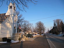
- Ohio State Route 582
-
State Route 582 Route information Maintained by ODOT Length: 20.08 mi[3] (32.32 km) Existed: 1940[1][2] – present Major junctions West end:  SR 65 near Haskins
 I-75 near Haskins
 US 23 near Luckey
East end:  SR 105 near Woodville
Location Counties: Wood, Sandusky Highway system Ohio highways
Interstates • U.S. Routes • State Routes←  SR 579
SR 585  →
→State Route 582 (SR 582. OH 582) is an east–west state highway in the northwestern portion of the U.S. state of Ohio. The western terminus of State Route 582 is at a T-intersection with State Route 65 nearly 2 miles (3.2 km) west of Haskins. Its eastern terminus is also at a T-intersection, this time with State Route 105 less than 0.50 miles (0.80 km) southwest of Woodville.
Contents
Route description
State Route 582 passes through the northern half of Wood County and a small portion of northwestern Sandusky County along its way. No part of State Route 582 is incorporated within the National Highway System, a system of routes determined to be most important for the nation's economy, mobility and defense.[4]
History
State Route 582 was established in 1940. Its original routing matches that which it utilizes to this day between State Route 65 and State Route 105 through northern Wood County and northwestern Sandusky County. State Route 582 has not experienced any significant changes since its inception.[1][2]
Major intersections
County Location Mile[3] Destinations Notes Wood Washington Township 0.00  SR 65
SR 65Western terminus at T-intersection. Haskins 2.61  SR 64
SR 64Middleton Township 5.34  SR 25
SR 25Signalized intersection. 6.88  I-75
I-75Exit 187 off of I-75, a diamond interchange. Webster Township 10.05  SR 199
Wood-Sandusky Troy Township-
Woodville Township18.35  US 23 north
Northern split of the very short US 23/SR 582 duplex. US 23 joins from the north. 18.39  US 23 south
Southern split of the very short US 23/SR 582 duplex. US 23 departs to the south. Sandusky Woodville Township 20.08  SR 105
Eastern terminus at T-intersection. 1.000 mi = 1.609 km; 1.000 km = 0.621 mi
Concurrency terminus • Closed/Former • Incomplete access • UnopenedReferences
- ^ a b Ohio Department of Highways (1939) (MrSID). Ohio Highway Map (Map). Cartography by ODOH. http://www.dot.state.oh.us/Divisions/TransSysDev/Innovation/prod_services/Documents/StateMaps/otm1939a.sid. Retrieved 2011-01-29.
- ^ a b Ohio Department of Highways (1940) (MrSID). Ohio Highway Map (Map). Cartography by ODOH. http://www.dot.state.oh.us/Divisions/TransSysDev/Innovation/prod_services/Documents/StateMaps/otm1940a.sid. Retrieved 2011-01-29.
- ^ a b Ohio Department of Transportation. "Technical Services Straight Line Diagrams". http://www.odotonline.org/techservapps/SLD/default.htm. Retrieved 2007-10-21.
- ^ Federal Highway Administration (December 2003) (PDF). National Highway System: Ohio (Map). http://www.fhwa.dot.gov/planning/nhs/maps/oh/oh_Ohio.pdf. Retrieved 2011-01-29.
External links
Categories:- State highways in Ohio
- Transportation in Sandusky County, Ohio
- Transportation in Wood County, Ohio
Wikimedia Foundation. 2010.


