- Chapala, Jalisco
-
Chapala, Jalisco — Municipality and town — 

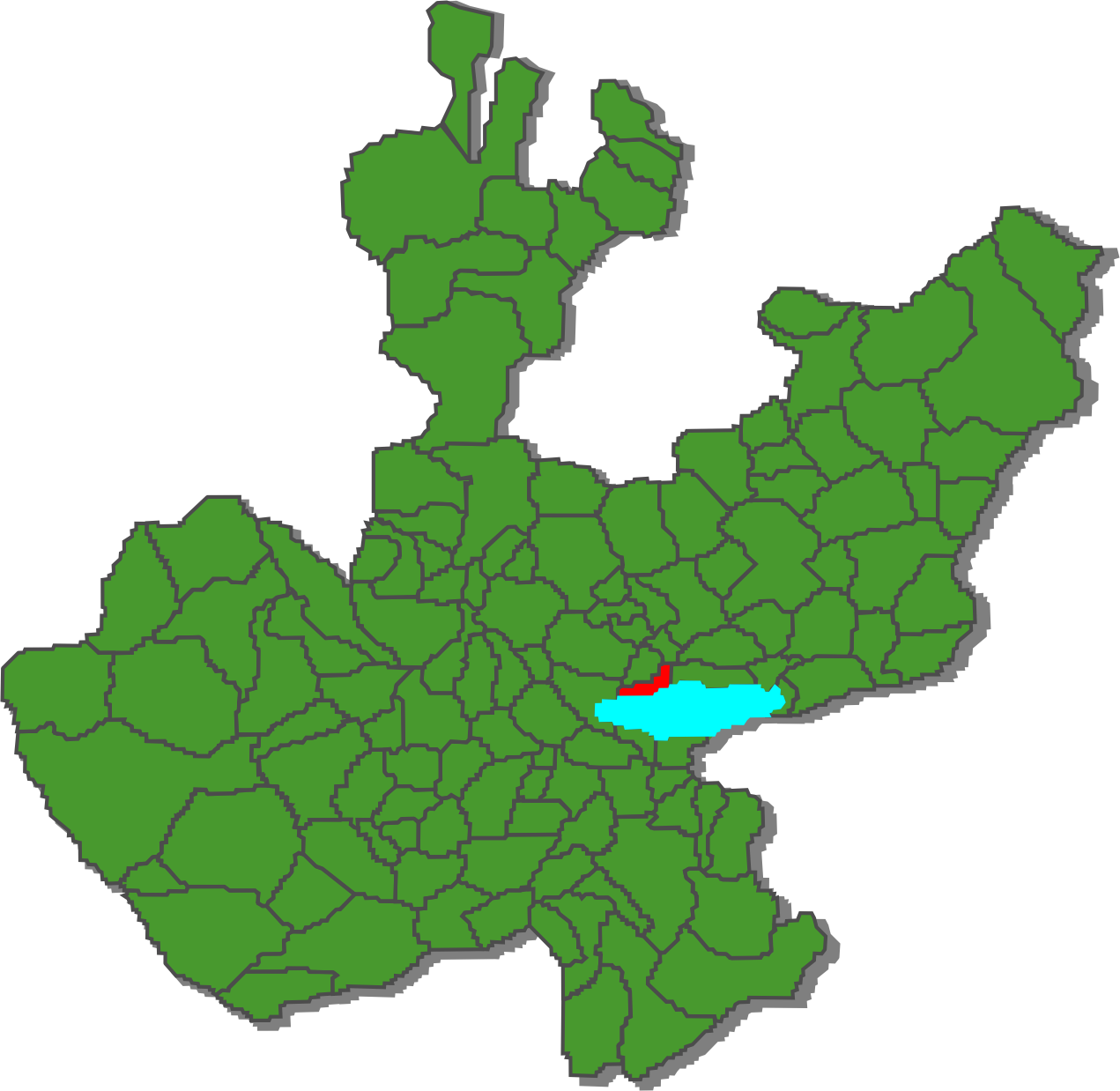
Coat of armsMunicipality location in Jalisco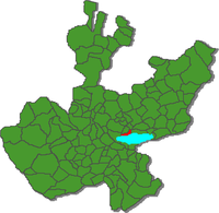 Location in Mexico
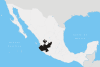
 Chapala, Jalisco
Coordinates: 20°20′N 103°10′W / 20.333°N 103.167°W Country  Mexico
State Jalisco Area - Total 385.58 km2 (148.9 sq mi) Population (2005) - Total 43,345 Time zone CST (UTC-6) - Summer (DST) CDT (UTC-5) Chapala is a city and municipality in the central Mexican state of Jalisco, located on the north shore of Lake Chapala, Mexico's largest freshwater lake. According to the 2005 census, its population is 43,345 for the municipality.
Contents
Geography
Chapala is 28 miles (45 km) south-southeast of Guadalajara, on Mexico Highway 44. It is located at 20°20' North, 103°10' West.
History
Although there are several theories as to the origin of the city's name, the most likely is that it comes from Chapalac, the name of the last chief of the Nahuatl-speaking indigenous people of the region. Chapala became an official municipality on September 10, 1864, by decree of the Jalisco State Congress.
Culture
In the late 1940s the famous American writer Tennessee Williams settled in Chapala for a while to work in the play called The Poker Night, which later became A Streetcar Named Desire. As Williams explains in his essay "The Catastrophe of Success," Chapala offered him an ideal place to work, "a remote place among strangers where there is good swimming."
Since the 1960s, Chapala has been frequented by both Mexican and international tourists. Among the area's cultural attractions is mariachi music, for which the state of Jalisco is particularly known. While many fine mariachi bands have been based in Chapala, the most famous groups are based in larger cities nearby. The most famous mariachi in Mexico is Mariachi Vargas de Tecalitlán, founded in the late 19th century in the southern Jalisco city of Tecalitlán, Jalisco, but now based in Mexico City. Although mariachi music is believed to have originated in the town of Cocula, the greatest concentration of mariachis can be found in the city of Guadalajara, located about 30 miles north of Chapala; it is considered the city that most epitomizes the external concept of Mexico propagated by the international mass media (characterized by charros, tequila, sombreros, and mariachis). A worldwide mariachi festival is held there each fall, mariachis from throughout the world (including Europe and Asia) regularly participate.
Tourism
Chapala, along with its namesake lake, is well established as a weekend getaway destination primarily for inhabitants of the city of Guadalajara. Most of the area's expatriate population (originating primarily from the United States and Canada) reside not in the city proper but in and around Ajijic, a village of approximately 5,000 inhabitants located approximately 5 miles west of Chapala. Many of these residents, stay for a long time, and try to make Chapala like "home."
-

A Chapala view
-

The Chapala beach viewed from the Malecon
-

Hotel by the Chapala Malecon
Coordinates: 20°20′N 103°11′W / 20.333°N 103.183°W
Guadalajara (capital) Municipalities
and
(municipal seats)Acatic · Acatlán de Juárez · Ahualulco de Mercado · Amacueca · Amatitán · Ameca · Arandas · Atemajac de Brizuela · Atengo · Atenguillo · Atotonilco El Alto · Atoyac · Autlán de Navarro · Ayotlán · Ayutla · Bolaños · Cabo Corrientes (El Tuito) · Cañadas de Obregón · Casimiro Castillo · Chapala · Chimaltitán · Chiquilistlán · Cihuatlán · Cocula · Colotlán · Concepción de Buenos Aires · Cuautitlán de García Barragán · Cuautla · Cuquío · Degollado · Ejutla · El Arenal · El Grullo · El Limón · El Salto · Encarnación de Diaz · Etzatlán · Gómez Farías (San Sebastián del Sur) · Guachinango · Guadalajara · Hostotipaquillo · Huejúcar · Huejuquilla El Alto · Ixtlahuacán de los Membrillos · Ixtlahuacan del Río · Jalostotitlán · Jamay · Jesús María · Jilotlán de los Dolores · Jocotepec · Juanacatlán · Juchitlán · La Barca · La Huerta · La Manzanilla de La Paz · Lagos de Moreno · Magdalena · Mascota · Mazamitla · Mexticacan · Mezquitic · Mixtlán · Ocotlán · Ojuelos de Jalisco · Píhuamo · Poncitlán · Puerto Vallarta · Quitupan · San Cristobal de la Barranca · San Diego de Alejandría · San Gabriel · San Ignacio · San Juan de los Lagos · San Juanito de Escobedo (Antonio Escobedo) · San Julián, Jalisco · San Marcos · San Martín de Bolaños · San Martín de Hidalgo · San Miguel El Alto · San Sebastián del Oeste · Santa María del Oro · Santa María de los Angeles · Sayula · Tala · Talpa de Allende · Tamazula de Gordiano · Tapalpa · Tecalitlán · Techaluta de Montenegro · Tecolotlán · Tenamaxtlán · Teocaltiche · Teocuitatlán de Corona · Tepatitlán de Morelos · Tequila · Teuchitlán · Tizapan El Alto · Tlajomulco de Zuñiga · Tlaquepaque · Tolimán · Tomatlán · Tonalá · Tonaya · Tonila · Totatiche · Tototlán · Tuxcacuesco · Tuxcueca · Tuxpan · Unión de San Antonio · Unión de Tula · Valle de Guadalupe (Northern) · Valle de Guadalupe (Southern) · Valle de Juárez · Villa Corona · Villa Guerrero · Villa Hidalgo · Villa Purificación · Yahualica de González Gallo · Zacoalco de Torres · Zapopan · Zapotiltic · Zapotitlán de Vadillo · Zapotlán del Rey · Zapotlán el Grande · Zapotlanejo
 Categories:
- Populated places in Jalisco
- Municipalities of Jalisco
- Populated places established in 1864
-


Wikimedia Foundation. 2010.