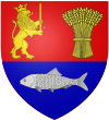
Coşoveni

Coşoveni
Coşoveni
—  Commune  —
Coşoveni is located in Romania
Coşoveni
Coordinates: 44°15′N 23°56′E / 44.25°N 23.933°E / 44.25; 23.933
Country  Romania
County Dolj County
Population (2002)[1] 5,080
Time zone EET (UTC+2)
 – Summer (DST) EEST (UTC+3)

Coşoveni is a commune in Dolj County, Romania with a population of 4,982 people. It is composed of a single village, Coşoveni. It also included Cârcea village until 2004, when it was split off to form a separate commune.

Coordinates: 44°15′N 23°56′E / 44.25°N 23.933°E / 44.25; 23.933

References

  1. ^ Romanian census data, 2002; retrieved on March 1, 2010

Wikimedia Foundation. 2010.

Игры ⚽ Нужно решить контрольную?

Look at other dictionaries:

  • Cosoveni — Original name in latin Cooveni Name in other language Cosoveni, Cosovenii de Sus, Cooveni, Coovenii de Sus State code RO Continent/City Europe/Bucharest longitude 44.25 latitude 23.93333 altitude 171 Population 5024 Date 2012 06 12 …   Cities with a population over 1000 database

  • Comuna Cosoveni — Admin ASC 2 Code Orig. name Comuna Coşoveni Country and Admin Code RO.17.71885 RO …   World countries Adminstrative division ASC I-II

  • Bănesele River — Geobox River name = Lumaşu River native name = other name = other name1 = image size = image caption = country type = Countries state type = region type = district type = Counties city type = Villages country = Romania country1 = state = state1 …   Wikipedia

  • Ţuţurele River — Geobox River name = Ţuţurele River native name = other name = other name1 = image size = image caption = country type = Countries state type = region type = district type = Counties city type = Villages country = Romania country1 = state = state1 …   Wikipedia

  • Dolj County — Dolj   County (Judeţ)   Coat of arms …   Wikipedia

  • Lumaşu River — Geobox River name = Lumaşu River native name = other name = other name1 = image size = image caption = country type = Countries state type = region type = district type = Counties city type = Villages country = Romania country1 = state = state1 …   Wikipedia

  • Cârcea —   Commune   …   Wikipedia

  • Craiova — Coordinates: 44°20′00″N 23°49′00″E / 44.333333°N 23.816667°E / 44.333333; 23.816667 …   Wikipedia

  • Calafat —   Municipality   The monument commemorating the soldiers who fought in the War of Independence in 1877 …   Wikipedia

  • Dăbuleni —   Town   …   Wikipedia

Share the article and excerpts

Direct link
Do a right-click on the link above
and select “Copy Link”