- Dixonville, Alberta
-
Hamlet of Dixonville — Hamlet — Location of Dixonville in Alberta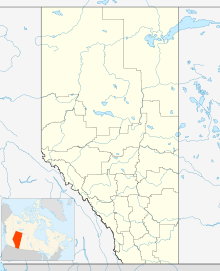

Coordinates: 56°32′14″N 117°40′15″W / 56.5372°N 117.6708°WCoordinates: 56°32′14″N 117°40′15″W / 56.5372°N 117.6708°W Country  Canada
Province  Alberta
Census division No. 17 Municipal district County of Northern Lights Government – Type Unincorporated – Governing body County of Northern Lights Council Area[1] – Total 1.08 km2 (0.4 sq mi) Elevation 640 m (2,100 ft) Population (2006)[1] – Total 121 – Density 112.3/km2 (290.9/sq mi) – Dwellings 45 Time zone MST (UTC-7) Dixonville is a hamlet in Alberta, Canada within the County of Northern Lights.[2] It is located along the Mackenzie Highway (Highway 35), approximately 43 kilometres (27 mi) north of Grimshaw. It has an elevation of 640 metres (2,100 ft).
The hamlet is located in census division No. 17 and in the federal riding of Peace River.
Demographics
As of 2006, Dixonville had a total population of 121 living in 45 dwellings. With a land area of 1.08 km2 (0.42 sq mi), it has a population density of 112.3 /km2 (291 /sq mi).[1]
Industry Canada shows that Dixonville's greater rural area had a total population of 704 living in 263 dwellings in 2001. With a land area of 2,104.8 km2 (812.7 sq mi), its greater rural area has a population density of 17.0 /km2 (44 /sq mi).[3]
See also
- List of communities in Alberta
- List of hamlets in Alberta
References
- ^ a b c Statistics Canada (2007). "Population and dwelling counts, for Canada, provinces and territories, and designated places, 2006 and 2001 censuses". http://www12.statcan.ca/english/census06/data/popdwell/Table.cfm?T=1302&SR=1&S=1&O=A&RPP=9999&PR=48&CMA=0. Retrieved 2010-01-29.
- ^ Alberta Municipal Affairs (2010-04-01). "Specialized and Rural Municipalities and Their Communities". http://municipalaffairs.gov.ab.ca/documents/msb/2010-ruralmun.pdf. Retrieved 2010-07-03.
- ^ Industry Canada/Web Archive (2006-11-04). "Dixonville - Community demographics (2001 census)". http://www.collectionscanada.gc.ca/webarchives/20061104084225/http://broadband.gc.ca/maps/province.html?prov=48. Retrieved 2010-02-07.
 Subdivisions of Alberta
Subdivisions Regions · Census divisions · Municipal districts (counties) · Specialized municipalities · School districts · Regional health authoritiesCommunities Cities · Towns · Villages · Summer villages · Hamlets · Indian reserves · Métis settlements · Ghost towns · Designated placesCities and Urban
Service AreasAirdrie · Brooks · Calgary · Camrose · Cold Lake · Edmonton (capital) · Fort McMurray · Fort Saskatchewan · Grande Prairie · Lacombe · Leduc · Lethbridge · Lloydminster · Medicine Hat · Red Deer · Sherwood Park · Spruce Grove · St. Albert · WetaskiwinCategories:- Hamlets in Alberta
- Designated places in Alberta
- Northern Lights County, Alberta
- Northern Alberta geography stubs

Wikimedia Foundation. 2010.