- Nevada State Route 161
-
State Route 161
Goodsprings Road Route information Maintained by NDOT Length: 7.290 mi[1] (11.732 km) Existed: 1976 – present History: Established as SR 53 by 1935 Major junctions West end: EsmealdaGoodsprings East end:  I-15 at Jean
Highway system ←  SR 160
SR 163  →
→State Route 161 (SR 161) is a state highway in Clark County, Nevada. It is known as Goodsprings Road, connecting the town of Goodsprings to Interstate 15 at Jean. The route was part of State Route 53 prior to 1976.
Contents
Route description
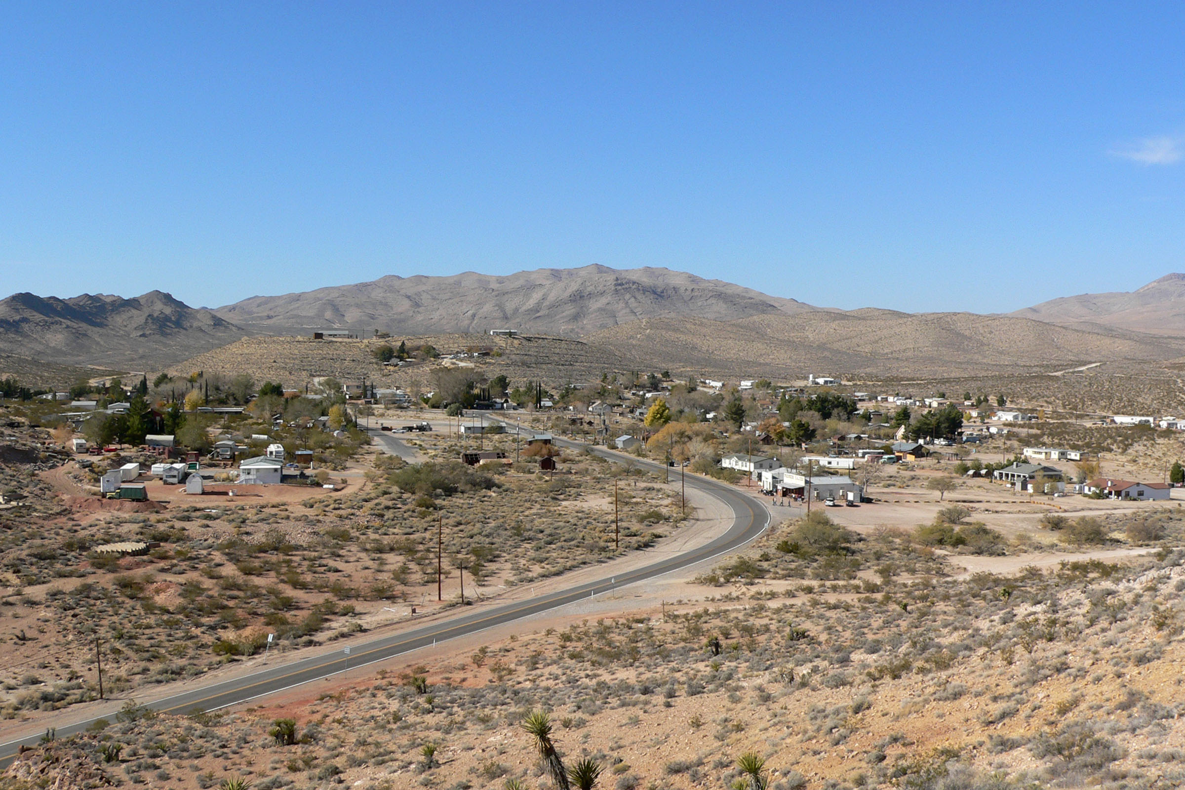
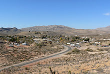 SR 161 entering Goodsprings
The route begins at the intersection of Esmeralda Street and Spring Street in Goodsprings. It runs east along Spring Street, then exits the town and heads southeastward, intersecting Sandy Valley Road in the Mojave Desert. The road continues southeastward for about 7 miles (11 km) before entering Jean. SR 161 ends in Jean at an interchange with Interstate 15[1][2]
History
 SR 161 was originally part of State Route 53.
A connection between Goodsprings and U.S. Route 91 (and SR 6) at Jean first appeared on official Nevada state maps in 1933. At that time, it was an unimproved county road.[3] By 1935, that road was incorporated into State Route 53, which connected Jean to Goodsprings before curving southwest towards the California state line.[4] By 1941, the first 7 miles (11 km) of the SR 53 reaching Goodsprings was paved, with the remaining 13 miles (21 km) in to Sandy Valley and on to California remained unimproved.[5]
SR 53 remained unchanged until the 1976 renumbering of Nevada's state highway system that was authorized on July 1, 1976. In that process, the paved portion of the highway between Jean and Goodsprings was renumbered to State Route 161. This change was first seen on the 1978-1979 edition of the official state map[6][7] The remaining section of SR 53 to Sandy Valley continued to be shown on the state map, but was dropped from the state system by 1982.[8] Sandy Valley is now reachable via the Sandy Valley road turnoff from SR 161, prior to entering Goodsprings.
Major intersections
The entire route is in Clark County.
Location Mile Destinations Notes Goodsprings 0.00 Esmeralda Street Jean I-15 – Las Vegas, Los Angeles1.000 mi = 1.609 km; 1.000 km = 0.621 mi References
- ^ a b "State Maintained Highways of Nevada: Descriptions and Maps - Quarter 2 Update". Nevada Department of Transportation. July 2011. http://www.nevadadot.com/Documents/State_Maintained_Highways,_Descriptions,_Index___Maps.aspx. Retrieved 26 July 2011.
- ^ Microsoft. Map of Overview of SR 161 – Bing Maps (Map). Cartography by NavTEQ, Inc. http://www.bing.com/maps/#JmNwPXB6MHhmNTVjamRqZyZsdmw9MTMmZGlyPTAmc3R5PWImcnRwPXBvcy4zNS44MzI0Mzk2MjM3MzcyMV8tMTE1LjQzNTg4OTg1MTQzMDY5X25lYXIlMjBXJTIwU3ByaW5nJTIwU3QlMkMlMjBKZWFuJTJDJTIwTlYlMjA4OTAxOV9fX2FffnBvcy4zNS43Nzk4MjE5MjA4NDkxNF8tMTE1LjMyNjMyOTg2NzEwNDVfX19fYV8mbW9kZT1EJnJ0b3A9MH4wfjB+. Retrieved 8 Feb 2011.
- ^ Nevada Department of Highways (1933). Official Road Map of Nevada (Map). http://contentdm.library.unr.edu/u?/hmaps,461. Retrieved 26 July 2011.
- ^ Nevada Department of Highways (1935). Official Road Map of the state of Nevada (Map). http://contentdm.library.unr.edu/u?/hmaps,465. Retrieved 26 July 2011.
- ^ Nevada Department of Highways (1941). Official Road Map of the state of Nevada (Map). http://contentdm.library.unr.edu/u?/hmaps,475. Retrieved 26 July 2011.
- ^ Nevada State Maintained Highways: Descriptions, Index and Maps. Nevada Department of Transportation. January 2001. p. 99.
- ^ Nevada Department of Highways (1978). Official Highway Map of Nevada (Map). Section F6. http://contentdm.library.unr.edu/u?/hmaps,535. Retrieved 26 July 2011.
- ^ Nevada Department of Transportation (1982). Official Highway Map of Nevada (Map). Section F6. http://contentdm.library.unr.edu/u?/hmaps,53. Retrieved 26 July 2011.
Categories:- Ivanpah Valley
- State highways in Nevada
- Streets in the Las Vegas metropolitan area

Wikimedia Foundation. 2010.