- Goodsprings, Nevada
Infobox Settlement
official_name = Goodsprings, Nevada
settlement_type = CDP
imagesize =
image_caption =
imagesize =
image_caption =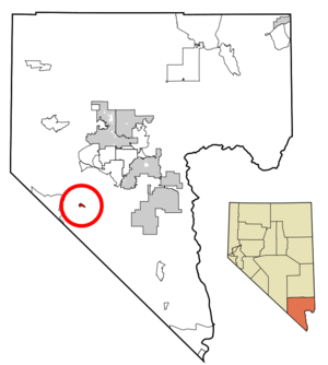
mapsize = 250px
map_caption = Location of Goodsprings in Clark County,Nevada
mapsize1 =
map_caption1 =
image_dot_
dot_mapsize =
dot_map_caption =
dot_x =
dot_y =
subdivision_type = Country
subdivision_name =United States
subdivision_type1 = State
subdivision_name1 =Nevada
subdivision_type2 =
subdivision_name2 =
subdivision_type3 =
subdivision_name3 =
government_type =
leader_title =
leader_name =
established_title =
established_date =
area_magnitude =
unit_pref = Imperial
area_footnotes =
area_total_km2 = 3.9
area_land_km2 = 3.9
area_water_km2 = 0.0
area_total_sq_mi = 1.5
area_land_sq_mi = 1.5
area_water_sq_mi = 0.0
area_water_percent =
population_as_of = 2000
population_footnotes =
population_note =
population_total = 232
population_density_km2 = 59.5
population_density_sq_mi = 154.7
population_blank1_title =
population_blank1 =
population_density_blank1_km2 =
population_density_blank1_sq_mi =
timezone = PST
utc_offset = -8
timezone_DST = PDT
utc_offset_DST = -7
latd = 35 |latm = 49 |lats = 54 |latNS = N
longd = 115 |longm = 26 |longs = 3 |longEW = W
elevation_footnotes =
elevation_m = 1130
elevation_ft = 3707
postal_code_type =ZIP code
postal_code = 89019
area_code = 702
blank_name = FIPS code
blank_info = 32-29500
blank1_name = GNIS feature ID
blank1_info = 0845306
website =
footnotes =Goodsprings is a
census-designated place (CDP) in Clark County,Nevada ,United States . The population was 232 at the 2000 census.Geography
Goodsprings is located at coor dms|35|49|54|N|115|26|3|W|city (35.831720, -115.434174)GR|1.
According to the
United States Census Bureau , the CDP has a total area of 1.5square mile s (3.9km² ), all of it land.History
Named for Joseph Good, whose cattle frequented a spring nestled in the southeastern foothills of the Spring Mountains, Goodsprings was once the heart of the most productive mining districts in Clark County. Over the years, lead, silver, copper, zinc, gold and silver have all been mined from this area. Before 1900, a small cluster of tent cabins and a mill were erected, a post office was opened, and Lincoln County established Goodsprings Township. In 1904, Salt Lake City mining interests platted the Goodsprings Township. Most early buildings in the town were constructed during the boom spurred by the railroad in 1910-1911.
After a number of moves, the current Goodsprings school building was erected in 1913. Now on the
National Register of Historic Places , it is the oldest school in Clark County that was built as a school and is still used as a school.After World War I, mining slowed and families moved away. World War II created a second boom, but it too slowed after the war ended. The town's population has dwindled to approximately 200.
Goodsprings is currently the home of the Pioneer Saloon, considered to be the oldest saloon in Nevada (over 90 years old). The saloon houses a bullet hole on the side of the building and a coroner's letter describing how it was created. The saloon is said to be "haunted" by the victim's ghost by many. In addition, the Pioneer Saloon has a small memorial to both Clark Gable and Carole Lombard. Ms. Lombard's plane crashed in the area in 1942, and the saloon was the center of operations for the search. The crash resulted in her death.
Demographics
As of the
census GR|2 of 2000, there were 232 people, 107 households, and 63 families residing in the CDP. Thepopulation density was 155.7 people per square mile (60.1/km²). There were 122 housing units at an average density of 81.9/sq mi (31.6/km²). The racial makeup of the CDP was 89.66% White, 1.72% African American, 0.43% Native American, 1.72% from other races, and 6.47% from two or more races. Hispanic or Latino of any race were 4.74% of the population.There were 107 households out of which 20.6% had children under the age of 18 living with them, 45.8% were married couples living together, 11.2% had a female householder with no husband present, and 40.2% were non-families. 35.5% of all households were made up of individuals and 13.1% had someone living alone who was 65 years of age or older. The average household size was 2.17 and the average family size was 2.83.
In the CDP the population was spread out with 22.8% under the age of 18, 3.0% from 18 to 24, 22.8% from 25 to 44, 28.9% from 45 to 64, and 22.4% who were 65 years of age or older. The median age was 46 years. For every 100 females there were 90.2 males. For every 100 females age 18 and over, there were 105.7 males.
The median income for a household in the CDP was $40,430, and the median income for a family was $58,125. Males had a median income of $35,924 versus $28,594 for females. The
per capita income for the CDP was $22,282. None of the families and 9.2% of the population were living below thepoverty line , including no under eighteens and 19.6% of those over 64.Notable residents
*
Felix Viscuglia , former clarinetist withBoston Symphony Orchestra andBoston Pops Orchestra References
External links
* [http://goodsprings.org Goodsprings Historical Society]
* [http://historyofgoodsprings.com Another Goodsprings Historical Site]
* [http://gotr.goodsprings.org/index.php Goodsprings Old Timers Reunion]
* [http://pioneersaloon.info Official site of the Pioneer Saloon]
Wikimedia Foundation. 2010.