- Oberhasli
-
For other uses, see Oberhasli (disambiguation).
Oberhasli
Hasli— Talschaft — 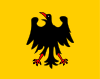
Flag
Country  Switzerland
Canton  Bern
BernRegion Interlaken-Oberhasli Area - Total 551 km2 (212.7 sq mi) Population (2007) - Total 7,843 - Density 14.2/km2 (36.9/sq mi) Time zone CET (UTC+1) - Summer (DST) CEST (UTC+2) Municipalities 6 The Hasli region (also called Oberhasli, or Haslital "Hasli valley") is a historical Landvogtei or Talschaft in the Bernese Oberland, Switzerland, bordering on the cantons of Obwalden, Uri and Wallis. The local dialect is of the Highest Alemannic variety.
From 1833 to 2009, Hasli was incorporated as the Oberhasli district, the easternmost of the 26 districts of the Canton of Bern, bordering the district of Interlaken to the west. Since 2010, Oberhasli and Interlaken have been administratively united as the region of Interlaken-Oberhasli.
It has an area of 550 km², comprising the six municipalities of Gadmen, Guttannen, Hasliberg, Innertkirchen, Meiringen and Schattenhalb, with a total population of just below 8,000, corresponding to a population density of less than 15/km2 (compared to a Swiss average of 181/km2), due to a significant portion of the area of Oberhasli being uninhabitable High Alps.
The name Haslital is first attested in 1234. The prefix Ober- ("Upper Hasli") first appears in the 16th century for disambiguation with Hasle bei Burgdorf, Oberhasli is in official use since 1798. The origin of the name is likely Old High German hasal "hazel".
The upper parts of the Hasli valleys are part of the World Heritage Site of the Jungfrau–Aletsch–Bietschhorn as defined in 2007.[1]
Contents
Situation
Hasli has historically been of great strategical significance due to its central location in the Central Alps, commanding the passes of Grimsel, Susten, Brünig, Joch and Grosse Scheidegg.
The main valley is the alluvial plain of the Aare between Meiringen and Lake Brienz. Upstream of Meiringen, Hasli includes five main valleys,
- the upper Aare valley (the Haslital proper), stretching from Meiringen to the south-east for some 15 km, to Innertkirchen and Guttannen, terminating near the source of the Aare and the Grimselpass.
- the Gadmertal stretching eastwards to Gadmen, terminating at the Sustenpass
- the Reichenbachtal (also Rosenlauital) Engelhörner, from Schattenhalb to Rosenlaui and as far as the Grosse Scheidegg pass connecting to Grindelwald. The Reichenbach forms the Reichenbach Falls cataract before joining the Aare at Meiringen.
- The Urbachtal running from Innertkirchen east of the Engelhörner, terminating at Mattenalpsee.
- the Gental to the northwest of Gadmertal, terminating at Engstlenalp.
History
 The people of Hasle swear allegiance to Bern in 1334 (depiction in the Spiezer Schilling, 1480s).
During the High Middle Ages, Hasli was a reichsfrei region administered by an Amtmann. In 1275 if formed an alliance with the city of Bern. In 1311, Hasli was given to the house of Weissenburg by Henry VII. After an unsuccessful revolt in 1334, Hasli passed to the city of Bern as a subject territory in name but regained most of its earlier privileges. Bern was careful to appoint men native to Hasli to administrative posts and as judges. Hasli proved an important ally to Bern militarily. In 1339, Hasli provided a force of 300 men participating in the Battle of Laupen. The arrangement of Hasli as a nominal subject territory with de facto self-governance endured until 1528, when Bern enforced the Protestant confession in Hasli. About half of the population of Hasli participated in an armed revolt against Bern. After this, Bern tried to enforce Bernese administration in Hasli, but met such resistance that in a 1557 treaty the old privileges were re-instated.
In the 17th to 18th century, an upper class of influential families native to Hasli emerged, the so-called Ehrbarkeit. Before the introduction of a separate parish in Innertkirchein in 1709, there was a single parish in Meiringen for all of Hasli. In the 19th century, parishes in Gadmen (1808) and Guttannen (1816) followed.
During the existence of the Helvetic Republic, Hasli was part of the Kanton Oberland. Since 1833, it has formed the Oberhasli district. Hasli was organized in fifteen collectives of independent farming estates, the so-called Bäuerten, between them forming the Talschaft of Hasli. This structure was replaced by the six municipalities of the contemporary Oberhasli district in 1834. The sovereign law of Hasli (Landrecht) became inactive in 1843, during the Swiss Restauration.
Demographics
In 1558, there were 253 hearths (households) registered in Hasli, in 1653 the number had grown to 360. In 1669, population had declined to ca. 500 individuals following an outbreak of plague. In 1764, there were 3,253 inhabitants, and population more than doubled over the following century, to 7,054 in 1850. Population has remained more or less stable since, numbering 7,574 in 1880, 7,008 in 1900, 6,507 in 1920; 7,878 in 1950, 8,189 in 2000 and 7,843 in 2007.
Administrative divisions
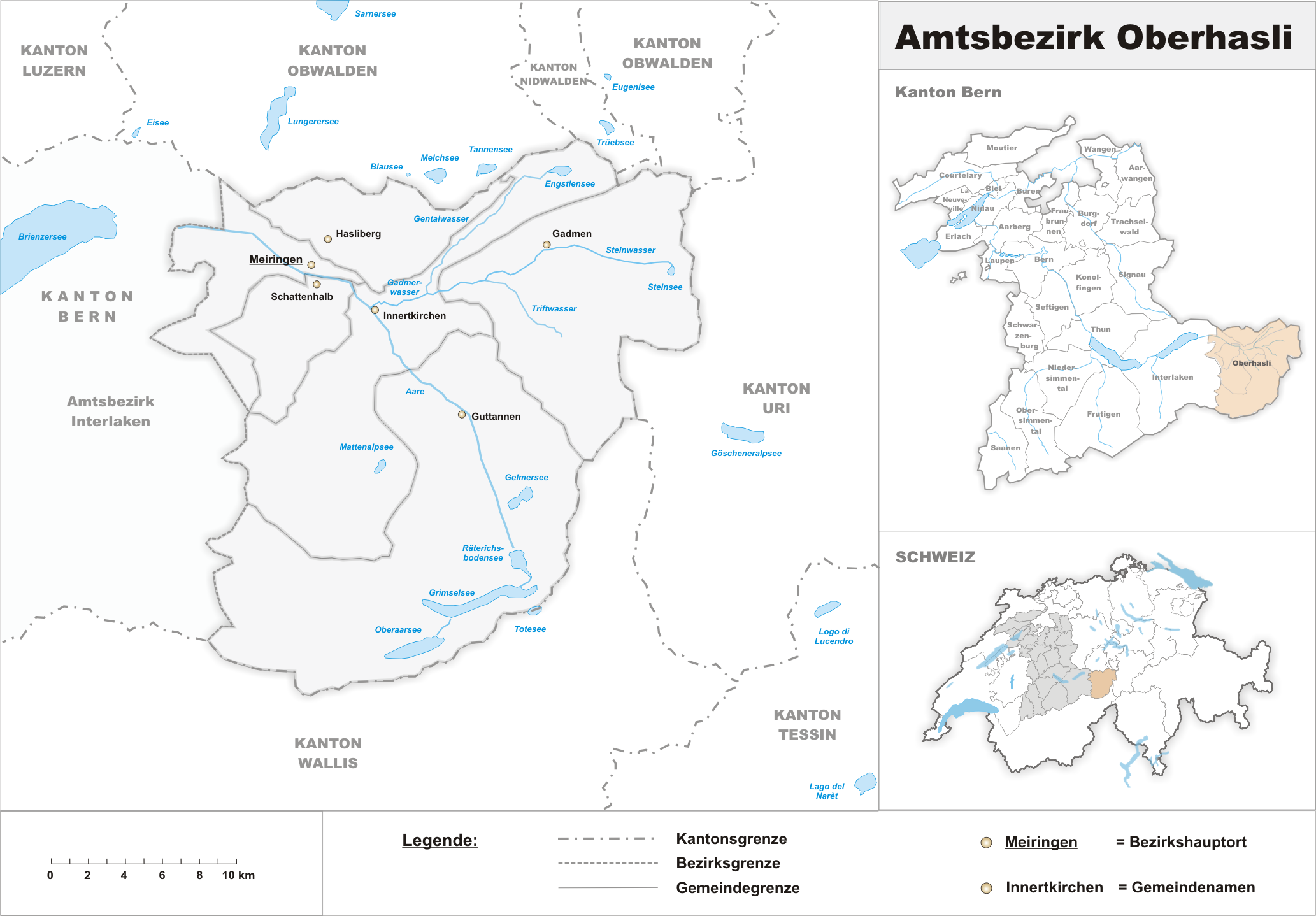
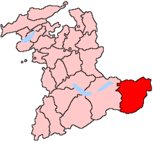 The Oberhasli district within the canton of Bern
 Map Oberhasli, with locator maps placing it within the canton of Bern and within Switzerland
The Oberhasli district was the easternmost of the 26 districts of the canton of Bern, from 1833 to 2009, encompassing an area of 550 km². The administrative capital is Meiringen. Oberhasli since 1843 comprises six municipalities:
municipality population (2007) area (km²)  Gadmen
250 116.4  Guttannen
316 200.7  Hasliberg
1,234 41.7  Innertkirchen
901 120.0  Meiringen
4,533 40.7  Schattenhalb
609 31.5 Total 7,843 551.0 Four of the six municipalities retain the black eagle on golden background of the historical Hasli flag, Meiringen insisted to retain the flag without modification. Historically, the flag of Hasli is identical to the medieval flag of the Holy Roman Empire, showing a black eagle in a yellow field. The Bernese elite allowed the Hasli troops to keep displaying this flag even after the de facto independence from the empire.
Economy and infrastructure
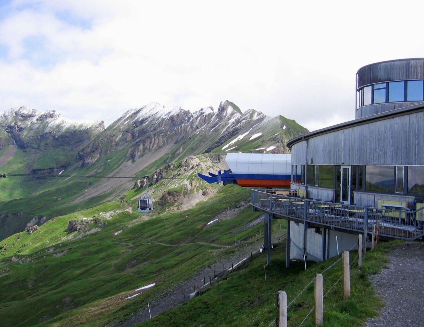
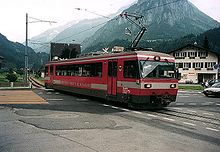 Meiringen-Innertkirchen-Bahn in Innertkirchen.
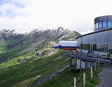 "Alpen tower" station and panorama restaurant.
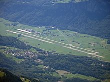 Meiringen airbase as seen from Brienzer Rothorn.
 An Oberhasli goat.
The economy of Hasli was based on agriculture and transhumance (goats, sheep) in the Late Middle Ages, shifting to livestock breeding (cattle, horses) and cheese production during the Early Modern period. Livestock and cheese was exported to Italy across the Grimsel and Nufenen passes. In the 18th century, there were three yearly livestock markets. There was also some iron mining, beginning in the 15th century, and phased out after 1798. From the 17th century, there was rockhounding for crystals, intensified with the rise of tourism in the 19th century. Booming tourism triggered significant investments in structure, notably the Brünig road in 1857 and the Brünigbahn in 1888, connecting Oberhasli to Lucerne via Obwalden, and from there to Greater Zürich and the Swiss plateau in general; the Grimsel road opened in 1894 and the Susten road in 1945. The number of hotels in Meiringen grew from two in 1831 to eighteen in 1900.
After 1973, additional infrastructure turned Hasliberg into a major skiing resort. As of 2005, employment in the primary sector (agriculture) was down to below 20%, while the tertiary sector (mostly tourism) had risen to above 65%. Another important of industry branch is production of hydroelectricity, Kraftwerke Oberhasli AG currently producing about 1.1 GW or 12% of Swiss electricity consumption. The Swiss Air Force has an airbase in Unterbach, Meiringen municipality.
Culture and folklore
Hasli is situated at the core of Highest Alemannic Alpine culture and preserves a number of elements typical of Swiss folklore. Hasli became affected by the modern era comparatively late, in the second half of the 19th century with the booming of tourism in Switzerland, and it preserved a rich tradition of folklore into the 20th century.
The main yearly festival of Hasli is the Ubersitz (lit. the "sitting out" of the night drinking) culminating a week of Trychel marches in Meiringen.
In 1846, Johann Georg Kohl travelled to Hasli, describing both its natural landscape and its population. Kohl recorded a tradition claiming Scandinavian origin of the people of Hasli, telling of a march of 6,000 Frisians and Swedes exiled from their homes by a famine. The names of the leaders of the immigrating Swedes is reported as Restius and Hastus. Kohl describes the architecture of the Meiringen church as reminiscent of North Frisian and Scandinavian types. This legend was first recorded by Petermann Etterlin in his 1507 Chronicle.[2] The Hasli legend was received in Scandinavian Romantic nationalism, with e.g. Danish poet Adam Oehlenschläger publishing a poem Haslidalen in 1849.
A collection of folk tales was published in 1943 by Melchior Sooder (1885–1955), a teacher at Rohrbach and a native of Schattenhalb, as Zelleni us em Haslital. Dwarves figure prominently in these tales, with a dwarf king called Muggestutz. They also tell of the disappearance of the dwarves after their help was not appreciated by the people of Hasli. A grammar of the Hasli dialect was published by Hans Dauwalder (b. 1925) in 1992.
See also
- Highest Alemannic
- Walser
- Ubersitz
- History of the Alps
References
- ^ haslital.ch
- ^ Der Glaube an ihre Abstammung von den Schweden ist unter den Oberhaslern ganz allgemein. Und da mir an dieser uns leider so unwahrscheinlich überlieferten Sage eben jener allgemein im Volke verbreitete Glaube das Merkwürdigste ist, so will ich über diesen Punkt noch einige Beobachtungen, die ich machte, mittheilen. Nicht nur jeder Prediger und Gelehrte in diesen Gegenden weiss von dieser Sage, die dahin geht, dass zur Zeit einer Hungersnoth (das Jahr Christi kennt man nicht) 6000 Schweden und Friesen sich den Rhein hinauf gekämpft und nach der Erreichung der hiesigen Bergthäler, die ihrem Vaterlande so ähnlich gesehen, hier fixirt hätten – sondern auch fast alle Bauern glauben selbst daran. ... Das Volk von Hasli trägt sich sogar noch täglich mit den Namen der ersten Anführer der Schweden herum. Sie sollen Restius und Hastus geheissen haben. Bei jenen 6000 Schweden, die einen Grafen Peter von Franken am Rhein besiegten, die daher allerfrühestens doch erst am Anfange des Mittelalters kommen konnten, begreift man nicht, wie sie sich ohne gewaltige Kämpfe, von denen die Geschichte uns gewiss einige Kunde aufbewahrt hätte, in den Besitz der jener damals längst bewohnten Thäler, die ihnen zugeschrieben werden, setzen konnten. Man beschreibt die Oberhasler gewöhnlich als auffallend grosse, langgewachsene, starke und blondhaarige Leute und bringt auch dies mit ihrer schwedischen Abkunft in Verbindung. ... Ganz Merkwürdig ist es, dass die Kirche in Meiringen ähnlich gebaut ist, wie die Kirchen in Nordfriesland und Skandinavien. Ihr Thurm steht nämlich neben der Kirche, ganz von dem Gebäude derselben isolirt. cited after jungfrauzeitung.ch 16 May 2008. C.f. Grimm, Deutsche Sagen (1818), citing Etterlin.
Literature
- Gottlieb Kurz und Christian Lerch, Geschichte der Landschaft Hasli, Meiringen 1979
- Oberhasli in German, French and Italian in the online Historical Dictionary of Switzerland.
- Johann Ludwig Wurstemberger, Geschichte der alten Landschaft Bern (1862).[1]
- Peter Glatthard, Dialektologisch-volkskundliche Probleme im Oberhasli (1981), ISBN 9783258028538.
External links
Regions Bernese Mittelland · Bernese Oberland · Emmental-Oberaargau Region · Jura Bernois Region · SeelandDistricts Bern-Mittelland · Bernese Jura · Biel/Bienne · Emmental · Frutigen-Niedersimmental · Interlaken-Oberhasli · Oberaargau · Obersimmental-Saanen · Seeland · ThunDistricts of Switzerland · Municipalities of the canton of Bern Categories:- Oberhasli
- Bernese Oberland
- Valleys of the Alps
- Aar drainage basin


Wikimedia Foundation. 2010.