- Meithalun
-
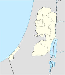
Meithalun Other transcription(s) - Arabic ميثلون Location of Meithalun within the Palestinian territories Coordinates: 32°20′56.92″N 35°16′23.98″E / 32.3491444°N 35.2733278°ECoordinates: 32°20′56.92″N 35°16′23.98″E / 32.3491444°N 35.2733278°E Governorate Jenin Government - Type Village Council Area - Jurisdiction 12 dunams (0 km2 / 0 sq mi) Population (2006) - Jurisdiction 7,006 Meithalun (Arabic: ميثلون) is a Palestinian town in the West Bank, located 17 km South of the city of Jenin in the northern West Bank. According to the Palestinian Central Bureau of Statistics, the town had a population of 7,006 inhabitants in mid-year 2006.[1] The town has four mosques, 6 schools, 4 pharmacies, 2 weather stations, 2 kindergartens, 2 clinics: matgernity; general, plenty of workshops, 2 multipurpose halls, 2 cemitaries, 1 police station, minstry of interior office, 3 backery shops, 4 Internet cafes, 2 cultural centers, 2 major diwans, 1 Bank (Bank of Palestine) with ATM and a lot more services. The town occupies an area of 12 thousand donums.
Footnotes
External links
Cities 

Municipalities Ajjah · Arrabah · Burqin · Deir Abu Da'if · Jaba · Kafr Dan · Kafr Rai · Meithalun · Silat ad-Dhahr · Silat al-Harithiya · Yabad · Al-Yamun · Zababdeh ·Villages 'Anin · Anzah · al-Attara · Araqah · Arranah · Barta'a ash-Sharqiyah · Bir al-Basha · Dahiyat Sabah al-Kheir · Deir Ghazaleh · Fahma · Fandaqumiya · Faqqua · Jalamah · Jalbun · Jalqamus · Kufeirit · al-Manshiyya · Mirka · Misilyah · al-Mughayyir · Nazlet Zeid · Rummanah · Sanur · ash-Shuhada · Sir · at-Tayba · Ti'inik · Tura al-Gharbiya · Umm ar-Rihan · Umm at-Tut · ZububaCategories:- Jenin Governorate
- Palestine geography stubs
- Villages in the West Bank
Wikimedia Foundation. 2010.

