- Danton Pinch
-
Coordinates: 51°05′45″N 1°07′39″E / 51.095828°N 1.127635°E
Danton Pinch 
 Danton Pinch
Danton Pinch shown within KentPopulation 0 District Shepway Shire county Kent Region South East Country England Sovereign state United Kingdom Police Kent Fire Kent Ambulance South East Coast EU Parliament South East England UK Parliament Folkestone and Hythe List of places: UK • England • Kent Danton Pinch was a small village in Kent, England north-west of Folkestone. Its location is now within the confines of the Channel Tunnel. The village was demolished[1] and its residents moved when the construction of the tunnel required its demolition. The only evidence of its original existence is a small lane known as Danton Lane which lies north of the site. Evidence of the access road is seen in Satellite imagery where a line of trees runs from the lane to the perimeter fence of the Channel Tunnel.
A fortified house was built in Danton Pinch however as with the village, it no longer exists.
External links
References
Towns and villages in the Shepway district of Kent, England 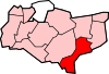 Acrise · Arpinge · Beachborough · Bladbean · Bodsham · Breach · Brenzett · Brookland · Burmarsh · Cheriton · Danton Pinch · Densole · Dymchurch · Dungeness · Elham · Elmsted · Etchinghill · Folkestone · Frogholt · Greatstone-on-Sea · Hawkinge · Hythe · Ivychurch · Lade · Littlestone-on-Sea · Lydd · Lydd-on-Sea · Lyminge · Lympne · Monks Horton · Newchurch · Newingreen · Newington · New Romney · Old Romney · Paddlesworth · Pedlinge · Peene · Postling · Rhodes Minnis · Saltwood · Sandgate · Sandling · Sellindge · Selsted · Snargate · Stanford · Stelling Minnis · St Mary in the Marsh · St Mary's Bay · Westenhanger · West Hythe · WingmoreCategories:
- Villages in Kent
- Kent geography stubs


Wikimedia Foundation. 2010.