- Tatshenshini-Alsek Park
Infobox_protected_area | name = Tatshenshini-Alsek Park
iucn_category =
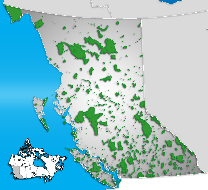
caption = Location of "Tatshenshini-Alsek" inBritish Columbia (this map shows only Canadian land; the blue region to the left does not distinguish betweenAlaska and the Pacific ocean)
locator_x = 15
locator_y = 15
location = flagicon|British ColumbiaBritish Columbia , CAN
nearest_city =Mule Creek Airport , flagicon|British Columbia BC & Whitehorse, flagicon|YukonYukon
lat_degrees = 59
lat_minutes = 52
lat_seconds = 03
lat_direction = N
long_degrees = 138
long_minutes = 00
long_seconds = 49
long_direction = W
area = ~10,000 km²
established = 1993
visitation_num =
visitation_year =
governing_body = BC ParksTatshenshini-Alsek Park or Tatshenshini-Alsek Provincial Wilderness Park in
British Columbia, Canada (9,580 km²) was established in 1993 after an intensive campaign by Canadian and American conservation organizations to halt mining exploration and development in the area and protect the area for its strong natural heritage and biodiversity values. The park is situated in the very northwest corner of British Columbia having borders with both the American State ofAlaska and the CanadianYukon Territory . It nestles betweenKluane National Park and Reserve in the Yukon and Glacier Bay & Wrangell-St. EliasNational Park s and Preserves in Alaska. It is part of the Kluane/Wrangell-St. Elias/Glacier Bay/Tatshenshini-Alsek ParkUNESCO World Heritage Site .History
Sites of numerous
Tlingit andSouthern Tutchone fishing villages were located along the rivers. The eastern edge of the park follows an ancient trade route used by the Chilkat tribe to barter with the Tutchone.In the mid-1800s, a tragic flood occurred with the sudden expulsion of a huge lake dammed up for years by a glacier that had advanced until it completely blocked the
Alsek River . A wall of water 7 metres high and 15 metres wide swept an entire Tutchone village into the sea at Dry Bay.Tatshenshini-Alsek was one of the last areas of British Columbia to be mapped and explored. In the 1960s the first geological exploration for minerals took place in the area. Significant copper deposits were found in the vicinity of Windy Craggy Mountain, in the middle of the Tatshenshini region. In the mid-1970s two companies began rafting the Tatshenshini (Tat) and Alsek rivers for the first time. In the mid-1980s a proposal surfaced to develop Windy Craggy peak into a huge open-pit mine.
In 1991 Tatshenshini International was established, linking together the top 50 conservation organisations in North America. An extremely intensive campaign followed in Canada and in the United States, particularly the
U.S. Congress , and eventually theWhite House , when the active involvement of then Vice-PresidentAl Gore was enlisted. Eventually, then BC PremierMike Harcourt responded by undertaking a review of the issues surrounding Tatshenshini-Alsek by the Commission on Resources and the Environment (CORE). BC government under Premier Harcourt decided in June 1993 to protect Tatshenshini-Alsek as a Class A park. The owners of the Windy-Craggy mineral claims were given a $103.8 million settlement.In combination with the adjoining national parks this completed the world's largest international park complex. The International Union for the Conservation of Nature (
IUCN ) then proposed the area for protection as a World Heritage Site.The
Kluane-Wrangell-St. Elias-Glacier Bay-Tatshenshini-Alsek transfrontalier park system comprising Kluane, Wrangell-St Elias, Glacier Bay and Tatshenshini-Alsek parks, was declared aUNESCO World Heritage Site in 1994 for the spectacular glacier and icefield landscapes as well as for the importance of grizzly bears, caribou and Dall sheep habitat.In 1999, a party of sheep hunters found artifacts and remains of a human at the foot of a glacier. The well-preserved frozen body turned out to be about 550 years old.
Wildlife
The Alsek and Tatshenshini rivers flow through the park in glacier-carved U-shaped valleys. These valleys through the coastal mountains allow cool, moist ocean air into the cold interior. The quick change from ocean to interior environment, frequent floods, landslides and avalanches, a varied geology and great elevation changes have together created an exceptionally diverse range of habitat conditions.
Tatshenshini-Alsek Park supports a large grizzly bear population. A green area that cuts through a barrier of mountain and ice connects coastal and interior grizzly bear populations and provides a perfect habitat. The park is the only Canadian home of the glacier bear. This extremely rare blue-grey colour phase of the black bear is found only within the park and just over the border in to the United States.
As well as bears, Tatshenshini-Alsek Park also supports
Dall's sheep , and exceptional numbers ofmountain goat s, Kenaimoose , grey wolves, eagles (bald & golden),falcon s (peregrine & gyr), andtrumpeter swan s.Along the coastline,
sea lion s andhumpback whale s can be seen.Alsek Ranges are situated there and
Mount Fairweather , at 4,663 metres is the province’s highest peak. The Tatshenshini-Alsek area lies in a region of high earthquake activity. Slippages along the Fairweather and Hubbard/Boarder Faults to the west and theDenali Fault to the north cause regular quakes.ources
* [http://wlapwww.gov.bc.ca/bcparks/explore/parkpgs/tatshen.htm BC parks]
* [http://www.tbpa.net/case_05.htm Global Transboundary Protected Areas]
* [http://www.spacesfornature.org/greatspaces/tatshenshini.html Great Wild Spaces]
* [http://canadianparks.com/bcolumbia/tatshen/index.htm Great Canadian Parks]ee also
*
Alaska Boundary Dispute External links
* [http://www.env.gov.bc.ca/bcparks/explore/parkpgs/tatshen.html Tatshenshini-Alsek at BC Parks]
* [http://www.spacesfornature.org/greatspaces/12reasons.html The Campaign: The 12 Top Reasons why Tatshenshini was Protected]
* [http://www.americanwhitewater.org/rivers/id/50/ Tatshenshini River info]
* [http://www.tatshenshini.com/trips/tatshenshiniriver/?view=gallery&pid=1 Tatshenshini River Photos and Map]
Wikimedia Foundation. 2010.